
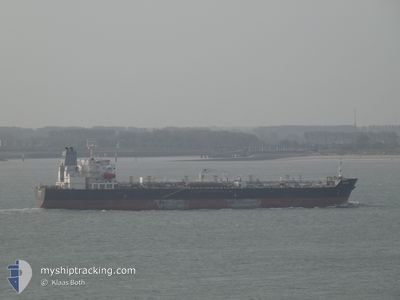
TAURUS
Oil/Chemical Tanker
Current Trip
OM SOH
| Time Travelled | 15 days |
|---|---|
| Remaining Time | --- |
| Distance Travelled | 3243.36 nm |
| Remaining Distance | --- |
| AVG Speed | 12.1 Knots |
| MAX Speed | 14.6 Knots |
| AVG Wind | 8.6 knots |
| MAX Wind | 25.7 knots |
| MIN Temp | 23°C / 73.4°F |
| MAX Temp | 27.8°C / 82.04°F |
| Dybgang | 7.8 m |
| Position Modtaget | 18 d siden |
Current Position
| Longitude | --- |
|---|---|
| Latitude | --- |
| Status | Under way using engine |
| Fart | 13.3 Knots |
| Kurs | 179.6° |
| Område | Gulf of Oman |
| Station | T-AIS |
| Position Modtaget | 18 d siden |
Info
Information
The current position of TAURUS is in Gulf of Oman with coordinates 24.78728° / 56.62542° as reported on 2025-02-13 16:40 by AIS to our vessel tracker app. The vessel's current speed is 13.3 Knots
The vessel TAURUS (IMO: 9417206, MMSI: 636014088) is a Oil/Chemical Tanker that was built in 2009 ( 16 år gamle ). It's sailing under the flag of [LR] Liberia.
In this page you can find informations about the vessels current position, last detected port calls, and current voyage information. If the vessels is not in coverage by AIS you will find the latest position.
The current position of TAURUS is detected by our AIS receivers and we are not responsible for the reliability of the data. The last position was recorded while the vessel was in Coverage by the Ais receivers of our vessel tracking app.
The current draught of TAURUS as reported by AIS is 7.8 meters
Weather
| Temperature | 23.9°C / 75.02°F |
|---|---|
| Wind Speed | 19 knots |
| Direction | 39° NE |
| Pressure | 1015.3 hPa |
| Humidity | 52.4 % |
| Cloud Coverage | 1 % |
Featured Company
Most Visited Ports (Last year)
| Port | Arrivals | |
|---|---|---|
| 2 | ||
| 2 | ||
| 1 | ||
| 1 | ||
| 1 | ||
| 1 |
Last Trips
| Origin | Departure | Destination | Arrival | Distance | |
|---|---|---|---|---|---|
| 2025-01-03 06:54 | 2025-02-14 19:49 | 9278.00 nm | |||
| 2024-12-15 09:01 | 2025-01-02 00:00 | 3148.67 nm |
Events
| Tid | Hændelsen | Detaljer | Position / Dest | Info |
|---|---|---|---|---|
| 2025-02-26 02:00 | START Sejllads | 4.9 nm, South West of JIZAN |
16.83249 / 42.48815
OM SOH
|
Fart: 3.4 kn Kurs: 298° |
| 2025-02-24 00:37 | STOP Sejllads | 4.87 nm, South West of JIZAN |
16.83101 / 42.49193
OM SOH
|
Fart: 0.2 kn Kurs: 25° |
| 2025-02-23 23:49 | START Sejllads | 4.89 nm, South West of JIZAN |
16.84953 / 42.46682
OM SOH
|
Fart: 5.7 kn Kurs: 145° |