

SUSTAINABLE EARTH
Cargo A

Current Trip
KIJ
| Time Travelled | 5 days |
|---|---|
| Remaining Time | --- |
| Distance Travelled | 1310.67 морская миля |
| Remaining Distance | --- |
| AVG Speed | 13.4 Узлы |
| MAX Speed | 17.9 Узлы |
| AVG Wind | 13.4 knots |
| MAX Wind | 32 knots |
| MIN Temp | 0.8°C / 33.44°F |
| MAX Temp | 11.6°C / 52.88°F |
| Осадка | 6.9 м |
| Позиция Получена | 12 h, 55 m тому назад |
Current Position
| Долгота | --- |
|---|---|
| Широта | --- |
| Статус | Under way using engine |
| Скорость | 17.2 Узлы |
| Курс | 258.3° |
| Район | Japan Sea |
| Станция | T-AIS |
| Позиция Получена | 12 h, 55 m тому назад |
Information
The current position of SUSTAINABLE EARTH is in Japan Sea with coordinates 37.67737° / 137.89456° as reported on 2025-03-08 16:23 by AIS to our vessel tracker app. The vessel's current speed is 17.2 Узлы
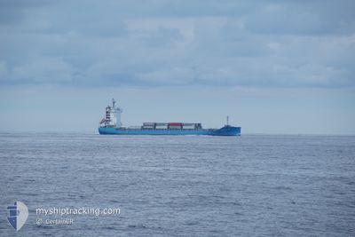
The vessel SUSTAINABLE EARTH (IMO: 9929235, MMSI: 636021093) is a Cargo A It's sailing under the flag of [LR] Liberia.
In this page you can find informations about the vessels current position, last detected port calls, and current voyage information. If the vessels is not in coverage by AIS you will find the latest position.
The current position of SUSTAINABLE EARTH is detected by our AIS receivers and we are not responsible for the reliability of the data. The last position was recorded while the vessel was in Coverage by the Ais receivers of our vessel tracking app.
The current draught of SUSTAINABLE EARTH as reported by AIS is 6.9 meters
Weather
| Temperature | 7.6°C / 45.68°F |
|---|---|
| Wind Speed | 4 knots |
| Direction | 248° WSW |
| Pressure | 1029.9 hPa |
| Humidity | 58.3 % |
| Cloud Coverage | 43 % |


Featured Company
Last Port Calls
| Port | Arrival | Departure | Time In Port |
|---|---|---|---|
| 2025-03-03 03:51 | 2025-03-03 19:09 | 15 h | |
| 2025-02-24 21:53 | 2025-02-25 10:01 | 12 h | |
| 2025-02-20 23:05 | 2025-02-21 07:57 | 8 h | |
| 2025-02-15 05:29 | 2025-02-15 16:57 | 11 h | |
| 2025-02-13 11:45 | 2025-02-13 20:57 | 9 h | |
| 2025-02-05 00:09 | 2025-02-06 13:45 | 1 d | |
| 2025-01-25 01:09 | 2025-01-25 16:21 | 15 h | |
| 2025-01-19 22:05 | 2025-01-20 08:04 | 9 h | |
| 2025-01-15 22:09 | 2025-01-16 07:05 | 8 h | |
| 2025-01-12 11:31 | 2025-01-12 22:33 | 11 h |
Most Visited Ports (Last year)
| Port | Arrivals | |
|---|---|---|
| 27 | ||
| 17 | ||
| 16 | ||
| 14 |
Last Trips
| Origin | Departure | Destination | Arrival | Distance | |
|---|---|---|---|---|---|
| 2025-02-25 19:01 | 2025-03-03 11:51 | 1267.24 морская миля | |||
| 2025-02-21 16:57 | 2025-02-25 06:53 | 522.81 морская миля | |||
| 2025-02-16 00:57 | 2025-02-21 08:05 | 998.79 морская миля | |||
| 2025-02-14 04:57 | 2025-02-15 13:29 | 391.60 морская миля | |||
| 2025-02-06 22:45 | 2025-02-13 19:45 | 1447.96 морская миля | |||
| 2025-01-26 00:21 | 2025-02-05 09:09 | 1264.31 морская миля | |||
| 2025-01-20 17:04 | 2025-01-25 09:09 | 1245.93 морская миля | |||
| 2025-01-16 16:05 | 2025-01-20 07:05 | 541.23 морская миля | |||
| 2025-01-13 06:33 | 2025-01-16 07:09 | 963.45 морская миля | |||
| 2025-01-10 06:45 | 2025-01-12 19:31 | 393.51 морская миля |
Events
| Время | Событие | Детали | Позиция / Направление | Информация |
|---|---|---|---|---|
| 2025-03-08 17:11 | Статус изменился | Default Under way using engine |
37.63624 / 137.61247
KIJ
|
Скорость: 17.2 kn Курс: 258.3° |
| 2025-03-08 16:23 | Вне покрытия |
37.67737 / 137.89456
Japan Sea
|
Скорость: 17.2 kn Курс: 258.3° |
|
| 2025-03-08 15:51 | Статус изменился | Under way using engine Default |
37.72812 / 138.07571
KIJ
|
Скорость: 16.7 kn Курс: 254° |
| 2025-03-08 15:51 | В покрытии |
37.72812 / 138.07571
Japan Sea
|
Скорость: 16.5 kn Курс: 251.6° |
|
| 2025-03-08 11:54 | Начало движения | 2.73 nm, East of NIIGATA |
37.97133 / 139.22713
KIJ
|
Скорость: 4.8 kn Курс: 47° |
| 2025-03-07 21:46 | Окончание движения | 2.55 nm, East of NIIGATA |
37.96852 / 139.22263
KIJ
|
Скорость: 0.3 kn Курс: 41° |
| 2025-03-07 16:27 | Статус изменился | Default Under way using engine |
37.70781 / 138.15138
KIJ
|
Скорость: 15.8 kn Курс: 73.4° |
| 2025-03-07 16:25 | Вне покрытия |
37.70298 / 138.13775
Japan Sea
KIJ
|
Скорость: 15.8 kn Курс: 73.4° |
|
| 2025-03-07 15:07 | Осадка изменилась | 6.9 8.1 |
37.64003 / 137.72776
KIJ
|
Скорость: 14.7 kn Курс: 85.3° |
| 2025-03-07 15:07 | ETA изменился | 2025/03/08 05:40 2025/02/22 09:15 |
37.64003 / 137.72776
KIJ
|
Скорость: 14.7 kn Курс: 85.3° |