

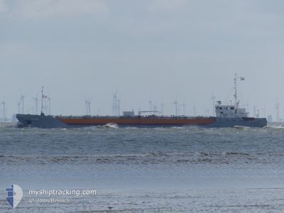
STAR BONAIRE
Edible Oil Tanker

Current Trip
| Time Travelled | 18 h, 18 mins |
|---|---|
| Remaining Time | --- |
| Distance Travelled | 51.75 морская миля |
| Remaining Distance | --- |
| AVG Speed | 9.6 Узлы |
| MAX Speed | 11 Узлы |
| AVG Wind | 5.5 knots |
| MAX Wind | 13 knots |
| MIN Temp | 5.3°C / 41.54°F |
| MAX Temp | 11.2°C / 52.16°F |
| Осадка | 5.4 м |
| Позиция Получена | 1 m тому назад |
Current Position
| Долгота | --- |
|---|---|
| Широта | --- |
| Статус | At anchor |
| Скорость | |
| Курс | 244° |
| Район | North Sea |
| Станция | T-AIS |
| Позиция Получена | 1 m тому назад |
Information
The current position of STAR BONAIRE is in North Sea with coordinates 51.41605° / 1.43668° as reported on 2025-03-28 00:02 by AIS to our vessel tracker app. The vessel's current speed is 0 Узлы
The vessel STAR BONAIRE (IMO: 9148453, MMSI: 246359000) is a Edible Oil Tanker that was built in 1997 ( 28 лет ). It's sailing under the flag of [NL] Netherlands.
In this page you can find informations about the vessels current position, last detected port calls, and current voyage information. If the vessels is not in coverage by AIS you will find the latest position.
The current position of STAR BONAIRE is detected by our AIS receivers and we are not responsible for the reliability of the data. The last position was recorded while the vessel was in Coverage by the Ais receivers of our vessel tracking app.
The current draught of STAR BONAIRE as reported by AIS is 5.4 meters
Weather
| Temperature | 7.9°C / 46.22°F |
|---|---|
| Wind Speed | 13 knots |
| Direction | 225° SW |
| Pressure | 1015.2 hPa |
| Humidity | 93.6 % |
| Cloud Coverage | 2 % |


Featured Company
Last Port Calls
| Port | Arrival | Departure | Time In Port |
|---|---|---|---|
| 2025-03-26 01:44 | 2025-03-27 05:46 | 1 d | |
| 2025-03-24 06:39 | 2025-03-24 07:22 | 43 m | |
| 2025-03-21 19:24 | 2025-03-23 10:38 | 1 d | |
| 2025-03-17 08:46 | 2025-03-19 13:19 | 2 d | |
| 2025-03-16 15:44 | 2025-03-17 07:23 | 15 h | |
| 2025-03-15 06:46 | 2025-03-16 00:09 | 17 h | |
| 2025-03-13 07:33 | 2025-03-14 05:41 | 22 h | |
| 2025-03-10 08:21 | 2025-03-11 07:25 | 23 h | |
| 2025-03-08 05:12 | 2025-03-09 02:05 | 20 h | |
| 2025-03-06 22:19 | 2025-03-07 14:06 | 15 h |
Most Visited Ports (Last year)
| Port | Arrivals | |
|---|---|---|
| 29 | ||
| 28 | ||
| 27 | ||
| 27 | ||
| 19 | ||
| 9 |
Last Trips
| Origin | Departure | Destination | Arrival | Distance | |
|---|---|---|---|---|---|
| 2025-03-24 08:22 | 2025-03-26 02:44 | 430.27 морская миля | |||
| 2025-03-23 11:38 | 2025-03-24 07:39 | 230.51 морская миля | |||
| 2025-03-19 14:19 | 2025-03-21 20:24 | 561.24 морская миля | |||
| 2025-03-17 08:23 | 2025-03-17 09:46 | 10.72 морская миля | |||
| 2025-03-16 00:09 | 2025-03-16 16:44 | 162.33 морская миля | |||
| 2025-03-14 05:41 | 2025-03-15 06:46 | 264.76 морская миля | |||
| 2025-03-11 08:25 | 2025-03-13 07:33 | 438.27 морская миля | |||
| 2025-03-09 03:05 | 2025-03-10 09:21 | 329.62 морская миля | |||
| 2025-03-07 14:06 | 2025-03-08 06:12 | 160.85 морская миля | |||
| 2025-03-06 21:44 | 2025-03-06 22:19 | 2.26 морская миля |
Events
| Время | Событие | Детали | Позиция / Направление | Информация |
|---|---|---|---|---|
| 2025-03-27 19:23 | Статус изменился | At anchor Default |
51.41483 / 1.43612
PURFLEET
|
Скорость: Курс: 42° |
| 2025-03-27 19:20 | Статус изменился | Default At anchor |
51.41488 / 1.43613
PURFLEET
|
Скорость: Курс: 41° |
| 2025-03-27 15:15 | Статус изменился | At anchor Default |
51.41512 / 1.43745
PURFLEET
|
Скорость: Курс: 280° |
| 2025-03-27 15:12 | Статус изменился | Default At anchor |
51.41508 / 1.43745
PURFLEET
|
Скорость: Курс: 280° |
| 2025-03-27 11:07 | Окончание движения | 5.49 nm, North of RAMSGATE |
51.41668 / 1.43422
PURFLEET
|
Скорость: 0.3 kn Курс: 136° |
| 2025-03-27 11:06 | Статус изменился | At anchor Under way using engine |
51.41663 / 1.43418
PURFLEET
|
Скорость: 0.9 kn Курс: 120° |
| 2025-03-27 08:55 | ETA изменился | 2025/03/27 19:00 2025/03/27 17:00 |
51.16240 / 1.61417
PURFLEET
|
Скорость: 8.9 kn Курс: 314.7° |
| 2025-03-27 08:19 | Изменение морского района | United Kingdom part of the North Sea French part of the North Sea |
51.09385 / 1.70563
North Sea
PURFLEET
|
Скорость: 9.7 kn Курс: 308.2° |
| 2025-03-27 07:29 | Осадка изменилась | 5.4 3.9 |
51.04488 / 1.89750
PURFLEET
|
Скорость: 9.7 kn Курс: 270.5° |
| 2025-03-27 07:29 | Пункт назначения изменился | PURFLEET DUNKERQUE |
51.04488 / 1.89750
PURFLEET
|
Скорость: 9.7 kn Курс: 270.5° |