
ST NICHOLAS
Tanker D
Current Trip
| Time Travelled | 22 days |
|---|---|
| Remaining Time | 8 days |
| Distance Travelled | 6248.77 морская миля |
| Remaining Distance | 2864.88 морская миля |
| AVG Speed | 11.4 Узлы |
| MAX Speed | 14.4 Узлы |
| AVG Wind | 13.7 knots |
| MAX Wind | 31.8 knots |
| MIN Temp | 3.2°C / 37.76°F |
| MAX Temp | 24.2°C / 75.56°F |
| Осадка | 12.2 м |
| Позиция Получена | 5 d тому назад |
Current Position
| Долгота | 32.95198° |
|---|---|
| Широта | -30.76464° |
| Статус | Under way using engine |
| Скорость | 8.9 Узлы |
| Курс | 61.1° |
| Район | Indian Ocean |
| Станция | T-AIS |
| Позиция Получена | 5 d тому назад |
Info
Information
The current position of ST NICHOLAS is in Indian Ocean with coordinates -30.76464° / 32.95198° as reported on 2024-06-12 12:41 by AIS to our vessel tracker app. The vessel's current speed is 8.9 Узлы and is heading at the port of CHENNAI. The estimated time of arrival as calculated by MyShipTracking vessel tracking app is 2024-06-26 20:25 LT
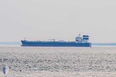
The vessel ST NICHOLAS (IMO: 9934149, MMSI: 229476000) is a Tanker D It's sailing under the flag of [MT] Malta.
In this page you can find informations about the vessels current position, last detected port calls, and current voyage information. If the vessels is not in coverage by AIS you will find the latest position.
The current position of ST NICHOLAS is detected by our AIS receivers and we are not responsible for the reliability of the data. The last position was recorded while the vessel was in Coverage by the Ais receivers of our vessel tracking app.
The current draught of ST NICHOLAS as reported by AIS is 12.2 meters
Weather
| Temperature | 20°C / 68°F |
|---|---|
| Wind Speed | 4 knots |
| Direction | 156° SSE |
| Pressure | 1019 hPa |
| Humidity | 81.1 % |
| Cloud Coverage | 15 % |
Featured Company
Last Port Calls
| Port | Arrival | Departure | Time In Port |
|---|---|---|---|
| 2024-05-25 03:21 | 2024-05-26 03:46 | 1 d | |
| 2024-05-15 04:29 | 2024-05-19 02:57 | 3 d | |
| 2024-05-02 06:47 | 2024-05-07 11:18 | 5 d |
Most Visited Ports (Last year)
| Port | Arrivals | |
|---|---|---|
| 3 | ||
| 2 | ||
| 1 | ||
| 1 | ||
| 1 | ||
| 1 |
Last Trips
| Origin | Departure | Destination | Arrival | Distance | |
|---|---|---|---|---|---|
| 2024-05-19 02:57 | 2024-05-25 03:21 | 826.18 морская миля | |||
| 2024-05-07 11:18 | 2024-05-15 04:29 | 1524.48 морская миля | |||
| 2024-03-17 23:39 | 2024-05-02 06:47 | 2976.40 морская миля |
Events
| Время | Событие | Детали | Позиция / Направление | Информация |
|---|---|---|---|---|
| 2024-06-17 12:32 | Окончание движения | 2.27 nm, West of PORT LOUIS |
-20.15062 / 57.44366
INMAA
|
Скорость: 0.3 kn Курс: 206° |
| 2024-06-12 12:46 | Статус изменился | Default Under way using engine |
-30.75949 / 32.96342
INMAA
|
Скорость: 8.9 kn Курс: 61.1° |
| 2024-06-12 12:41 | Статус изменился | Under way using engine Default |
-30.76464 / 32.95198
INMAA
|
Скорость: 8.2 kn Курс: 60° |
| 2024-06-12 12:41 | Вне покрытия |
-30.76464 / 32.95198
Indian Ocean
|
Скорость: 8.9 kn Курс: 61.1° |
|
| 2024-06-12 12:27 | В покрытии |
-30.76464 / 32.95198
Indian Ocean
|
Скорость: 8.9 kn Курс: 61.1° |
|
| 2024-06-12 09:59 | Статус изменился | Default Under way using engine |
-30.92529 / 32.57721
INMAA
|
Скорость: 7.3 kn Курс: 60.3° |
| 2024-06-12 09:52 | Вне покрытия |
-30.93141 / 32.56197
Indian Ocean
|
Скорость: 7.3 kn Курс: 60.3° |
|
| 2024-06-12 09:52 | Статус изменился | Under way using engine Default |
-30.93155 / 32.56165
INMAA
|
Скорость: 8 kn Курс: 62° |
| 2024-06-12 09:30 | Статус изменился | Default Under way using engine |
-30.95097 / 32.51346
INMAA
|
Скорость: 7.9 kn Курс: 64° |
| 2024-06-12 09:24 | Статус изменился | Under way using engine Default |
-30.95626 / 32.50006
INMAA
|
Скорость: 7.4 kn Курс: 66° |