
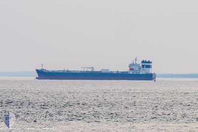
ST NICHOLAS
Tanker
Current Trip
| Time Travelled | 2 days |
|---|---|
| Remaining Time | 7 days |
| Distance Travelled | 635.49 nm |
| Remaining Distance | 2146.29 nm |
| AVG Speed | 11.8 Noeuds |
| MAX Speed | 14.6 Noeuds |
| AVG Wind | 7 knots |
| MAX Wind | 11.7 knots |
| MIN Temp | 8.6°C / 47.48°F |
| MAX Temp | 11.4°C / 52.52°F |
| Tirant d eau | 11.5 m |
| Position reçue | Maintenant |
Current Position
| Longitude | --- |
|---|---|
| Latitude | --- |
| Etat | Under way using engine |
| Vitesse | 12.6 Noeuds |
| Parcours | 213.8° |
| Zone | Celtic Sea |
| Station | T-AIS |
| Position reçue | Maintenant |
Info
Information
The current position of ST NICHOLAS is in Celtic Sea with coordinates 48.60455° / -6.10321° as reported on 2024-12-27 16:52 by AIS to our vessel tracker app. The vessel's current speed is 12.6 Noeuds and is heading at the port of DAKAR. The estimated time of arrival as calculated by MyShipTracking vessel tracking app is 2025-01-04 06:25 LT
The vessel ST NICHOLAS (IMO: 9934149, MMSI: 229476000) is a Tanker It's sailing under the flag of [MT] Malta.
In this page you can find informations about the vessels current position, last detected port calls, and current voyage information. If the vessels is not in coverage by AIS you will find the latest position.
The current position of ST NICHOLAS is detected by our AIS receivers and we are not responsible for the reliability of the data. The last position was recorded while the vessel was in Coverage by the Ais receivers of our vessel tracking app.
The current draught of ST NICHOLAS as reported by AIS is 11.5 meters
Weather
| Temperature | 11.1°C / 51.98°F |
|---|---|
| Wind Speed | 5 knots |
| Direction | 72° ENE |
| Pressure | 1029.9 hPa |
| Humidity | 83.4 % |
| Cloud Coverage | 75 % |
Featured Company
Last Port Calls
| Port | Arrival | Departure | Time In Port |
|---|---|---|---|
| 2024-12-20 15:07 | 2024-12-25 12:16 | 4 d | |
| 2024-12-14 00:04 | 2024-12-15 09:28 | 1 d | |
| 2024-12-10 16:50 | 2024-12-11 17:17 | 1 d | |
| 2024-12-05 20:49 | 2024-12-07 22:20 | 2 d | |
| 2024-12-04 15:15 | 2024-12-05 20:00 | 1 d | |
| 2024-12-01 22:51 | 2024-12-04 14:30 | 2 d | |
| 2024-11-01 02:09 | 2024-11-11 08:18 | 10 d | |
| 2024-10-13 21:50 | 2024-10-15 18:31 | 1 d | |
| 2024-10-04 00:44 | 2024-10-08 07:34 | 4 d |
Most Visited Ports (Last year)
| Port | Arrivals | |
|---|---|---|
| 2 | ||
| 2 | ||
| 2 | ||
| 2 | ||
| 1 | ||
| 1 |
Last Trips
| Origin | Departure | Destination | Arrival | Distance | |
|---|---|---|---|---|---|
| 2024-12-15 09:28 | 2024-12-20 15:07 | 315.56 nm | |||
| 2024-12-11 18:17 | 2024-12-14 00:04 | 199.63 nm | |||
| 2024-12-07 23:20 | 2024-12-10 17:50 | 87.38 nm | |||
| 2024-12-05 21:00 | 2024-12-05 21:49 | 2.67 nm | |||
| 2024-12-04 15:30 | 2024-12-04 16:15 | 3.24 nm | |||
| 2024-11-11 02:18 | 2024-12-01 23:51 | 5317.71 nm | |||
| 2024-10-15 14:31 | 2024-10-31 21:09 | 2916.54 nm | |||
| 2024-10-08 02:34 | 2024-10-13 17:50 | 1463.91 nm | |||
| 2024-09-09 20:47 | 2024-10-03 19:44 | 7446.11 nm |
Events
| Heure | Evenement | Détails | Position/ Destination | Info |
|---|---|---|---|---|
| 2024-12-27 16:34 | Etat Changé | Under way using engine Default |
48.65432 / -6.05018
SNDKR
|
Vitesse: 12.4 kn Parcours: 214° |
| 2024-12-27 16:20 | Etat Changé | Default Under way using engine |
48.69467 / -6.00762
SNDKR
|
Vitesse: 12.3 kn Parcours: 214.9° |
| 2024-12-27 16:13 | Etat Changé | Under way using engine Default |
48.71389 / -5.98751
SNDKR
|
Vitesse: 12.4 kn Parcours: 216° |
| 2024-12-27 16:09 | Etat Changé | Default Under way using engine |
48.72322 / -5.97756
SNDKR
|
Vitesse: 12.3 kn Parcours: 214.2° |
| 2024-12-27 13:04 | Etat Changé | Under way using engine Default |
49.08593 / -5.30279
SNDKR
|
Vitesse: 8.2 kn Parcours: 242° |
| 2024-12-27 13:03 | Etat Changé | Default Under way using engine |
49.08743 / -5.29864
SNDKR
|
Vitesse: 8.2 kn Parcours: 243.7° |
| 2024-12-27 13:02 | Etat Changé | Under way using engine Default |
49.08830 / -5.29608
SNDKR
|
Vitesse: 7.9 kn Parcours: 241° |
| 2024-12-27 12:47 | Etat Changé | Default Under way using engine |
49.10324 / -5.25303
SNDKR
|
Vitesse: 7.4 kn Parcours: 241.6° |
| 2024-12-27 11:25 | Changement de zone | French part of the Celtic Sea French part of the English Channel |
49.18643 / -5.01432
Celtic Sea
SNDKR
|
Vitesse: 11.5 kn Parcours: 241.1° |
| 2024-12-27 11:20 | Etat Changé | Under way using engine Default |
49.19493 / -4.99035
SNDKR
|
Vitesse: 11.6 kn Parcours: 243° |