

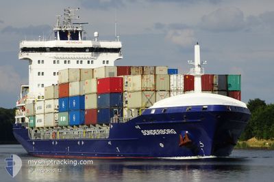
SONDERBORG
Container Ship
Current Trip
| Trip Time | 2 days |
|---|---|
| Trip Distance | 590.91 морская миля |
| AVG Speed | 13.4 Узлы |
| MAX Speed | 15.6 Узлы |
| Осадка | 8.8 м |
| AVG Wind | 14.4 knots |
| MAX Wind | 31.7 knots |
| MIN Temp | 5.9°C / 42.62°F |
| MAX Temp | 14.2°C / 57.56°F |
| Позиция Получена | 2 d тому назад |
Current Position
| Долгота | --- |
|---|---|
| Широта | --- |
| Статус | Under way using engine |
| Скорость | 14.8 Узлы |
| Курс | 172.9° |
| Район | Tyrrhenian Sea |
| Станция | T-AIS |
| Позиция Получена | 2 d тому назад |
Information
The current position of SONDERBORG is in Tyrrhenian Sea with coordinates 41.40269° / 9.86963° as reported on 2025-02-02 06:15 by AIS to our vessel tracker app. The vessel's current speed is 14.8 Узлы and is currently inside the port of BEJAIA.
The vessel SONDERBORG (IMO: 9454242, MMSI: 255806086) is a Container Ship that was built in 2012 ( 13 лет ). It's sailing under the flag of [PT] Portugal.
In this page you can find informations about the vessels current position, last detected port calls, and current voyage information. If the vessels is not in coverage by AIS you will find the latest position.
The current position of SONDERBORG is detected by our AIS receivers and we are not responsible for the reliability of the data. The last position was recorded while the vessel was in Coverage by the Ais receivers of our vessel tracking app.
The current draught of SONDERBORG as reported by AIS is 8.8 meters
Weather
| Temperature | 13.2°C / 55.76°F |
|---|---|
| Wind Speed | 5 knots |
| Direction | 32° NNE |
| Pressure | 1025.3 hPa |
| Humidity | 65.6 % |
| Cloud Coverage | 8 % |

Featured Company
Last Port Calls
| Port | Arrival | Departure | Time In Port |
|---|---|---|---|
| 2025-02-04 05:24 | |||
| 2025-02-01 02:17 | 2025-02-01 17:25 | 15 h | |
| 2025-01-30 21:24 | 2025-01-31 16:53 | 19 h | |
| 2025-01-24 19:00 | 2025-01-28 09:45 | 3 d | |
| 2025-01-18 09:29 | 2025-01-18 23:56 | 14 h | |
| 2025-01-09 00:58 | 2025-01-13 07:33 | 4 d | |
| 2025-01-04 13:48 | 2025-01-05 11:36 | 21 h | |
| 2024-12-28 03:09 | 2024-12-31 01:09 | 2 d | |
| 2024-12-22 23:42 | 2024-12-24 00:01 | 1 d | |
| 2024-12-10 14:22 | 2024-12-14 15:27 | 4 d |
Most Visited Ports (Last year)
| Port | Arrivals | |
|---|---|---|
| 37 | ||
| 30 | ||
| 17 | ||
| 5 | ||
| 5 | ||
| 4 |
Last Trips
| Origin | Departure | Destination | Arrival | Distance | |
|---|---|---|---|---|---|
| 2025-02-01 18:25 | 2025-02-04 06:24 | 590.91 морская миля | |||
| 2025-01-31 17:53 | 2025-02-01 03:17 | 48.42 морская миля | |||
| 2025-01-28 10:45 | 2025-01-30 22:24 | 666.56 морская миля | |||
| 2025-01-19 00:56 | 2025-01-24 20:00 | 710.92 морская миля | |||
| 2025-01-13 08:33 | 2025-01-18 10:29 | 674.89 морская миля | |||
| 2025-01-05 12:36 | 2025-01-09 01:58 | 664.73 морская миля | |||
| 2024-12-31 02:09 | 2025-01-04 14:48 | 717.84 морская миля | |||
| 2024-12-24 01:01 | 2024-12-28 04:09 | 700.28 морская миля | |||
| 2024-12-14 16:27 | 2024-12-23 00:42 | 865.41 морская миля | |||
| 2024-12-07 15:43 | 2024-12-10 15:22 | 654.78 морская миля |
Events
| Время | Событие | Детали | Позиция / Направление | Информация |
|---|---|---|---|---|
| 2025-02-04 05:47 | Окончание движения |
36.74294 / 5.07931
[DZ] BEJAIA
|
Скорость: 0.2 kn Курс: 172° |
|
| 2025-02-04 05:24 | Порт |
|
36.75159 / 5.09401
[DZ] BEJAIA
|
Скорость: 5.9 kn Курс: 306° |
| 2025-02-04 04:33 | Начало движения | 2.85 nm, South East of BEJAIA |
36.72776 / 5.14617
DZBJA
|
Скорость: 3.6 kn Курс: 300° |
| 2025-02-03 13:35 | Окончание движения | 3.2 nm, South East of BEJAIA |
36.72364 / 5.15156
DZBJA
|
Скорость: 0.2 kn Курс: 332° |
| 2025-02-02 06:15 | Вне покрытия |
41.40269 / 9.86963
Tyrrhenian Sea
DZBJA
|
Скорость: 14.8 kn Курс: 172.9° |
|
| 2025-02-02 05:58 | Обнаружено в море | Italian part of the Tyrrhenian Sea |
41.46917 / 9.85922
Tyrrhenian Sea
DZBJA
|
Скорость: 14.6 kn Курс: 173.2° |
| 2025-02-02 00:24 | Изменение морского района | French part of the Tyrrhenian Sea Italian part of the Ligurian Sea |
42.84649 / 9.63337
Tyrrhenian Sea
DZBJA
|
Скорость: 14.9 kn Курс: 168.9° |
| 2025-02-02 00:24 | В покрытии |
42.84649 / 9.63337
Tyrrhenian Sea
DZBJA
|
Скорость: 14.9 kn Курс: 168.9° |
|
| 2025-02-01 18:09 | Статус изменился | Default Under way using engine |
44.16089 / 8.60070
DZBJA
|
Скорость: 15.4 kn Курс: 143.9° |
| 2025-02-01 18:04 | Вне покрытия |
44.17885 / 8.58277
Ligurian Sea
DZBJA
|
Скорость: 15.4 kn Курс: 143.9° |