

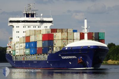
SONDERBORG
Container Ship

Current Trip
| Trip Time | 2 days |
|---|---|
| Trip Distance | 590.91 nm |
| AVG Speed | 13.4 Noeuds |
| MAX Speed | 15.6 Noeuds |
| Tirant d eau | 8.8 m |
| AVG Wind | 14.4 knots |
| MAX Wind | 31.7 knots |
| MIN Temp | 5.9°C / 42.62°F |
| MAX Temp | 14.2°C / 57.56°F |
| Position reçue | 2 d depuis |
Current Position
| Longitude | --- |
|---|---|
| Latitude | --- |
| Etat | Under way using engine |
| Vitesse | 14.8 Noeuds |
| Parcours | 172.9° |
| Zone | Tyrrhenian Sea |
| Station | T-AIS |
| Position reçue | 2 d depuis |
Information
The current position of SONDERBORG is in Tyrrhenian Sea with coordinates 41.40269° / 9.86963° as reported on 2025-02-02 06:15 by AIS to our vessel tracker app. The vessel's current speed is 14.8 Noeuds and is currently inside the port of BEJAIA.
The vessel SONDERBORG (IMO: 9454242, MMSI: 255806086) is a Container Ship that was built in 2012 ( 13 Age ). It's sailing under the flag of [PT] Portugal.
In this page you can find informations about the vessels current position, last detected port calls, and current voyage information. If the vessels is not in coverage by AIS you will find the latest position.
The current position of SONDERBORG is detected by our AIS receivers and we are not responsible for the reliability of the data. The last position was recorded while the vessel was in Coverage by the Ais receivers of our vessel tracking app.
The current draught of SONDERBORG as reported by AIS is 8.8 meters
Weather
| Temperature | 7.6°C / 45.68°F |
|---|---|
| Wind Speed | 5 knots |
| Direction | 226° SW |
| Pressure | 1024.7 hPa |
| Humidity | 82.3 % |
| Cloud Coverage | 9 % |


Featured Company
Last Port Calls
| Port | Arrival | Departure | Time In Port |
|---|---|---|---|
| 2025-02-04 06:24 | |||
| 2025-02-01 03:17 | 2025-02-01 18:25 | 15 h | |
| 2025-01-30 22:24 | 2025-01-31 17:53 | 19 h | |
| 2025-01-24 20:00 | 2025-01-28 10:45 | 3 d | |
| 2025-01-18 10:29 | 2025-01-19 00:56 | 14 h | |
| 2025-01-09 01:58 | 2025-01-13 08:33 | 4 d | |
| 2025-01-04 14:48 | 2025-01-05 12:36 | 21 h | |
| 2024-12-28 04:09 | 2024-12-31 02:09 | 2 d | |
| 2024-12-23 00:42 | 2024-12-24 01:01 | 1 d | |
| 2024-12-10 15:22 | 2024-12-14 16:27 | 4 d |
Most Visited Ports (Last year)
| Port | Arrivals | |
|---|---|---|
| 37 | ||
| 30 | ||
| 17 | ||
| 5 | ||
| 5 | ||
| 4 |
Last Trips
| Origin | Departure | Destination | Arrival | Distance | |
|---|---|---|---|---|---|
| 2025-02-01 18:25 | 2025-02-04 06:24 | 590.91 nm | |||
| 2025-01-31 17:53 | 2025-02-01 03:17 | 48.42 nm | |||
| 2025-01-28 10:45 | 2025-01-30 22:24 | 666.56 nm | |||
| 2025-01-19 00:56 | 2025-01-24 20:00 | 710.92 nm | |||
| 2025-01-13 08:33 | 2025-01-18 10:29 | 674.89 nm | |||
| 2025-01-05 12:36 | 2025-01-09 01:58 | 664.73 nm | |||
| 2024-12-31 02:09 | 2025-01-04 14:48 | 717.84 nm | |||
| 2024-12-24 01:01 | 2024-12-28 04:09 | 700.28 nm | |||
| 2024-12-14 16:27 | 2024-12-23 00:42 | 865.41 nm | |||
| 2024-12-07 15:43 | 2024-12-10 15:22 | 654.78 nm |
Events
| Heure | Evenement | Détails | Position/ Destination | Info |
|---|---|---|---|---|
| 2025-02-04 05:47 | Arret |
36.74294 / 5.07931
[DZ] BEJAIA
|
Vitesse: 0.2 kn Parcours: 172° |
|
| 2025-02-04 05:24 | Port d'arrivée |
|
36.75159 / 5.09401
[DZ] BEJAIA
|
Vitesse: 5.9 kn Parcours: 306° |
| 2025-02-04 04:33 | Démarrage | 2.85 nm, South East of BEJAIA |
36.72776 / 5.14617
DZBJA
|
Vitesse: 3.6 kn Parcours: 300° |
| 2025-02-03 13:35 | Arret | 3.2 nm, South East of BEJAIA |
36.72364 / 5.15156
DZBJA
|
Vitesse: 0.2 kn Parcours: 332° |
| 2025-02-02 06:15 | Hors de la zone couverte |
41.40269 / 9.86963
Tyrrhenian Sea
DZBJA
|
Vitesse: 14.8 kn Parcours: 172.9° |
|
| 2025-02-02 05:58 | Detecté en mer | Italian part of the Tyrrhenian Sea |
41.46917 / 9.85922
Tyrrhenian Sea
DZBJA
|
Vitesse: 14.6 kn Parcours: 173.2° |
| 2025-02-02 00:24 | Changement de zone | French part of the Tyrrhenian Sea Italian part of the Ligurian Sea |
42.84649 / 9.63337
Tyrrhenian Sea
DZBJA
|
Vitesse: 14.9 kn Parcours: 168.9° |
| 2025-02-02 00:24 | Dans la zone couverte |
42.84649 / 9.63337
Tyrrhenian Sea
DZBJA
|
Vitesse: 14.9 kn Parcours: 168.9° |
|
| 2025-02-01 18:09 | Etat Changé | Default Under way using engine |
44.16089 / 8.60070
DZBJA
|
Vitesse: 15.4 kn Parcours: 143.9° |
| 2025-02-01 18:04 | Hors de la zone couverte |
44.17885 / 8.58277
Ligurian Sea
DZBJA
|
Vitesse: 15.4 kn Parcours: 143.9° |