

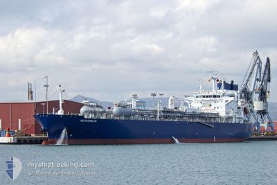
SEARAMBLER
Tanker

Current Trip
| Trip Time | 7 days |
|---|---|
| Trip Distance | 1309.77 морская миля |
| AVG Speed | 14.8 Узлы |
| MAX Speed | 17.5 Узлы |
| Осадка | 8.5 м |
| AVG Wind | 9.7 knots |
| MAX Wind | 24 knots |
| MIN Temp | 17.7°C / 63.86°F |
| MAX Temp | 32.8°C / 91.04°F |
| Позиция Получена | 5 d тому назад |
Current Position
| Долгота | --- |
|---|---|
| Широта | --- |
| Статус | Under way using engine |
| Скорость | 14.9 Узлы |
| Курс | 247.9° |
| Район | Persian Gulf |
| Станция | T-AIS |
| Позиция Получена | 5 d тому назад |
Information
The current position of SEARAMBLER is in Persian Gulf with coordinates 27.85924° / 49.90373° as reported on 2025-03-21 18:26 by AIS to our vessel tracker app. The vessel's current speed is 14.9 Узлы and is currently inside the port of RAS AL KHAIR.
The vessel SEARAMBLER (IMO: 9892822, MMSI: 215956000) is a Tanker It's sailing under the flag of [MT] Malta.
In this page you can find informations about the vessels current position, last detected port calls, and current voyage information. If the vessels is not in coverage by AIS you will find the latest position.
The current position of SEARAMBLER is detected by our AIS receivers and we are not responsible for the reliability of the data. The last position was recorded while the vessel was in Coverage by the Ais receivers of our vessel tracking app.
The current draught of SEARAMBLER as reported by AIS is 8.5 meters
Weather
| Temperature | 24.1°C / 75.38°F |
|---|---|
| Wind Speed | 6 knots |
| Direction | 44° NE |
| Pressure | 1014.6 hPa |
| Humidity | 25.8 % |
| Cloud Coverage | --- |


Featured Company
Last Port Calls
| Port | Arrival | Departure | Time In Port |
|---|---|---|---|
| 2025-03-26 10:21 | |||
| 2025-03-17 13:44 | 2025-03-18 14:16 | 1 d | |
| 2025-03-08 23:06 | 2025-03-11 13:37 | 2 d | |
| 2025-01-18 02:53 | 2025-01-20 14:01 | 2 d |
Most Visited Ports (Last year)
| Port | Arrivals | |
|---|---|---|
| 7 | ||
| 2 | ||
| 2 | ||
| 1 | ||
| 1 | ||
| 1 |
Last Trips
| Origin | Departure | Destination | Arrival | Distance | |
|---|---|---|---|---|---|
| 2025-03-18 14:16 | 2025-03-26 10:21 | 1309.77 морская миля | |||
| 2025-03-11 13:37 | 2025-03-17 13:44 | 1280.33 морская миля | |||
| 2025-01-20 14:01 | 2025-03-08 23:06 | 11267.84 морская миля | |||
| 2024-12-05 13:18 | 2025-01-18 02:53 | 12856.82 морская миля |
Events
| Время | Событие | Детали | Позиция / Направление | Информация |
|---|---|---|---|---|
| 2025-03-26 08:01 | Окончание движения |
27.55420 / 49.20855
[SA] RAS AL KHAIR
|
Скорость: Курс: 358° |
|
| 2025-03-26 07:21 | Порт |
|
27.57773 / 49.21859
[SA] RAS AL KHAIR
|
Скорость: 11.8 kn Курс: 231° |
| 2025-03-26 05:56 | Начало движения | 15.4 nm, North East of RAS AL KHAIR |
27.72241 / 49.43399
SARAZ
|
Скорость: 3.4 kn Курс: 235° |
| 2025-03-22 00:36 | Окончание движения | 15.69 nm, North East of RAS AL KHAIR |
27.70983 / 49.44946
SARAZ
|
Скорость: 0.3 kn Курс: 185° |
| 2025-03-21 18:28 | Статус изменился | Default Under way using engine |
27.85640 / 49.89594
SARAZ
|
Скорость: 14.9 kn Курс: 247.9° |
| 2025-03-21 18:26 | Вне покрытия |
27.85924 / 49.90373
Persian Gulf
SARAZ
|
Скорость: 14.9 kn Курс: 247.9° |
|
| 2025-03-21 18:10 | Изменение морского района | Saudi Arabian part of the Persian Gulf Iranian part of the Persian Gulf |
27.88371 / 49.97341
Persian Gulf
SARAZ
|
Скорость: 14.8 kn Курс: 247.7° |
| 2025-03-21 15:24 | ETA изменился | 2025/03/21 21:00 2025/03/21 22:00 |
27.81110 / 50.71382
SARAZ
|
Скорость: 14.9 kn Курс: 287.8° |
| 2025-03-21 13:49 | Статус изменился | Under way using engine Default |
27.63858 / 51.10268
SARAZ
|
Скорость: 15.5 kn Курс: 309° |
| 2025-03-21 13:49 | В покрытии |
27.63988 / 51.10085
Persian Gulf
SARAZ
|
Скорость: 15.4 kn Курс: 308.9° |