
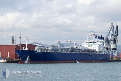
SEARAMBLER
Tanker
Current Trip
| Time Travelled | 5 days |
|---|---|
| Remaining Time | --- |
| Distance Travelled | 1547.00 nm |
| Remaining Distance | --- |
| AVG Speed | 13.8 Knots |
| MAX Speed | 15.7 Knots |
| AVG Wind | 10.2 knots |
| MAX Wind | 31.7 knots |
| MIN Temp | 17.5°C / 63.5°F |
| MAX Temp | 26.7°C / 80.06°F |
| Draught | 10.3 m |
| Position Received | 4 d ago |
Current Position
| Longitude | --- |
|---|---|
| Latitude | --- |
| Status | Under way using engine |
| Speed | 13.7 Knots |
| Course | 66.9° |
| Area | Persian Gulf |
| Station | T-AIS |
| Position Received | 4 d ago |
Info
Information
The current position of SEARAMBLER is in Persian Gulf with coordinates 26.08964° / 55.77823° as reported on 2025-12-31 02:45 by AIS to our vessel tracker app. The vessel's current speed is 13.7 Knots and is heading at the port of FUJAIRAH. The estimated time of arrival as calculated by MyShipTracking vessel tracking app is 2025-12-31 18:00 LT
The vessel SEARAMBLER (IMO: 9892822, MMSI: 215956000) is a Tanker It's sailing under the flag of [MT] Malta.
In this page you can find informations about the vessels current position, last detected port calls, and current voyage information. If the vessels is not in coverage by AIS you will find the latest position.
The current position of SEARAMBLER is detected by our AIS receivers and we are not responsible for the reliability of the data. The last position was recorded while the vessel was in Coverage by the Ais receivers of our vessel tracking app.
The current draught of SEARAMBLER as reported by AIS is 10.3 meters
Weather
| Temperature | 27.2°C / 80.96°F |
|---|---|
| Wind Speed | 14 knots |
| Direction | 35° NE |
| Pressure | 1015 hPa |
| Humidity | 65.9 % |
| Cloud Coverage | 58 % |
Featured Company
Last Port Calls
| Port | Arrival | Departure | Time In Port |
|---|---|---|---|
| 2025-12-26 10:08 | 2025-12-30 02:47 | 3 d | |
| 2025-12-12 19:07 | 2025-12-13 18:36 | 23 h | |
| 2025-12-05 02:56 | 2025-12-06 01:57 | 23 h | |
| 2025-12-01 06:57 | 2025-12-03 08:17 | 2 d | |
| 2025-11-28 07:59 | 2025-11-29 20:29 | 1 d | |
| 2025-11-15 22:20 | 2025-11-18 02:44 | 2 d |
Most Visited Ports (Last year)
| Port | Arrivals | |
|---|---|---|
| 8 | ||
| 4 | ||
| 2 | ||
| 2 | ||
| 2 | ||
| 1 |
Last Trips
| Origin | Departure | Destination | Arrival | Distance | |
|---|---|---|---|---|---|
| 2025-12-13 18:36 | 2025-12-26 10:08 | 3168.70 nm | |||
| 2025-12-06 01:57 | 2025-12-12 19:07 | 301.76 nm | |||
| 2025-12-03 08:17 | 2025-12-05 02:56 | 356.98 nm | |||
| 2025-11-29 20:29 | 2025-12-01 06:57 | 354.23 nm | |||
| 2025-11-18 02:44 | 2025-11-28 07:59 | 3349.40 nm | |||
| 2025-10-02 22:10 | 2025-11-15 22:20 | 3389.10 nm |
Events
| Time | Event | Details | Position / Dest | Info |
|---|---|---|---|---|
| 2026-01-01 17:56 | START Moving | 7.88 nm, North East of SOHAR |
24.61500 / 56.71167
AE FJR
|
Speed: 7 kn Course: 94° |
| 2026-01-01 07:32 | STOP Moving | 7.36 nm, North East of SOHAR |
24.61341 / 56.69603
AE FJR
|
Speed: 0.2 kn Course: 273° |
| 2026-01-01 03:00 | START Moving | 9.79 nm, South East of KHORFAKKAN |
25.27886 / 56.51964
AE FJR
|
Speed: 3.8 kn Course: 110° |
| 2025-12-31 13:24 | STOP Moving | 9.53 nm, South East of KHORFAKKAN |
25.27636 / 56.51249
AE FJR
|
Speed: 0.2 kn Course: 62° |
| 2025-12-31 02:53 | Status Changed | Default Under way using engine |
26.10202 / 55.80692
AE FJR
|
Speed: 13.7 kn Course: 66.9° |
| 2025-12-31 02:45 | OUT of Coverage |
26.08964 / 55.77823
Persian Gulf
AE FJR
|
Speed: 13.7 kn Course: 66.9° |
|
| 2025-12-31 01:33 | Draught Changed | 10.3 7 |
26.02144 / 55.47936
AE FJR
|
Speed: 14.3 kn Course: 88.8° |
| 2025-12-31 01:33 | Destination Changed | AE FJR SA RAZ |
26.02144 / 55.47936
AE FJR
|
Speed: 14.3 kn Course: 88.8° |
| 2025-12-31 01:33 | ETA Changed | 2025/12/31 14:00 2025/12/21 22:00 |
26.02144 / 55.47936
AE FJR
|
Speed: 14.3 kn Course: 88.8° |
| 2025-12-31 01:01 | Status Changed | Under way using engine Default |
26.02055 / 55.34063
SA RAZ
|
Speed: 14.2 kn Course: 93° |