
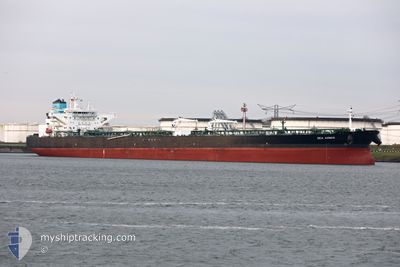
SEA AMBER
Tanker
Current Trip
EGSKT
| Time Travelled | 8 days |
|---|---|
| Remaining Time | --- |
| Distance Travelled | 2579.57 морская миля |
| Remaining Distance | --- |
| AVG Speed | 12.6 Узлы |
| MAX Speed | 16.7 Узлы |
| AVG Wind | 12.9 knots |
| MAX Wind | 23.8 knots |
| MIN Temp | 6.1°C / 42.98°F |
| MAX Temp | 18.1°C / 64.58°F |
| Осадка | 6.3 м |
| Позиция Получена | 13 h, 17 m тому назад |
Current Position
| Долгота | 14.72540° |
|---|---|
| Широта | 36.16347° |
| Статус | Under way using engine |
| Скорость | 12.8 Узлы |
| Курс | 111° |
| Район | Mediterranean Sea - Eastern Basin |
| Станция | T-AIS |
| Позиция Получена | 13 h, 17 m тому назад |
Info
Information
The current position of SEA AMBER is in Mediterranean Sea - Eastern Basin with coordinates 36.16347° / 14.72540° as reported on 2024-05-01 02:50 by AIS to our vessel tracker app. The vessel's current speed is 12.8 Узлы
The vessel SEA AMBER (IMO: 9772931, MMSI: 241466000) is a Tanker It's sailing under the flag of [GR] Greece.
In this page you can find informations about the vessels current position, last detected port calls, and current voyage information. If the vessels is not in coverage by AIS you will find the latest position.
The current position of SEA AMBER is detected by our AIS receivers and we are not responsible for the reliability of the data. The last position was recorded while the vessel was in Coverage by the Ais receivers of our vessel tracking app.
The current draught of SEA AMBER as reported by AIS is 6.3 meters
Weather
| Temperature | 18°C / 64.4°F |
|---|---|
| Wind Speed | 12 knots |
| Direction | 134° SE |
| Pressure | 1013 hPa |
| Humidity | 87.8 % |
| Cloud Coverage | 73 % |
Featured Company
Most Visited Ports (Last year)
| Port | Arrivals | |
|---|---|---|
| 2 | ||
| 1 | ||
| 1 | ||
| 1 | ||
| 1 | ||
| 1 |
Events
| Время | Событие | Детали | Позиция / Направление | Информация |
|---|---|---|---|---|
| 2024-05-01 02:53 | Статус изменился | Default Under way using engine |
36.15905 / 14.73914
EGSKT
|
Скорость: 12.8 kn Курс: 111° |
| 2024-05-01 02:50 | Вне покрытия |
36.16347 / 14.72540
Mediterranean Sea - Eastern Basin
EGSKT
|
Скорость: 12.8 kn Курс: 111° |
|
| 2024-04-30 23:13 | Изменение морского района | Maltese part of the Mediterranean Sea - Eastern Basin Algerian part of the Mediterranean Sea - Western Basin |
36.44079 / 13.86666
Mediterranean Sea - Eastern Basin
EGSKT
|
Скорость: 12.3 kn Курс: 113° |
| 2024-04-30 23:13 | Статус изменился | Under way using engine Default |
36.44079 / 13.86666
EGSKT
|
Скорость: 12.3 kn Курс: 112° |
| 2024-04-30 23:13 | В покрытии |
36.44079 / 13.86666
Mediterranean Sea - Eastern Basin
EGSKT
|
Скорость: 12.3 kn Курс: 113° |
|
| 2024-04-28 17:59 | Статус изменился | Default Under way using engine |
36.71446 / .54613
EGSKT
|
Скорость: 11.8 kn Курс: 82.2° |
| 2024-04-28 17:13 | Вне покрытия |
36.68135 / .29753
Mediterranean Sea - Western Basin
EGSKT
|
Скорость: 11.8 kn Курс: 82.2° |
|
| 2024-04-28 16:12 | Статус изменился | Under way using engine Default |
36.65651 / .11062
EGSKT
|
Скорость: 12.2 kn Курс: 81° |
| 2024-04-28 16:00 | Статус изменился | Default Under way using engine |
36.65075 / .06546
EGSKT
|
Скорость: 12.3 kn Курс: 80.9° |
| 2024-04-28 15:57 | Статус изменился | Under way using engine Default |
36.64890 / .05089
EGSKT
|
Скорость: 12.3 kn Курс: 81° |