
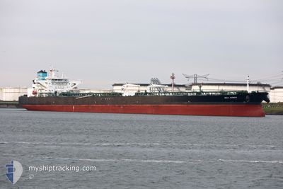
SEA AMBER
Tanker
Current Trip
| Time Travelled | 29 days |
|---|---|
| Remaining Time | 6 h, 35 mins |
| Distance Travelled | 7367.72 nm |
| Remaining Distance | 84.41 nm |
| AVG Speed | 11.9 Knots |
| MAX Speed | 16.7 Knots |
| AVG Wind | 13.6 knots |
| MAX Wind | 29 knots |
| MIN Temp | 6.1°C / 42.98°F |
| MAX Temp | 23°C / 73.4°F |
| Dybgang | 15 m |
| Position Modtaget | 30 m siden |
Current Position
| Longitude | 17.15121° |
|---|---|
| Latitude | 54.86601° |
| Status | Under way using engine |
| Fart | 11.7 Knots |
| Kurs | 69.2° |
| Område | Baltic Sea |
| Station | T-AIS |
| Position Modtaget | 30 m siden |
Info
Information
The current position of SEA AMBER is in Baltic Sea with coordinates 54.86601° / 17.15121° as reported on 2024-05-22 15:05 by AIS to our vessel tracker app. The vessel's current speed is 11.7 Knots and is heading at the port of GDANSK. The estimated time of arrival as calculated by MyShipTracking vessel tracking app is 2024-05-22 22:11 LT
The vessel SEA AMBER (IMO: 9772931, MMSI: 241466000) is a Tanker It's sailing under the flag of [GR] Greece.
In this page you can find informations about the vessels current position, last detected port calls, and current voyage information. If the vessels is not in coverage by AIS you will find the latest position.
The current position of SEA AMBER is detected by our AIS receivers and we are not responsible for the reliability of the data. The last position was recorded while the vessel was in Coverage by the Ais receivers of our vessel tracking app.
The current draught of SEA AMBER as reported by AIS is 15 meters
Weather
| Temperature | 12.7°C / 54.86°F |
|---|---|
| Wind Speed | 17 knots |
| Direction | 76° ENE |
| Pressure | 1012.7 hPa |
| Humidity | 87.1 % |
| Cloud Coverage | --- |
Featured Company
Most Visited Ports (Last year)
| Port | Arrivals | |
|---|---|---|
| 1 | ||
| 1 | ||
| 1 | ||
| 1 | ||
| 1 | ||
| 1 |
Events
| Tid | Hændelsen | Detaljer | Position / Dest | Info |
|---|---|---|---|---|
| 2024-05-22 15:21 | Status er ændret | Default Under way using engine |
54.87763 / 17.23560
PLGDN
|
Fart: 11.7 kn Kurs: 69.2° |
| 2024-05-22 14:36 | Status er ændret | Under way using engine Default |
54.83457 / 16.99705
PLGDN
|
Fart: 11.6 kn Kurs: 70° |
| 2024-05-22 14:24 | Status er ændret | Default Under way using engine |
54.82219 / 16.93313
PLGDN
|
Fart: 11.6 kn Kurs: 72.4° |
| 2024-05-22 08:26 | Ændre havområde | Polish part of the Baltic Sea Danish part of the Kattegat |
54.63893 / 14.87286
Baltic Sea
PLGDN
|
Fart: 12.6 kn Kurs: 81.4° |
| 2024-05-22 07:26 | Ændre havområde | Danish part of the Kattegat German part of the Baltic Sea |
54.60800 / 14.51684
Kattegat
PLGDN
|
Fart: 12.3 kn Kurs: 81.3° |
| 2024-05-22 07:08 | Status er ændret | Under way using engine Constrained by her draught |
54.60109 / 14.41370
PLGDN
|
Fart: 12.2 kn Kurs: 84.4° |
| 2024-05-22 00:59 | Ændre havområde | German part of the Baltic Sea Danish part of the Baltic Sea |
54.64117 / 12.39365
Baltic Sea
PLGDN
|
Fart: 10.6 kn Kurs: 57° |
| 2024-05-22 00:08 | Ændre havområde | Danish part of the Baltic Sea German part of the Baltic Sea |
54.54303 / 12.26708
Baltic Sea
PLGDN
|
Fart: 7.4 kn Kurs: 357.8° |
| 2024-05-21 23:10 | ETA er ændret | 2024/05/22 23:30 2024/05/22 23:00 |
54.41132 / 12.13101
PLGDN
|
Fart: 10.1 kn Kurs: 79.1° |
| 2024-05-21 23:05 | Ændre havområde | German part of the Baltic Sea Danish part of the Baltic Sea |
54.40896 / 12.10784
Baltic Sea
PLGDN
|
Fart: 10.3 kn Kurs: 83.1° |