

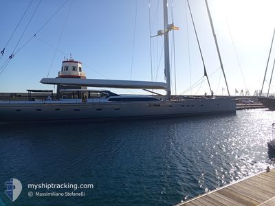
RAVENGER
Sailing

Current Trip
ANTIGUA
| Time Travelled | 4 days |
|---|---|
| Remaining Time | --- |
| Distance Travelled | 145.55 морская миля |
| Remaining Distance | --- |
| AVG Speed | 11.2 Узлы |
| MAX Speed | 13.2 Узлы |
| AVG Wind | 4.3 knots |
| MAX Wind | 9 knots |
| MIN Temp | 24.4°C / 75.92°F |
| MAX Temp | 26.1°C / 78.98°F |
| Осадка | 7 м |
| Позиция Получена | 3 d тому назад |
Current Position
| Долгота | --- |
|---|---|
| Широта | --- |
| Статус | Moored |
| Скорость | 13 Узлы |
| Курс | 265.4° |
| Район | Caribbean Sea |
| Станция | T-AIS |
| Позиция Получена | 3 d тому назад |
Information
The current position of RAVENGER is in Caribbean Sea with coordinates 17.84504° / -65.63332° as reported on 2025-03-19 06:39 by AIS to our vessel tracker app. The vessel's current speed is 13 Узлы
The vessel RAVENGER (MMSI: 232007762) is a Sailing It's sailing under the flag of [GB] United Kingdom.
In this page you can find informations about the vessels current position, last detected port calls, and current voyage information. If the vessels is not in coverage by AIS you will find the latest position.
The current position of RAVENGER is detected by our AIS receivers and we are not responsible for the reliability of the data. The last position was recorded while the vessel was in Coverage by the Ais receivers of our vessel tracking app.
The current draught of RAVENGER as reported by AIS is 7 meters
Weather
| Temperature | 25.6°C / 78.08°F |
|---|---|
| Wind Speed | 8 knots |
| Direction | 296° WNW |
| Pressure | 1013.4 hPa |
| Humidity | 72.2 % |
| Cloud Coverage | 65 % |


Featured Company
Last Port Calls
| Port | Arrival | Departure | Time In Port |
|---|---|---|---|
| 2025-03-17 11:55 | 2025-03-18 10:36 | 22 h | |
| 2025-03-07 15:57 | 2025-03-08 05:48 | 13 h | |
| 2025-03-06 15:24 | 2025-03-07 10:23 | 18 h | |
| 2025-03-01 16:17 | 2025-03-06 10:22 | 4 d | |
| 2025-03-01 12:55 | |||
| 2025-01-14 17:59 | 2025-02-07 08:17 | 23 d | |
| 2025-01-14 14:21 |
Most Visited Ports (Last year)
| Port | Arrivals | |
|---|---|---|
| 21 | ||
| 4 | ||
| 3 | ||
| 2 | ||
| 2 | ||
| 1 |
Last Trips
| Origin | Departure | Destination | Arrival | Distance | |
|---|---|---|---|---|---|
| 2025-03-08 05:48 | 2025-03-17 11:55 | 380.85 морская миля | |||
| 2025-03-07 10:23 | 2025-03-07 15:57 | 39.78 морская миля | |||
| 2025-03-06 10:22 | 2025-03-06 15:24 | 46.56 морская миля | |||
| 2025-03-01 12:55 | 2025-03-01 16:17 | 23.59 морская миля | |||
| 2025-01-14 14:21 | 2025-01-14 17:59 | 11.29 морская миля |
Events
| Время | Событие | Детали | Позиция / Направление | Информация |
|---|---|---|---|---|
| 2025-03-19 06:39 | Вне покрытия |
17.84504 / -65.63332
Caribbean Sea
|
Скорость: 13 kn Курс: 265.4° |
|
| 2025-03-19 00:32 | Обнаружено в море | Puerto Rican part of the Caribbean Sea |
17.95806 / -64.29634
Caribbean Sea
|
Скорость: 12.8 kn Курс: 267.4° |
| 2025-03-19 00:32 | В покрытии |
17.95806 / -64.29634
Caribbean Sea
|
Скорость: 12.8 kn Курс: 267.4° |
|
| 2025-03-18 21:14 | Вне покрытия |
18.00750 / -63.58427
Caribbean Sea
|
Скорость: 12.8 kn Курс: 273.7° |
|
| 2025-03-18 21:11 | Изменение морского района | Anguilla part of the Caribbean Sea Saint-Martin part of the Caribbean Sea |
18.00667 / -63.57115
Caribbean Sea
|
Скорость: 12.9 kn Курс: 274° |
| 2025-03-18 19:22 | Изменение морского района | Saint-Martin part of the Caribbean Sea Sint-Maarten part of the Caribbean Sea |
18.02298 / -63.17672
Caribbean Sea
|
Скорость: 12.5 kn Курс: 265.1° |
| 2025-03-18 18:57 | Начало движения | 0.92 nm, South West of ST MAARTEN |
18.02785 / -63.10471
ANTIGUA
|
Скорость: 5.3 kn Курс: 241.5° |
| 2025-03-18 14:48 | Окончание движения | 0.81 nm, South West of ST MAARTEN |
18.02938 / -63.10346
ANTIGUA
|
Скорость: 0.1 kn Курс: 239° |
| 2025-03-18 14:36 | ПОРТ ОТПРАВЛЕНИЯ |
|
18.03500 / -63.09600
ANTIGUA
|
Скорость: 4.2 kn Курс: 238° |
| 2025-03-18 14:35 | Начало движения |
18.03561 / -63.09476
[SX] ST MAARTEN
|
Скорость: 3.2 kn Курс: 245° |