

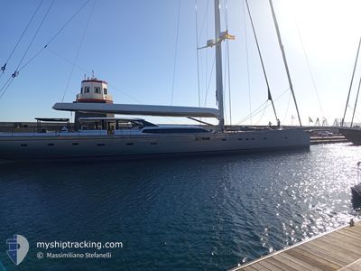
RAVENGER
Sailing

Current Trip
| Trip Time | 6 days |
|---|---|
| Trip Distance | 1503.93 nm |
| AVG Speed | 11.6 Knots |
| MAX Speed | 17.3 Knots |
| Draught | 7 m |
| AVG Wind | 8.2 knots |
| MAX Wind | 19.3 knots |
| MIN Temp | 16°C / 60.8°F |
| MAX Temp | 26.1°C / 78.98°F |
| Position Received | 4 m ago |
Current Position
| Longitude | --- |
|---|---|
| Latitude | --- |
| Status | Moored |
| Speed | |
| Course | 130° |
| Area | North Atlantic Ocean |
| Station | T-AIS |
| Position Received | 4 m ago |
Information
The current position of RAVENGER is in North Atlantic Ocean with coordinates 32.77836° / -79.95468° as reported on 2025-03-25 21:35 by AIS to our vessel tracker app. The vessel's current speed is 0 Knots and is currently inside the port of CHARLESTON.
The vessel RAVENGER (MMSI: 232007762) is a Sailing It's sailing under the flag of [GB] United Kingdom.
In this page you can find informations about the vessels current position, last detected port calls, and current voyage information. If the vessels is not in coverage by AIS you will find the latest position.
The current position of RAVENGER is detected by our AIS receivers and we are not responsible for the reliability of the data. The last position was recorded while the vessel was in Coverage by the Ais receivers of our vessel tracking app.
The current draught of RAVENGER as reported by AIS is 7 meters
Weather
| Temperature | 20.9°C / 69.62°F |
|---|---|
| Wind Speed | 9 knots |
| Direction | 183° S |
| Pressure | 1015.9 hPa |
| Humidity | 39.8 % |
| Cloud Coverage | --- |


Featured Company
Last Port Calls
| Port | Arrival | Departure | Time In Port |
|---|---|---|---|
| 2025-03-24 16:33 | |||
| 2025-03-17 11:55 | 2025-03-18 10:36 | 22 h | |
| 2025-03-07 15:57 | 2025-03-08 05:48 | 13 h | |
| 2025-03-06 15:24 | 2025-03-07 10:23 | 18 h | |
| 2025-03-01 16:17 | 2025-03-06 10:22 | 4 d | |
| 2025-03-01 12:55 | |||
| 2025-01-14 17:59 | 2025-02-07 08:17 | 23 d | |
| 2025-01-14 14:21 |
Most Visited Ports (Last year)
| Port | Arrivals | |
|---|---|---|
| 21 | ||
| 4 | ||
| 3 | ||
| 2 | ||
| 2 | ||
| 1 |
Last Trips
| Origin | Departure | Destination | Arrival | Distance | |
|---|---|---|---|---|---|
| 2025-03-18 10:36 | 2025-03-24 16:33 | 1503.93 nm | |||
| 2025-03-08 05:48 | 2025-03-17 11:55 | 380.85 nm | |||
| 2025-03-07 10:23 | 2025-03-07 15:57 | 39.78 nm | |||
| 2025-03-06 10:22 | 2025-03-06 15:24 | 46.56 nm | |||
| 2025-03-01 12:55 | 2025-03-01 16:17 | 23.59 nm | |||
| 2025-01-14 14:21 | 2025-01-14 17:59 | 11.29 nm |
Events
| Time | Event | Details | Position / Dest | Info |
|---|---|---|---|---|
| 2025-03-25 17:38 | IN Coverage |
32.77833 / -79.95465
North Atlantic Ocean
[US] CHARLESTON
|
Speed: Course: 227.4° |
|
| 2025-03-25 16:32 | OUT of Coverage |
32.77827 / -79.95464
North Atlantic Ocean
[US] CHARLESTON
|
Speed: Course: 227.4° |
|
| 2025-03-25 15:56 | IN Coverage |
32.77827 / -79.95464
North Atlantic Ocean
[US] CHARLESTON
|
Speed: Course: 227.4° |
|
| 2025-03-25 13:50 | OUT of Coverage |
32.77825 / -79.95467
North Atlantic Ocean
[US] CHARLESTON
|
Speed: Course: 227.4° |
|
| 2025-03-25 07:53 | IN Coverage |
32.77827 / -79.95464
North Atlantic Ocean
[US] CHARLESTON
|
Speed: Course: 227.4° |
|
| 2025-03-25 05:59 | OUT of Coverage |
32.77835 / -79.95468
North Atlantic Ocean
[US] CHARLESTON
|
Speed: Course: 227.4° |
|
| 2025-03-24 20:44 | STOP Moving |
32.77833 / -79.95464
[US] CHARLESTON
|
Speed: Course: 131° |
|
| 2025-03-24 20:33 | PORT ARRIVAL |
|
32.77824 / -79.95474
[US] CHARLESTON
|
Speed: 0.9 kn Course: 157° |
| 2025-03-24 16:25 | IN Coverage |
32.29619 / -79.60003
North Atlantic Ocean
|
Speed: 12.8 kn Course: 7.8° |
|
| 2025-03-24 14:32 | OUT of Coverage |
31.76551 / -79.59728
North Atlantic Ocean
|
Speed: 11.7 kn Course: 358.8° |