
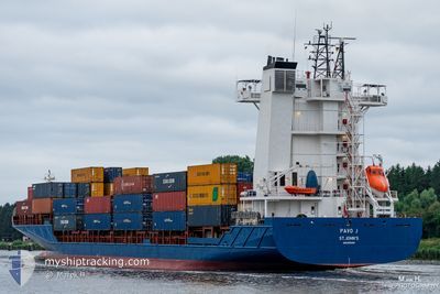
PAVO J
Container Ship
Current Trip
| Time Travelled | 1 day |
|---|---|
| Remaining Time | 3 h, 38 mins |
| Distance Travelled | 517.90 морская миля |
| Remaining Distance | 62.92 морская миля |
| AVG Speed | 16.1 Узлы |
| MAX Speed | 18.1 Узлы |
| AVG Wind | 5 knots |
| MAX Wind | 11 knots |
| MIN Temp | 9.4°C / 48.92°F |
| MAX Temp | 17.9°C / 64.22°F |
| Осадка | 5.2 м |
| Позиция Получена | Сейчас |
Current Position
| Долгота | -7.18909° |
|---|---|
| Широта | 51.11706° |
| Статус | Under way using engine |
| Скорость | 16.3 Узлы |
| Курс | 313.7° |
| Район | Celtic Sea |
| Станция | T-AIS |
| Позиция Получена | Сейчас |
Info
Information
The current position of PAVO J is in Celtic Sea with coordinates 51.11706° / -7.18909° as reported on 2024-05-02 02:33 by AIS to our vessel tracker app. The vessel's current speed is 16.3 Узлы and is heading at the port of CORK. The estimated time of arrival as calculated by MyShipTracking vessel tracking app is 2024-05-02 06:12 LT
The vessel PAVO J (IMO: 9355458, MMSI: 305055000) is a Container Ship that was built in 2007 ( 17 лет ). It's sailing under the flag of [AG] Antigua Barbuda.
In this page you can find informations about the vessels current position, last detected port calls, and current voyage information. If the vessels is not in coverage by AIS you will find the latest position.
The current position of PAVO J is detected by our AIS receivers and we are not responsible for the reliability of the data. The last position was recorded while the vessel was in Coverage by the Ais receivers of our vessel tracking app.
The current draught of PAVO J as reported by AIS is 5.2 meters
Weather
| Temperature | 10.7°C / 51.26°F |
|---|---|
| Wind Speed | 2 knots |
| Direction | 8° N |
| Pressure | 1008.7 hPa |
| Humidity | 80.2 % |
| Cloud Coverage | 100 % |
Featured Company
Last Port Calls
| Port | Arrival | Departure | Time In Port |
|---|---|---|---|
| 2024-04-30 08:58 | 2024-04-30 17:24 | 8 h | |
| 2024-04-30 08:02 | 2024-04-30 08:41 | 38 m | |
| 2024-04-27 21:26 | 2024-04-28 11:23 | 13 h | |
| 2024-04-23 08:29 | 2024-04-26 02:31 | 2 d | |
| 2024-04-23 07:23 | 2024-04-23 08:12 | 49 m | |
| 2024-04-20 23:57 | 2024-04-21 11:58 | 12 h | |
| 2024-04-18 18:58 | 2024-04-19 05:29 | 10 h | |
| 2024-04-18 17:56 | 2024-04-18 18:53 | 56 m | |
| 2024-04-16 15:32 | 2024-04-17 01:36 | 10 h | |
| 2024-04-14 10:10 | 2024-04-14 10:44 | 34 m |
Last Trips
| Origin | Departure | Destination | Arrival | Distance | |
|---|---|---|---|---|---|
| 2024-04-30 10:41 | 2024-04-30 10:58 | 0.60 морская миля | |||
| 2024-04-28 12:23 | 2024-04-30 10:02 | 644.16 морская миля | |||
| 2024-04-26 04:31 | 2024-04-27 22:26 | 636.33 морская миля | |||
| 2024-04-23 10:12 | 2024-04-23 10:29 | 0.61 морская миля | |||
| 2024-04-21 12:58 | 2024-04-23 09:23 | 643.85 морская миля | |||
| 2024-04-19 07:29 | 2024-04-21 00:57 | 634.42 морская миля | |||
| 2024-04-18 20:53 | 2024-04-18 20:58 | 0.12 морская миля | |||
| 2024-04-17 02:36 | 2024-04-18 19:56 | 644.36 морская миля | |||
| 2024-04-14 12:44 | 2024-04-16 16:32 | 647.01 морская миля | |||
| 2024-04-14 06:35 | 2024-04-14 12:10 | 1.69 морская миля |
Events
| Время | Событие | Детали | Позиция / Направление | Информация |
|---|---|---|---|---|
| 2024-05-02 01:47 | Изменение морского района | Irish part of the Celtic Sea United Kingdom part of the Celtic Sea |
50.98743 / -6.93379
Celtic Sea
IEORK
|
Скорость: 16.2 kn Курс: 314° |
| 2024-05-02 01:25 | Статус изменился | Under way using engine Default |
50.92180 / -6.82476
IEORK
|
Скорость: 16.6 kn Курс: 315° |
| 2024-05-02 01:22 | Статус изменился | Default Under way using engine |
50.91077 / -6.80646
IEORK
|
Скорость: 16.8 kn Курс: 311.6° |
| 2024-05-02 00:25 | Статус изменился | Under way using engine Default |
50.73377 / -6.51648
IEORK
|
Скорость: 15.8 kn Курс: 312° |
| 2024-05-02 00:22 | Статус изменился | Default Under way using engine |
50.72510 / -6.50234
IEORK
|
Скорость: 15.3 kn Курс: 314.8° |
| 2024-05-02 00:16 | Статус изменился | Under way using engine Default |
50.70550 / -6.47073
IEORK
|
Скорость: 16.9 kn Курс: 318° |
| 2024-05-02 00:14 | Статус изменился | Default Under way using engine |
50.69993 / -6.46177
IEORK
|
Скорость: 16.6 kn Курс: 315.4° |
| 2024-05-01 21:01 | Статус изменился | Under way using engine Default |
49.97896 / -5.85342
IEORK
|
Скорость: 15.5 kn Курс: 285° |
| 2024-05-01 20:53 | Статус изменился | Default Under way using engine |
49.96770 / -5.80330
IEORK
|
Скорость: 16.1 kn Курс: 284° |
| 2024-05-01 20:25 | Изменение морского района | United Kingdom part of the Celtic Sea United Kingdom part of the English Channel |
49.93390 / -5.61545
Celtic Sea
IEORK
|
Скорость: 15.5 kn Курс: 284° |