
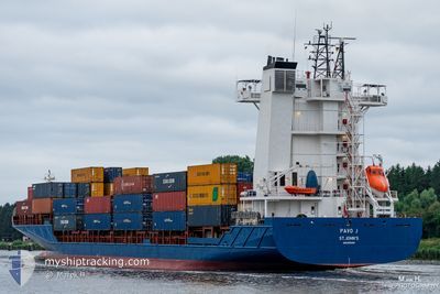
PAVO J
Container Ship
Current Trip
| Time Travelled | 19 h, 21 mins |
|---|---|
| Remaining Time | 1 day |
| Distance Travelled | 278.16 nm |
| Remaining Distance | 362.86 nm |
| AVG Speed | 14.7 Knots |
| MAX Speed | 18.3 Knots |
| AVG Wind | 5.8 knots |
| MAX Wind | 11 knots |
| MIN Temp | 4.8°C / 40.64°F |
| MAX Temp | 9°C / 48.2°F |
| Draught | 6.2 m |
| Position Received | 1 m ago |
Current Position
| Longitude | --- |
|---|---|
| Latitude | --- |
| Status | Under way using engine |
| Speed | 13 Knots |
| Course | 89° |
| Area | English Channel |
| Station | T-AIS |
| Position Received | 1 m ago |
Information
The current position of PAVO J is in English Channel with coordinates 49.86532° / -4.15462° as reported on 2025-02-28 09:47 by AIS to our vessel tracker app. The vessel's current speed is 13 Knots and is heading at the port of ROTTERDAM. The estimated time of arrival as calculated by MyShipTracking vessel tracking app is 2025-03-01 12:23 LT
The vessel PAVO J (IMO: 9355458, MMSI: 305055000) is a Container Ship that was built in 2007 ( 18 years old ). It's sailing under the flag of [AG] Antigua Barbuda.
In this page you can find informations about the vessels current position, last detected port calls, and current voyage information. If the vessels is not in coverage by AIS you will find the latest position.
The current position of PAVO J is detected by our AIS receivers and we are not responsible for the reliability of the data. The last position was recorded while the vessel was in Coverage by the Ais receivers of our vessel tracking app.
The current draught of PAVO J as reported by AIS is 6.2 meters
Weather
| Temperature | 8.2°C / 46.76°F |
|---|---|
| Wind Speed | 11 knots |
| Direction | 64° ENE |
| Pressure | 1029.4 hPa |
| Humidity | 66.9 % |
| Cloud Coverage | 5 % |
Featured Company
Last Port Calls
| Port | Arrival | Departure | Time In Port |
|---|---|---|---|
| 2025-02-26 11:43 | 2025-02-27 14:27 | 1 d | |
| 2025-02-20 19:21 | 2025-02-22 17:21 | 1 d | |
| 2025-02-20 18:20 | 2025-02-20 19:04 | 44 m | |
| 2025-02-18 08:33 | 2025-02-18 23:35 | 15 h | |
| 2025-02-16 02:06 | 2025-02-16 16:11 | 14 h | |
| 2025-02-16 01:01 | 2025-02-16 01:50 | 48 m | |
| 2025-02-13 13:27 | 2025-02-14 08:03 | 18 h | |
| 2025-02-11 05:48 | 2025-02-11 18:31 | 12 h | |
| 2025-02-11 04:52 | 2025-02-11 05:31 | 38 m | |
| 2025-02-08 12:30 | 2025-02-09 06:08 | 17 h |
Last Trips
| Origin | Departure | Destination | Arrival | Distance | |
|---|---|---|---|---|---|
| 2025-02-22 18:21 | 2025-02-26 11:43 | 647.32 nm | |||
| 2025-02-20 20:04 | 2025-02-20 20:21 | 0.67 nm | |||
| 2025-02-18 23:35 | 2025-02-20 19:20 | 642.16 nm | |||
| 2025-02-16 17:11 | 2025-02-18 08:33 | 634.49 nm | |||
| 2025-02-16 02:50 | 2025-02-16 03:06 | 0.72 nm | |||
| 2025-02-14 08:03 | 2025-02-16 02:01 | 640.99 nm | |||
| 2025-02-11 19:31 | 2025-02-13 13:27 | 633.09 nm | |||
| 2025-02-11 06:31 | 2025-02-11 06:48 | 0.74 nm | |||
| 2025-02-09 06:08 | 2025-02-11 05:52 | 641.15 nm | |||
| 2025-02-07 20:29 | 2025-02-08 12:30 | 69.78 nm |
Events
| Time | Event | Details | Position / Dest | Info |
|---|---|---|---|---|
| 2025-02-28 07:31 | Status Changed | Under way using engine Default |
49.86823 / -4.93903
NLRTM
|
Speed: 13.1 kn Course: 90° |
| 2025-02-28 07:20 | Status Changed | Default Under way using engine |
49.86906 / -5.00115
NLRTM
|
Speed: 13.2 kn Course: 92.6° |
| 2025-02-28 05:44 | Change Sea Area | United Kingdom part of the English Channel United Kingdom part of the Celtic Sea |
49.89163 / -5.56623
English Channel
NLRTM
|
Speed: 15.1 kn Course: 91.1° |
| 2025-02-28 05:07 | ETA Changed | 2025/03/01 12:45 2025/03/01 12:00 |
49.92097 / -5.81677
NLRTM
|
Speed: 16.2 kn Course: 103.5° |
| 2025-02-28 04:24 | Status Changed | Under way using engine Default |
50.00111 / -6.00835
NLRTM
|
Speed: 14.5 kn Course: 185° |
| 2025-02-28 04:20 | IN Coverage |
49.99575 / -6.00857
Celtic Sea
NLRTM
|
Speed: 14.7 kn Course: 187.9° |
|
| 2025-02-28 01:40 | Status Changed | Default Under way using engine |
50.66604 / -5.98670
NLRTM
|
Speed: 15.7 kn Course: 171.1° |
| 2025-02-28 01:32 | Status Changed | Under way using engine Default |
50.69692 / -5.98661
NLRTM
|
Speed: 15.5 kn Course: 173° |
| 2025-02-28 01:32 | OUT of Coverage |
50.69692 / -5.98661
Celtic Sea
NLRTM
|
Speed: 15.7 kn Course: 171.1° |
|
| 2025-02-28 01:23 | Status Changed | Default Under way using engine |
50.73573 / -5.98633
NLRTM
|
Speed: 15.6 kn Course: 178.4° |