
ODYSSEA
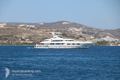
Yacht
Current Trip
| Trip Time | 4 days |
|---|---|
| Trip Distance | 145.29 морская миля |
| AVG Speed | 8.6 Узлы |
| MAX Speed | 12.3 Узлы |
| Осадка | 3 м |
| AVG Wind | 9.4 knots |
| MAX Wind | 17.9 knots |
| MIN Temp | 17°C / 62.6°F |
| MAX Temp | 24°C / 75.2°F |
| Позиция Получена | Сейчас |
Current Position
| Долгота | -71.31743° |
|---|---|
| Широта | 41.48181° |
| Статус | Under way using engine |
| Скорость | |
| Курс | 92° |
| Район | North Atlantic Ocean |
| Станция | T-AIS |
| Позиция Получена | Сейчас |
Info
Information
The current position of ODYSSEA is in North Atlantic Ocean with coordinates 41.48181° / -71.31743° as reported on 2024-07-03 16:03 by AIS to our vessel tracker app. The vessel's current speed is 0 Узлы and is currently inside the port of NEWPORT (RI).
The vessel ODYSSEA (IMO: 1011264, MMSI: 319143700) is a Yacht that was built in 2012 ( 12 лет ). It's sailing under the flag of [KY] Cayman Is.
In this page you can find informations about the vessels current position, last detected port calls, and current voyage information. If the vessels is not in coverage by AIS you will find the latest position.
The current position of ODYSSEA is detected by our AIS receivers and we are not responsible for the reliability of the data. The last position was recorded while the vessel was in Coverage by the Ais receivers of our vessel tracking app.
The current draught of ODYSSEA as reported by AIS is 3 meters
Weather
| Temperature | 23.7°C / 74.66°F |
|---|---|
| Wind Speed | 7 knots |
| Direction | 190° S |
| Pressure | 1022.5 hPa |
| Humidity | 54.1 % |
| Cloud Coverage | 85 % |
Featured Company
Last Port Calls
| Port | Arrival | Departure | Time In Port |
|---|---|---|---|
| 2024-07-03 14:15 | |||
| 2024-06-28 22:09 | 2024-06-29 11:56 | 13 h | |
| 2024-06-23 15:32 | 2024-06-27 09:32 | 3 d | |
| 2024-06-21 14:09 | 2024-06-22 14:43 | 1 d | |
| 2024-06-19 16:13 | 2024-06-20 11:12 | 18 h | |
| 2024-05-12 16:20 | 2024-06-02 18:16 | 21 d |
Most Visited Ports (Last year)
| Port | Arrivals | |
|---|---|---|
| 2 | ||
| 2 | ||
| 2 | ||
| 1 | ||
| 1 | ||
| 1 |
Last Trips
| Origin | Departure | Destination | Arrival | Distance | |
|---|---|---|---|---|---|
| 2024-06-29 07:56 | 2024-07-03 10:15 | 145.29 морская миля | |||
| 2024-06-27 05:32 | 2024-06-28 18:09 | 62.98 морская миля | |||
| 2024-06-22 10:43 | 2024-06-23 11:32 | 237.29 морская миля | |||
| 2024-06-20 07:12 | 2024-06-21 10:09 | 58.41 морская миля | |||
| 2024-06-02 14:16 | 2024-06-19 12:13 | 958.17 морская миля | |||
| 2024-04-29 15:07 | 2024-05-12 12:20 | 566.23 морская миля |
Events
| Время | Событие | Детали | Позиция / Направление | Информация |
|---|---|---|---|---|
| 2024-07-03 14:31 | Окончание движения |
41.48183 / -71.31771
[US] NEWPORT (RI)
|
Скорость: 0.3 kn Курс: 93° |
|
| 2024-07-03 14:15 | Порт |
|
41.48315 / -71.33437
[US] NEWPORT (RI)
|
Скорость: 4.4 kn Курс: 111° |
| 2024-07-03 12:00 | Статус изменился | Under way using engine At anchor |
41.25805 / -71.59152
HYDE PARK
|
Скорость: 9.5 kn Курс: 6.6° |
| 2024-07-03 11:15 | Начало движения | 1.36 nm, North West of BLOCK ISLAND |
41.18752 / -71.58065
HYDE PARK
|
Скорость: 3.3 kn Курс: 32° |
| 2024-07-03 10:36 | В покрытии |
41.18422 / -71.58107
North Atlantic Ocean
|
Скорость: Курс: 133.2° |
|
| 2024-07-03 09:27 | Вне покрытия |
41.18423 / -71.58109
North Atlantic Ocean
|
Скорость: Курс: 317.4° |
|
| 2024-07-03 08:21 | В покрытии |
41.18424 / -71.58107
North Atlantic Ocean
|
Скорость: Курс: 26.5° |
|
| 2024-07-03 06:54 | Вне покрытия |
41.18422 / -71.58108
North Atlantic Ocean
|
Скорость: 0.1 kn Курс: 199.1° |
|
| 2024-07-03 03:03 | В покрытии |
41.18422 / -71.58107
North Atlantic Ocean
|
Скорость: Курс: 20.4° |
|
| 2024-07-02 15:50 | Вне покрытия |
41.20914 / -71.60957
North Atlantic Ocean
|
Скорость: 5 kn Курс: 95.5° |