
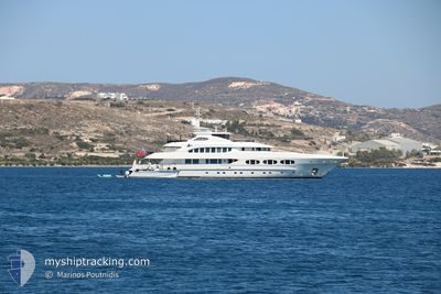
ODYSSEA
Yacht
Current Trip
HYDE PARK
| Time Travelled | 2 days |
|---|---|
| Remaining Time | --- |
| Distance Travelled | 48.68 nm |
| Remaining Distance | --- |
| AVG Speed | 9.8 Knopen |
| MAX Speed | 12.3 Knopen |
| AVG Wind | 12 knots |
| MAX Wind | 17.9 knots |
| MIN Temp | 21.1°C / 69.98°F |
| MAX Temp | 24°C / 75.2°F |
| Diepgang | 3 M |
| Positie ontvangen | 1 d geleden |
Current Position
| Lengtegraad | -73.08160° |
|---|---|
| Breedtegraat | 40.98960° |
| Status | At anchor |
| Snelheid | 11.6 Knopen |
| Koers | 73.4° |
| Gebied | North Atlantic Ocean |
| Station | T-AIS |
| Positie ontvangen | 1 d geleden |
Info
Information
The current position of ODYSSEA is in North Atlantic Ocean with coordinates 40.98960° / -73.08160° as reported on 2024-06-30 11:31 by AIS to our vessel tracker app. The vessel's current speed is 11.6 Knopen
The vessel ODYSSEA (IMO: 1011264, MMSI: 319143700) is a Yacht that was built in 2012 ( 12 Jaar oud ). It's sailing under the flag of [KY] Cayman Is.
In this page you can find informations about the vessels current position, last detected port calls, and current voyage information. If the vessels is not in coverage by AIS you will find the latest position.
The current position of ODYSSEA is detected by our AIS receivers and we are not responsible for the reliability of the data. The last position was recorded while the vessel was in Coverage by the Ais receivers of our vessel tracking app.
The current draught of ODYSSEA as reported by AIS is 3 meters
Weather
| Temperature | 21.2°C / 70.16°F |
|---|---|
| Wind Speed | 9 knots |
| Direction | 212° SSW |
| Pressure | 1013.9 hPa |
| Humidity | 98 % |
| Cloud Coverage | 100 % |
Featured Company
Last Port Calls
| Port | Arrival | Departure | Time In Port |
|---|---|---|---|
| 2024-06-28 22:09 | 2024-06-29 11:56 | 13 h | |
| 2024-06-23 15:32 | 2024-06-27 09:32 | 3 d | |
| 2024-06-21 14:09 | 2024-06-22 14:43 | 1 d | |
| 2024-06-19 16:13 | 2024-06-20 11:12 | 18 h | |
| 2024-05-12 16:20 | 2024-06-02 18:16 | 21 d |
Most Visited Ports (Last year)
| Port | Arrivals | |
|---|---|---|
| 2 | ||
| 2 | ||
| 2 | ||
| 1 | ||
| 1 | ||
| 1 |
Last Trips
| Origin | Departure | Destination | Arrival | Distance | |
|---|---|---|---|---|---|
| 2024-06-27 05:32 | 2024-06-28 18:09 | 62.98 nm | |||
| 2024-06-22 10:43 | 2024-06-23 11:32 | 237.29 nm | |||
| 2024-06-20 07:12 | 2024-06-21 10:09 | 58.41 nm | |||
| 2024-06-02 14:16 | 2024-06-19 12:13 | 958.17 nm | |||
| 2024-04-29 15:07 | 2024-05-12 12:20 | 566.23 nm |
Events
| Tijd | Evenement | Details | Positie / Bestemming | Info |
|---|---|---|---|---|
| 2024-06-30 11:31 | Buitenbereik |
40.98960 / -73.08160
North Atlantic Ocean
|
Snelheid: 11.6 kn Koers: 73.4° |
|
| 2024-06-30 11:16 | Start beweging | 0.6 nm, North West of PORT JEFFERSON |
40.95943 / -73.08169
HYDE PARK
|
Snelheid: 3.3 kn Koers: 349° |
| 2024-06-30 07:56 | Binnenbereik |
40.95806 / -73.08461
North Atlantic Ocean
|
Snelheid: Koers: 231.9° |
|
| 2024-06-30 06:17 | Buitenbereik |
40.95801 / -73.08423
North Atlantic Ocean
|
Snelheid: Koers: 54.7° |
|
| 2024-06-29 16:53 | Stop beweging | 0.61 nm, North West of PORT JEFFERSON |
40.95788 / -73.08414
HYDE PARK
|
Snelheid: Koers: 212° |
| 2024-06-29 15:57 | ETA Changed | 2024/06/27 16:00 |
40.99054 / -73.15883
HYDE PARK
|
Snelheid: 10.2 kn Koers: 89.7° |
| 2024-06-29 13:05 | Start beweging | 1.42 nm, North of KINGS POINT |
40.83508 / -73.77252
HYDE PARK
|
Snelheid: 6.5 kn Koers: 57.3° |
| 2024-06-29 13:03 | Stop beweging | 1.43 nm, North of KINGS POINT |
40.83471 / -73.77515
HYDE PARK
|
Snelheid: 0.1 kn Koers: 170° |
| 2024-06-29 11:56 | Vertrekhaven |
|
40.77570 / -73.93951
HYDE PARK
|
Snelheid: 9.1 kn Koers: 44° |
| 2024-06-29 11:01 | Start beweging |
40.68821 / -74.03915
[US] NEW YORK
|
Snelheid: 5.7 kn Koers: 42° |