
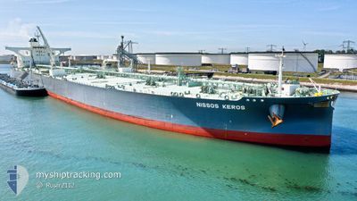
NISSOS KEROS
Tanker
Current Trip
CNZNG
| Time Travelled | 49 days |
|---|---|
| Remaining Time | --- |
| Distance Travelled | 14976.95 морская миля |
| Remaining Distance | --- |
| AVG Speed | 12.2 Узлы |
| MAX Speed | 15.9 Узлы |
| AVG Wind | 12.3 knots |
| MAX Wind | 31 knots |
| MIN Temp | 6.2°C / 43.16°F |
| MAX Temp | 31.1°C / 87.98°F |
| Осадка | 20.5 м |
| Позиция Получена | 8 d тому назад |
Current Position
| Долгота | 104.40508° |
|---|---|
| Широта | 1.36043° |
| Статус | Constrained by her draught |
| Скорость | 12.1 Узлы |
| Курс | 46.3° |
| Район | South China Sea |
| Станция | T-AIS |
| Позиция Получена | 8 d тому назад |
Info
Information
The current position of NISSOS KEROS is in South China Sea with coordinates 1.36043° / 104.40508° as reported on 2024-05-19 10:01 by AIS to our vessel tracker app. The vessel's current speed is 12.1 Узлы
The vessel NISSOS KEROS (IMO: 9856074, MMSI: 538008311) is a Tanker It's sailing under the flag of [MH] Marshall Is.
In this page you can find informations about the vessels current position, last detected port calls, and current voyage information. If the vessels is not in coverage by AIS you will find the latest position.
The current position of NISSOS KEROS is detected by our AIS receivers and we are not responsible for the reliability of the data. The last position was recorded while the vessel was in Coverage by the Ais receivers of our vessel tracking app.
The current draught of NISSOS KEROS as reported by AIS is 20.5 meters
Weather
| Temperature | 18°C / 64.4°F |
|---|---|
| Wind Speed | 11 knots |
| Direction | 46° NE |
| Pressure | 1007.9 hPa |
| Humidity | 68.6 % |
| Cloud Coverage | 100 % |
Featured Company
Last Port Calls
| Port | Arrival | Departure | Time In Port |
|---|---|---|---|
| 2024-04-05 22:01 | 2024-04-07 13:47 | 1 d | |
| 2024-03-29 16:58 | 2024-03-31 10:40 | 1 d | |
| 2024-03-28 14:35 | 2024-03-29 16:28 | 1 d |
Most Visited Ports (Last year)
| Port | Arrivals | |
|---|---|---|
| 3 | ||
| 2 | ||
| 2 | ||
| 1 | ||
| 1 | ||
| 1 |
Last Trips
| Origin | Departure | Destination | Arrival | Distance | |
|---|---|---|---|---|---|
| 2024-03-31 12:40 | 2024-04-06 00:01 | 647.05 морская миля | |||
| 2024-03-29 17:28 | 2024-03-29 17:58 | 2.01 морская миля | |||
| 2024-02-28 00:55 | 2024-03-28 15:35 | 6520.11 морская миля |
Events
| Время | Событие | Детали | Позиция / Направление | Информация |
|---|---|---|---|---|
| 2024-05-19 10:08 | Статус изменился | Default Constrained by her draught |
1.37808 / 104.42388
CNZNG
|
Скорость: 12.1 kn Курс: 46.3° |
| 2024-05-19 10:01 | Вне покрытия |
1.36043 / 104.40508
South China Sea
CNZNG
|
Скорость: 12.1 kn Курс: 46.3° |
|
| 2024-05-19 09:58 | Статус изменился | Constrained by her draught Default |
1.35418 / 104.39878
CNZNG
|
Скорость: 12 kn Курс: 41° |
| 2024-05-19 09:48 | Статус изменился | Default Constrained by her draught |
1.33045 / 104.37695
CNZNG
|
Скорость: 11.9 kn Курс: 45.1° |
| 2024-05-19 09:43 | Изменение морского района | Malaysian part of the South China Sea Malaysian part of the Singapore Strait |
1.31792 / 104.36446
South China Sea
CNZNG
|
Скорость: 11.9 kn Курс: 45.1° |
| 2024-05-19 09:37 | Статус изменился | Constrained by her draught Default |
1.30492 / 104.35116
CNZNG
|
Скорость: 11.8 kn Курс: 46° |
| 2024-05-19 09:36 | Статус изменился | Default Constrained by her draught |
1.30269 / 104.34878
CNZNG
|
Скорость: 11.6 kn Курс: 45.7° |
| 2024-05-19 09:18 | Статус изменился | Constrained by her draught Default |
1.27624 / 104.29974
CNZNG
|
Скорость: 12 kn Курс: 87° |
| 2024-05-19 09:16 | Статус изменился | Default Constrained by her draught |
1.27585 / 104.29306
CNZNG
|
Скорость: 11.8 kn Курс: 86.4° |
| 2024-05-19 08:28 | Обнаружено в море | Malaysian part of the Singapore Strait |
1.26031 / 104.14390
Singapore Strait
CNZNG
|
Скорость: 9.6 kn Курс: 81.9° |