
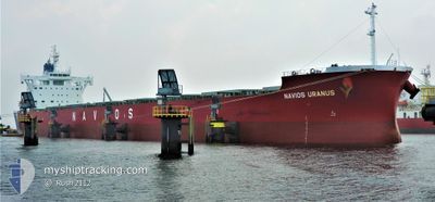
NAVIOS URANUS
Cargo
Current Trip
| Time Travelled | 5 days |
|---|---|
| Remaining Time | --- |
| Distance Travelled | 1856.46 морская миля |
| Remaining Distance | --- |
| AVG Speed | 13.7 Узлы |
| MAX Speed | 16.3 Узлы |
| AVG Wind | 17.5 knots |
| MAX Wind | 28 knots |
| MIN Temp | 12.8°C / 55.04°F |
| MAX Temp | 24.3°C / 75.74°F |
| Осадка | 8.6 м |
| Позиция Получена | 1 d тому назад |
Current Position
| Долгота | 141.31064° |
|---|---|
| Широта | 35.57616° |
| Статус | Under way using engine |
| Скорость | 16 Узлы |
| Курс | 49.3° |
| Район | North Pacific Ocean |
| Станция | T-AIS |
| Позиция Получена | 1 d тому назад |
Info
Information
The current position of NAVIOS URANUS is in North Pacific Ocean with coordinates 35.57616° / 141.31064° as reported on 2024-05-06 13:53 by AIS to our vessel tracker app. The vessel's current speed is 16 Узлы and is heading at the port of KALAMA. The estimated time of arrival as calculated by MyShipTracking vessel tracking app is 2024-05-18 23:00 LT
The vessel NAVIOS URANUS (IMO: 9852884, MMSI: 538008667) is a Cargo It's sailing under the flag of [MH] Marshall Is.
In this page you can find informations about the vessels current position, last detected port calls, and current voyage information. If the vessels is not in coverage by AIS you will find the latest position.
The current position of NAVIOS URANUS is detected by our AIS receivers and we are not responsible for the reliability of the data. The last position was recorded while the vessel was in Coverage by the Ais receivers of our vessel tracking app.
The current draught of NAVIOS URANUS as reported by AIS is 8.6 meters
Weather
| Temperature | 13°C / 55.4°F |
|---|---|
| Wind Speed | 19 knots |
| Direction | 207° SSW |
| Pressure | 1005.9 hPa |
| Humidity | 98.8 % |
| Cloud Coverage | 100 % |
Featured Company
Events
| Время | Событие | Детали | Позиция / Направление | Информация |
|---|---|---|---|---|
| 2024-05-06 14:01 | Статус изменился | Default Under way using engine |
35.59804 / 141.34166
US KAM
|
Скорость: 16 kn Курс: 49.3° |
| 2024-05-06 13:53 | Вне покрытия |
35.57616 / 141.31064
North Pacific Ocean
US KAM
|
Скорость: 16 kn Курс: 49.3° |
|
| 2024-05-06 07:26 | Изменение морского района | Japanese part of the North Pacific Ocean Japanese part of the Philippine Sea |
34.65506 / 139.64634
North Pacific Ocean
US KAM
|
Скорость: 15.7 kn Курс: 79.8° |
| 2024-05-06 07:08 | ETA изменился | 2024/05/18 23:00 2024/05/18 19:00 |
34.64168 / 139.54950
US KAM
|
Скорость: 15.5 kn Курс: 81.2° |
| 2024-05-06 07:02 | Статус изменился | Under way using engine Default |
34.63819 / 139.52167
US KAM
|
Скорость: 15.6 kn Курс: 82° |
| 2024-05-06 06:57 | Статус изменился | Default Under way using engine |
34.63515 / 139.49364
US KAM
|
Скорость: 15.4 kn Курс: 83.2° |
| 2024-05-06 06:50 | Изменение морского района | Japanese part of the Philippine Sea Taiwanese part of the Eastern China Sea |
34.63147 / 139.45860
Philippine Sea
US KAM
|
Скорость: 15.4 kn Курс: 83.2° |
| 2024-05-06 06:49 | Статус изменился | Under way using engine Default |
34.63107 / 139.45457
US KAM
|
Скорость: 15.2 kn Курс: 82° |
| 2024-05-06 06:45 | В покрытии |
34.63147 / 139.45860
Philippine Sea
US KAM
|
Скорость: 15.4 kn Курс: 83.2° |
|
| 2024-05-03 00:54 | Вне покрытия |
25.62954 / 121.75581
Eastern China Sea
US KAM
|
Скорость: 13.4 kn Курс: 56.7° |