
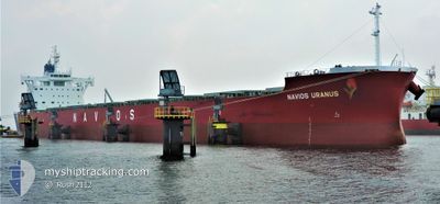
NAVIOS URANUS
Cargo
Current Trip
| Time Travelled | 8 h, 16 mins |
|---|---|
| Remaining Time | --- |
| Distance Travelled | 100.69 nm |
| Remaining Distance | --- |
| AVG Speed | 12.5 Noeuds |
| MAX Speed | 13.5 Noeuds |
| AVG Wind | 17.1 knots |
| MAX Wind | 21.8 knots |
| MIN Temp | 21.7°C / 71.06°F |
| MAX Temp | 22.7°C / 72.86°F |
| Tirant d eau | 8.6 m |
| Position reçue | 1 m depuis |
Current Position
| Longitude | 121.61831° |
|---|---|
| Latitude | 25.54612° |
| Etat | Under way using engine |
| Vitesse | 13.5 Noeuds |
| Parcours | 58.6° |
| Zone | Eastern China Sea |
| Station | T-AIS |
| Position reçue | 1 m depuis |
Info
Information
The current position of NAVIOS URANUS is in Eastern China Sea with coordinates 25.54612° / 121.61831° as reported on 2024-05-03 00:14 by AIS to our vessel tracker app. The vessel's current speed is 13.5 Noeuds and is heading at the port of KALAMA. The estimated time of arrival as calculated by MyShipTracking vessel tracking app is 2024-05-18 19:00 LT
The vessel NAVIOS URANUS (IMO: 9852884, MMSI: 538008667) is a Cargo It's sailing under the flag of [MH] Marshall Is.
In this page you can find informations about the vessels current position, last detected port calls, and current voyage information. If the vessels is not in coverage by AIS you will find the latest position.
The current position of NAVIOS URANUS is detected by our AIS receivers and we are not responsible for the reliability of the data. The last position was recorded while the vessel was in Coverage by the Ais receivers of our vessel tracking app.
The current draught of NAVIOS URANUS as reported by AIS is 8.6 meters
Weather
| Temperature | 22.2°C / 71.96°F |
|---|---|
| Wind Speed | 13 knots |
| Direction | 67° ENE |
| Pressure | 1016.1 hPa |
| Humidity | 75.8 % |
| Cloud Coverage | 99 % |
Featured Company
Events
| Heure | Evenement | Détails | Position/ Destination | Info |
|---|---|---|---|---|
| 2024-05-02 23:23 | Etat Changé | Under way using engine Default |
25.44467 / 121.44077
US KAM
|
Vitesse: 12.8 kn Parcours: 60° |
| 2024-05-02 23:08 | Etat Changé | Default Under way using engine |
25.41838 / 121.38963
US KAM
|
Vitesse: 12.5 kn Parcours: 59° |
| 2024-05-02 22:38 | Etat Changé | Under way using engine Default |
25.36388 / 121.28871
US KAM
|
Vitesse: 12.1 kn Parcours: 64° |
| 2024-05-02 22:34 | Etat Changé | Default Under way using engine |
25.35797 / 121.27752
US KAM
|
Vitesse: 12 kn Parcours: 61.9° |
| 2024-05-02 22:07 | Changement de zone | Taiwanese part of the Eastern China Sea Taiwanese part of the South China Sea |
25.31115 / 121.19390
Eastern China Sea
US KAM
|
Vitesse: 12.2 kn Parcours: 56.3° |
| 2024-05-02 22:02 | Tirant d'eau modifié | 8.6 12 |
25.29975 / 121.17533
US KAM
|
Vitesse: 12 kn Parcours: 56.9° |
| 2024-05-02 22:02 | Changement de destination | US KAM TW TXG |
25.29975 / 121.17533
US KAM
|
Vitesse: 12 kn Parcours: 56.9° |
| 2024-05-02 22:02 | Changement d'ETA | 2024/05/18 19:00 2024/04/22 22:00 |
25.29975 / 121.17533
US KAM
|
Vitesse: 12 kn Parcours: 56.9° |
| 2024-05-02 22:00 | Etat Changé | Under way using engine Default |
25.29673 / 121.17020
TW TXG
|
Vitesse: 12 kn Parcours: 56° |
| 2024-05-02 21:48 | Etat Changé | Default Under way using engine |
25.27556 / 121.13528
TW TXG
|
Vitesse: 11.9 kn Parcours: 56.2° |