

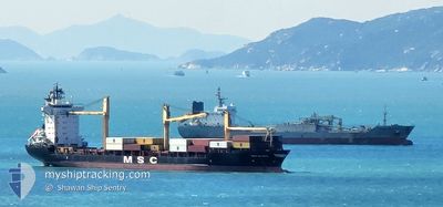
MSC ELSA3
Container Ship

Current Trip
| Time Travelled | 1 day |
|---|---|
| Remaining Time | --- |
| Distance Travelled | --- |
| Remaining Distance | --- |
| AVG Speed | --- |
| MAX Speed | --- |
| AVG Wind | --- |
| MAX Wind | --- |
| MIN Temp | --- |
| MAX Temp | --- |
| Осадка | 9.5 м |
| Позиция Получена | 2 d тому назад |
Current Position
| Долгота | --- |
|---|---|
| Широта | --- |
| Статус | Under way using engine |
| Скорость | 7.7 Узлы |
| Курс | 37.9° |
| Район | Indian Ocean |
| Станция | T-AIS |
| Позиция Получена | 2 d тому назад |
Information
The current position of MSC ELSA3 is in Indian Ocean with coordinates 5.84290° / 80.89743° as reported on 2025-02-23 00:55 by AIS to our vessel tracker app. The vessel's current speed is 7.7 Узлы
The vessel MSC ELSA3 (IMO: 9123221, MMSI: 636016814) is a Container Ship that was built in 1997 ( 28 лет ). It's sailing under the flag of [LR] Liberia.
In this page you can find informations about the vessels current position, last detected port calls, and current voyage information. If the vessels is not in coverage by AIS you will find the latest position.
The current position of MSC ELSA3 is detected by our AIS receivers and we are not responsible for the reliability of the data. The last position was recorded while the vessel was in Coverage by the Ais receivers of our vessel tracking app.
The current draught of MSC ELSA3 as reported by AIS is 9.5 meters
Weather
| Temperature | 27.4°C / 81.32°F |
|---|---|
| Wind Speed | 18 knots |
| Direction | 54° NE |
| Pressure | 1014.9 hPa |
| Humidity | 73.7 % |
| Cloud Coverage | 31 % |


Featured Company
Last Port Calls
| Port | Arrival | Departure | Time In Port |
|---|---|---|---|
| 2025-02-23 03:47 | 2025-02-23 23:22 | 19 h | |
| 2025-02-21 05:09 | 2025-02-22 11:29 | 1 d | |
| 2025-02-13 00:37 | 2025-02-13 13:33 | 12 h | |
| 2025-01-25 00:09 | 2025-01-25 15:37 | 15 h | |
| 2025-01-04 17:05 | 2025-01-06 01:05 | 1 d | |
| 2024-12-13 01:05 | 2024-12-13 15:08 | 14 h |
Most Visited Ports (Last year)
| Port | Arrivals | |
|---|---|---|
| 13 | ||
| 7 | ||
| 5 | ||
| 5 | ||
| 3 | ||
| 2 |
Last Trips
| Origin | Departure | Destination | Arrival | Distance | |
|---|---|---|---|---|---|
| 2025-02-22 16:59 | 2025-02-23 09:17 | 155.79 морская миля | |||
| 2025-02-13 19:03 | 2025-02-21 10:39 | 387.71 морская миля | |||
| 2025-01-25 21:07 | 2025-02-13 06:07 | 3125.00 морская миля | |||
| 2025-01-06 06:35 | 2025-01-25 05:39 | 847.10 морская миля | |||
| 2024-12-13 20:38 | 2025-01-04 22:35 | 3128.54 морская миля | |||
| 2024-11-26 15:14 | 2024-12-13 06:35 | 3095.54 морская миля |
Events
| Время | Событие | Детали | Позиция / Направление | Информация |
|---|---|---|---|---|
| 2025-02-23 23:22 | ПОРТ ОТПРАВЛЕНИЯ |
|
6.09696 / 81.11678
LKCMB
|
Скорость: 6.8 kn Курс: 153° |
| 2025-02-23 23:12 | Начало движения |
6.12018 / 81.10193
[LK] HAMBANTOTA
|
Скорость: 6.8 kn Курс: 153° |
|
| 2025-02-23 04:18 | Окончание движения |
6.12453 / 81.09724
[LK] HAMBANTOTA
|
Скорость: Курс: 181° |
|
| 2025-02-23 03:47 | Порт |
|
6.12185 / 81.10180
[LK] HAMBANTOTA
|
Скорость: 7 kn Курс: 326° |
| 2025-02-23 01:01 | Статус изменился | Default Under way using engine |
5.85272 / 80.90500
LKCMB
|
Скорость: 7.7 kn Курс: 37.9° |
| 2025-02-23 00:55 | Вне покрытия |
5.84290 / 80.89743
Indian Ocean
|
Скорость: 7.7 kn Курс: 37.9° |
|
| 2025-02-22 21:21 | Изменение морского района | Sri Lankan part of the Indian Ocean Sri Lankan part of the Laccadive Sea |
5.72246 / 80.51068
Indian Ocean
|
Скорость: 7.6 kn Курс: 92.3° |
| 2025-02-22 21:21 | Статус изменился | Under way using engine Default |
5.72246 / 80.51068
LKCMB
|
Скорость: 7.7 kn Курс: 100° |
| 2025-02-22 20:29 | Статус изменился | Default Under way using engine |
5.74623 / 80.40360
LKCMB
|
Скорость: 7.5 kn Курс: 95.7° |
| 2025-02-22 17:15 | Статус изменился | Under way using engine Default |
5.98698 / 80.02012
LKCMB
|
Скорость: 12.8 kn Курс: 141° |