

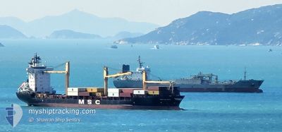
MSC ELSA3
Container Ship

Current Trip
| Time Travelled | 1 day |
|---|---|
| Remaining Time | --- |
| Distance Travelled | --- |
| Remaining Distance | --- |
| AVG Speed | --- |
| MAX Speed | --- |
| AVG Wind | --- |
| MAX Wind | --- |
| MIN Temp | --- |
| MAX Temp | --- |
| Djupgående | 9.5 m |
| Position mottagen | 2 d sen |
Current Position
| Longitud | --- |
|---|---|
| Latitude | --- |
| Status | Under way using engine |
| Fart | 7.7 Knop |
| Kurs | 37.9° |
| Område | Indian Ocean |
| Station | T-AIS |
| Position mottagen | 2 d sen |
Information
The current position of MSC ELSA3 is in Indian Ocean with coordinates 5.84290° / 80.89743° as reported on 2025-02-23 00:55 by AIS to our vessel tracker app. The vessel's current speed is 7.7 Knop
The vessel MSC ELSA3 (IMO: 9123221, MMSI: 636016814) is a Container Ship that was built in 1997 ( 28 År gammal ). It's sailing under the flag of [LR] Liberia.
In this page you can find informations about the vessels current position, last detected port calls, and current voyage information. If the vessels is not in coverage by AIS you will find the latest position.
The current position of MSC ELSA3 is detected by our AIS receivers and we are not responsible for the reliability of the data. The last position was recorded while the vessel was in Coverage by the Ais receivers of our vessel tracking app.
The current draught of MSC ELSA3 as reported by AIS is 9.5 meters
Weather
| Temperature | 27.4°C / 81.32°F |
|---|---|
| Wind Speed | 18 knots |
| Direction | 54° NE |
| Pressure | 1014.9 hPa |
| Humidity | 73.7 % |
| Cloud Coverage | 31 % |


Featured Company
Last Port Calls
| Port | Arrival | Departure | Time In Port |
|---|---|---|---|
| 2025-02-23 03:47 | 2025-02-23 23:22 | 19 h | |
| 2025-02-21 05:09 | 2025-02-22 11:29 | 1 d | |
| 2025-02-13 00:37 | 2025-02-13 13:33 | 12 h | |
| 2025-01-25 00:09 | 2025-01-25 15:37 | 15 h | |
| 2025-01-04 17:05 | 2025-01-06 01:05 | 1 d | |
| 2024-12-13 01:05 | 2024-12-13 15:08 | 14 h |
Most Visited Ports (Last year)
| Port | Arrivals | |
|---|---|---|
| 13 | ||
| 7 | ||
| 5 | ||
| 5 | ||
| 3 | ||
| 2 |
Last Trips
| Origin | Departure | Destination | Arrival | Distance | |
|---|---|---|---|---|---|
| 2025-02-22 16:59 | 2025-02-23 09:17 | 155.79 nm | |||
| 2025-02-13 19:03 | 2025-02-21 10:39 | 387.71 nm | |||
| 2025-01-25 21:07 | 2025-02-13 06:07 | 3125.00 nm | |||
| 2025-01-06 06:35 | 2025-01-25 05:39 | 847.10 nm | |||
| 2024-12-13 20:38 | 2025-01-04 22:35 | 3128.54 nm | |||
| 2024-11-26 15:14 | 2024-12-13 06:35 | 3095.54 nm |
Events
| Tid | Event | Detaljer | Position / Dest | Information |
|---|---|---|---|---|
| 2025-02-23 23:22 | AVGÅTT HAMN |
|
6.09696 / 81.11678
LKCMB
|
Fart: 6.8 kn Kurs: 153° |
| 2025-02-23 23:12 | STARTAR förflyttning |
6.12018 / 81.10193
[LK] HAMBANTOTA
|
Fart: 6.8 kn Kurs: 153° |
|
| 2025-02-23 04:18 | STOPPAR förflyttning |
6.12453 / 81.09724
[LK] HAMBANTOTA
|
Fart: Kurs: 181° |
|
| 2025-02-23 03:47 | ANLÄNDER HAMN |
|
6.12185 / 81.10180
[LK] HAMBANTOTA
|
Fart: 7 kn Kurs: 326° |
| 2025-02-23 01:01 | Status ändrad | Default Under way using engine |
5.85272 / 80.90500
LKCMB
|
Fart: 7.7 kn Kurs: 37.9° |
| 2025-02-23 00:55 | UTANFÖR täckningsområde |
5.84290 / 80.89743
Indian Ocean
|
Fart: 7.7 kn Kurs: 37.9° |
|
| 2025-02-22 21:21 | Byter havsområde | Sri Lankan part of the Indian Ocean Sri Lankan part of the Laccadive Sea |
5.72246 / 80.51068
Indian Ocean
|
Fart: 7.6 kn Kurs: 92.3° |
| 2025-02-22 21:21 | Status ändrad | Under way using engine Default |
5.72246 / 80.51068
LKCMB
|
Fart: 7.7 kn Kurs: 100° |
| 2025-02-22 20:29 | Status ändrad | Default Under way using engine |
5.74623 / 80.40360
LKCMB
|
Fart: 7.5 kn Kurs: 95.7° |
| 2025-02-22 17:15 | Status ändrad | Under way using engine Default |
5.98698 / 80.02012
LKCMB
|
Fart: 12.8 kn Kurs: 141° |