
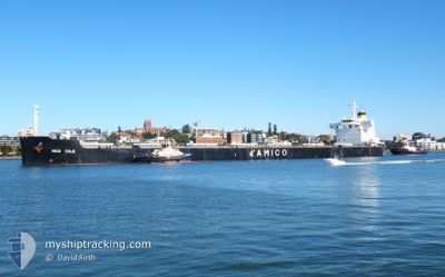
MEDI EOLIE
Cargo
Current Trip
| Time Travelled | 1 day |
|---|---|
| Remaining Time | --- |
| Distance Travelled | 470.35 морская миля |
| Remaining Distance | --- |
| AVG Speed | 10.2 Узлы |
| MAX Speed | 12 Узлы |
| AVG Wind | 14.4 knots |
| MAX Wind | 17.9 knots |
| MIN Temp | 13°C / 55.4°F |
| MAX Temp | 21.8°C / 71.24°F |
| Осадка | 14.6 м |
| Позиция Получена | 1 d тому назад |
Current Position
| Долгота | -75.91441° |
|---|---|
| Широта | 36.91008° |
| Статус | Under way using engine |
| Скорость | 10.4 Узлы |
| Курс | 137.5° |
| Район | North Atlantic Ocean |
| Станция | T-AIS |
| Позиция Получена | 1 d тому назад |
Info
Information
The current position of MEDI EOLIE is in North Atlantic Ocean with coordinates 36.91008° / -75.91441° as reported on 2024-05-19 12:01 by AIS to our vessel tracker app. The vessel's current speed is 10.4 Узлы and is heading at the port of COLOMBO. The estimated time of arrival as calculated by MyShipTracking vessel tracking app is 2024-06-27 09:00 LT
The vessel MEDI EOLIE (IMO: 9728186, MMSI: 636022128) is a Cargo It's sailing under the flag of [LR] Liberia.
In this page you can find informations about the vessels current position, last detected port calls, and current voyage information. If the vessels is not in coverage by AIS you will find the latest position.
The current position of MEDI EOLIE is detected by our AIS receivers and we are not responsible for the reliability of the data. The last position was recorded while the vessel was in Coverage by the Ais receivers of our vessel tracking app.
The current draught of MEDI EOLIE as reported by AIS is 14.6 meters
Weather
| Temperature | 21.4°C / 70.52°F |
|---|---|
| Wind Speed | 8 knots |
| Direction | 336° NNW |
| Pressure | 1010.8 hPa |
| Humidity | 85.1 % |
| Cloud Coverage | --- |
Featured Company
Last Port Calls
| Port | Arrival | Departure | Time In Port |
|---|---|---|---|
| 2024-05-16 21:14 | 2024-05-19 10:15 | 2 d | |
| 2024-04-29 07:42 | 2024-05-01 21:43 | 2 d | |
| 2024-04-29 00:18 | 2024-04-29 06:02 | 5 h |
Most Visited Ports (Last year)
| Port | Arrivals | |
|---|---|---|
| 2 | ||
| 2 | ||
| 1 | ||
| 1 | ||
| 1 | ||
| 1 |
Last Trips
| Origin | Departure | Destination | Arrival | Distance | |
|---|---|---|---|---|---|
| 2024-05-01 22:43 | 2024-05-16 17:14 | 3240.06 морская миля | |||
| 2024-02-29 09:30 | 2024-04-29 08:42 | 14567.53 морская миля | |||
| 2024-02-29 09:30 | 2024-04-29 01:18 | 14552.92 морская миля |
Events
| Время | Событие | Детали | Позиция / Направление | Информация |
|---|---|---|---|---|
| 2024-05-19 12:06 | Статус изменился | Default Under way using engine |
36.89964 / -75.90260
LKCMB
|
Скорость: 10.4 kn Курс: 137.5° |
| 2024-05-19 12:01 | Вне покрытия |
36.91008 / -75.91441
North Atlantic Ocean
|
Скорость: 10.4 kn Курс: 137.5° |
|
| 2024-05-19 11:59 | Статус изменился | Under way using engine Default |
36.91390 / -75.91894
LKCMB
|
Скорость: 10.2 kn Курс: 134° |
| 2024-05-19 11:58 | Статус изменился | Default Under way using engine |
36.91594 / -75.92144
LKCMB
|
Скорость: 10.1 kn Курс: 122.3° |
| 2024-05-19 11:51 | Статус изменился | Under way using engine Default |
36.92771 / -75.94337
LKCMB
|
Скорость: 10 kn Курс: 117° |
| 2024-05-19 11:34 | Статус изменился | Default Under way using engine |
36.94384 / -75.99738
LKCMB
|
Скорость: 9.6 kn Курс: 108.1° |
| 2024-05-19 11:29 | Статус изменился | Under way using engine Default |
36.94864 / -76.01527
LKCMB
|
Скорость: 9.6 kn Курс: 108° |
| 2024-05-19 11:26 | Статус изменился | Default Under way using engine |
36.95069 / -76.02315
LKCMB
|
Скорость: 10.2 kn Курс: 107.5° |
| 2024-05-19 10:15 | ПОРТ ОТПРАВЛЕНИЯ |
|
37.00556 / -76.26774
LKCMB
|
Скорость: 10.2 kn Курс: 75° |
| 2024-05-19 09:13 | Начало движения |
36.96489 / -76.43074
[US] NORFOLK
|
Скорость: 3.1 kn Курс: 144° |