
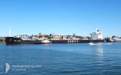
MEDI EOLIE
Cargo
Current Trip
US ORS
| Time Travelled | 2 days |
|---|---|
| Remaining Time | --- |
| Distance Travelled | 585.76 nm |
| Remaining Distance | --- |
| AVG Speed | 11.6 Knots |
| MAX Speed | 13.5 Knots |
| AVG Wind | 9.9 knots |
| MAX Wind | 16 knots |
| MIN Temp | 8.2°C / 46.76°F |
| MAX Temp | 11.3°C / 52.34°F |
| Draught | 8.6 m |
| Position Received | 1 d ago |
Current Position
| Longitude | -10.02633° |
|---|---|
| Latitude | 51.17349° |
| Status | Under way using engine |
| Speed | 12.5 Knots |
| Course | 270.6° |
| Area | Celtic Sea |
| Station | T-AIS |
| Position Received | 1 d ago |
Info
Information
The current position of MEDI EOLIE is in Celtic Sea with coordinates 51.17349° / -10.02633° as reported on 2024-05-02 17:13 by AIS to our vessel tracker app. The vessel's current speed is 12.5 Knots
The vessel MEDI EOLIE (IMO: 9728186, MMSI: 636022128) is a Cargo It's sailing under the flag of [LR] Liberia.
In this page you can find informations about the vessels current position, last detected port calls, and current voyage information. If the vessels is not in coverage by AIS you will find the latest position.
The current position of MEDI EOLIE is detected by our AIS receivers and we are not responsible for the reliability of the data. The last position was recorded while the vessel was in Coverage by the Ais receivers of our vessel tracking app.
The current draught of MEDI EOLIE as reported by AIS is 8.6 meters
Weather
| Temperature | 11.3°C / 52.34°F |
|---|---|
| Wind Speed | 9 knots |
| Direction | 168° SSE |
| Pressure | 1008.1 hPa |
| Humidity | 83.5 % |
| Cloud Coverage | 99 % |
Featured Company
Last Port Calls
| Port | Arrival | Departure | Time In Port |
|---|---|---|---|
| 2024-04-29 07:42 | 2024-05-01 21:43 | 2 d | |
| 2024-04-29 00:18 | 2024-04-29 06:02 | 5 h |
Most Visited Ports (Last year)
| Port | Arrivals | |
|---|---|---|
| 2 | ||
| 2 | ||
| 1 | ||
| 1 | ||
| 1 | ||
| 1 |
Last Trips
| Origin | Departure | Destination | Arrival | Distance | |
|---|---|---|---|---|---|
| 2024-02-29 09:30 | 2024-04-29 08:42 | 14567.53 nm | |||
| 2024-02-29 09:30 | 2024-04-29 01:18 | 14552.92 nm |
Events
| Time | Event | Details | Position / Dest | Info |
|---|---|---|---|---|
| 2024-05-02 17:20 | Status Changed | Default Under way using engine |
51.17333 / -10.06667
US ORS
|
Speed: 12.5 kn Course: 270.6° |
| 2024-05-02 17:13 | OUT of Coverage |
51.17349 / -10.02633
Celtic Sea
US ORS
|
Speed: 12.5 kn Course: 270.6° |
|
| 2024-05-02 16:07 | Status Changed | Under way using engine Default |
51.16776 / -9.65989
US ORS
|
Speed: 12 kn Course: 271° |
| 2024-05-02 15:59 | Status Changed | Default Under way using engine |
51.16667 / -9.61833
US ORS
|
Speed: 12.4 kn Course: 270.5° |
| 2024-05-02 09:08 | Status Changed | Under way using engine Default |
51.26909 / -7.37900
US ORS
|
Speed: 12 kn Course: 267° |
| 2024-05-02 09:02 | Status Changed | Default Under way using engine |
51.26833 / -7.34667
US ORS
|
Speed: 12.4 kn Course: 267.5° |
| 2024-05-02 08:51 | Change Sea Area | Irish part of the Celtic Sea United Kingdom part of the Celtic Sea |
51.27132 / -7.28823
Celtic Sea
US ORS
|
Speed: 12.4 kn Course: 267.6° |
| 2024-05-02 08:51 | Status Changed | Under way using engine Default |
51.27132 / -7.28823
US ORS
|
Speed: 12 kn Course: 266° |
| 2024-05-02 08:41 | IN Coverage |
51.27132 / -7.28823
Celtic Sea
US ORS
|
Speed: 12.4 kn Course: 267.6° |
|
| 2024-05-02 03:46 | OUT of Coverage |
51.34577 / -5.59006
Celtic Sea
US ORS
|
Speed: 12.8 kn Course: 267.2° |