
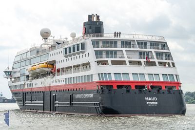
MAUD
Ro-Ro/Passenger Ship
Current Trip
| Time Travelled | 14 h, 13 mins |
|---|---|
| Remaining Time | 4 h, 15 mins |
| Distance Travelled | 165.32 морская миля |
| Remaining Distance | 52.63 морская миля |
| AVG Speed | 11.9 Узлы |
| MAX Speed | 12.6 Узлы |
| AVG Wind | 6.6 knots |
| MAX Wind | 18 knots |
| MIN Temp | 9.9°C / 49.82°F |
| MAX Temp | 12.3°C / 54.14°F |
| Осадка | 5.2 м |
| Позиция Получена | 1 m тому назад |
Current Position
| Долгота | -4.02295° |
|---|---|
| Широта | 58.70085° |
| Статус | Under way using engine |
| Скорость | 10.8 Узлы |
| Курс | 86.7° |
| Район | North Atlantic Ocean |
| Станция | T-AIS |
| Позиция Получена | 1 m тому назад |
Info
Information
The current position of MAUD is in North Atlantic Ocean with coordinates 58.70085° / -4.02295° as reported on 2024-05-13 03:02 by AIS to our vessel tracker app. The vessel's current speed is 10.8 Узлы and is heading at the port of STROMNESS. The estimated time of arrival as calculated by MyShipTracking vessel tracking app is 2024-05-13 07:18 LT
The vessel MAUD (IMO: 9247728, MMSI: 258595000) is a Ro-Ro/Passenger Ship that was built in 2003 ( 21 лет ). It's sailing under the flag of [NO] Norway.
In this page you can find informations about the vessels current position, last detected port calls, and current voyage information. If the vessels is not in coverage by AIS you will find the latest position.
The current position of MAUD is detected by our AIS receivers and we are not responsible for the reliability of the data. The last position was recorded while the vessel was in Coverage by the Ais receivers of our vessel tracking app.
The current draught of MAUD as reported by AIS is 5.2 meters
Weather
| Temperature | 9.9°C / 49.82°F |
|---|---|
| Wind Speed | 18 knots |
| Direction | 129° SE |
| Pressure | 1005.4 hPa |
| Humidity | 93.2 % |
| Cloud Coverage | 100 % |
Featured Company
Last Port Calls
| Port | Arrival | Departure | Time In Port |
|---|---|---|---|
| 2024-05-12 06:02 | 2024-05-12 12:50 | 6 h | |
| 2024-05-11 06:00 | 2024-05-11 17:38 | 11 h | |
| 2024-05-10 06:09 | 2024-05-10 15:52 | 9 h | |
| 2024-05-08 07:04 | 2024-05-08 17:14 | 10 h | |
| 2024-05-07 04:46 | 2024-05-07 13:14 | 8 h | |
| 2024-05-05 09:01 | 2024-05-05 17:01 | 8 h | |
| 2024-05-04 06:18 | 2024-05-04 16:10 | 9 h | |
| 2024-05-02 06:26 | 2024-05-02 16:18 | 9 h | |
| 2024-05-01 07:19 | 2024-05-01 18:01 | 10 h | |
| 2024-04-30 06:02 | 2024-04-30 12:58 | 6 h |
Last Trips
| Origin | Departure | Destination | Arrival | Distance | |
|---|---|---|---|---|---|
| 2024-05-11 18:38 | 2024-05-12 07:02 | 161.96 морская миля | |||
| 2024-05-10 16:52 | 2024-05-11 07:00 | 179.89 морская миля | |||
| 2024-05-08 18:14 | 2024-05-10 07:09 | 442.89 морская миля | |||
| 2024-05-07 14:14 | 2024-05-08 08:04 | 242.70 морская миля | |||
| 2024-05-05 18:01 | 2024-05-07 05:46 | 272.08 морская миля | |||
| 2024-05-04 17:10 | 2024-05-05 10:01 | 183.89 морская миля | |||
| 2024-05-02 17:18 | 2024-05-04 07:18 | 324.88 морская миля | |||
| 2024-05-01 19:01 | 2024-05-02 07:26 | 147.83 морская миля | |||
| 2024-04-30 13:58 | 2024-05-01 08:19 | 240.86 морская миля | |||
| 2024-04-29 18:22 | 2024-04-30 07:02 | 162.36 морская миля |
Events
| Время | Событие | Детали | Позиция / Направление | Информация |
|---|---|---|---|---|
| 2024-05-13 02:19 | Пункт назначения изменился | GB SNS GB CBA |
58.69254 / -4.27801
GB SNS
|
Скорость: 11.2 kn Курс: 86.6° |
| 2024-05-13 02:19 | ETA изменился | 2024/05/13 08:00 2024/05/12 06:00 |
58.69254 / -4.27801
GB SNS
|
Скорость: 11.2 kn Курс: 86.6° |
| 2024-05-13 02:02 | Изменение морского района | United Kingdom part of the North Atlantic Ocean United Kingdom part of the Inner Seas off the West Coast of Scotland |
58.68869 / -4.37716
North Atlantic Ocean
|
Скорость: 11 kn Курс: 86.5° |
| 2024-05-13 02:02 | Статус изменился | Under way using engine Default |
58.68869 / -4.37716
GB CBA
|
Скорость: 11 kn Курс: 84° |
| 2024-05-13 01:47 | В покрытии |
58.68869 / -4.37716
North Atlantic Ocean
|
Скорость: 11 kn Курс: 86.5° |
|
| 2024-05-12 12:50 | ПОРТ ОТПРАВЛЕНИЯ |
|
56.93850 / -7.48079
GB CBA
|
Скорость: 4.4 kn Курс: 155° |
| 2024-05-12 12:44 | Начало движения |
56.94530 / -7.49522
[GB] CASTLEBAY
|
Скорость: 4.4 kn Курс: 155° |
|
| 2024-05-12 06:13 | Окончание движения |
56.94772 / -7.49776
[GB] CASTLEBAY
|
Скорость: 0.1 kn Курс: 158° |
|
| 2024-05-12 06:02 | Порт |
|
56.94729 / -7.49689
[GB] CASTLEBAY
|
Скорость: 8.1 kn Курс: 321° |
| 2024-05-12 00:35 | Вне покрытия |
55.82716 / -6.88171
Inner Seas off the West Coast of Scotland
GB CBA
|
Скорость: 14 kn Курс: 329.4° |