
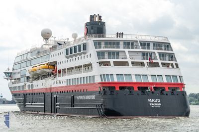
MAUD
Ro-Ro/Passenger Ship
Current Trip
| Time Travelled | 2 days |
|---|---|
| Remaining Time | --- |
| Distance Travelled | 407.56 nm |
| Remaining Distance | 143.41 nm |
| AVG Speed | 10.9 Knop |
| MAX Speed | 15.8 Knop |
| AVG Wind | 21.9 knots |
| MAX Wind | 29 knots |
| MIN Temp | 5.3°C / 41.54°F |
| MAX Temp | 9.1°C / 48.38°F |
| Djupgående | 5 m |
| Position mottagen | Nu |
Current Position
| Longitud | -2.82432° |
|---|---|
| Latitude | 59.10059° |
| Status | Under way using engine |
| Fart | 10.2 Knop |
| Kurs | 288.8° |
| Område | North Sea |
| Station | T-AIS |
| Position mottagen | Nu |
Info
Information
The current position of MAUD is in North Sea with coordinates 59.10059° / -2.82432° as reported on 2024-04-19 19:15 by AIS to our vessel tracker app. The vessel's current speed is 10.2 Knop and is heading at the port of STORNOWAY. The estimated time of arrival as calculated by MyShipTracking vessel tracking app is 2024-04-19 08:00 LT
The vessel MAUD (IMO: 9247728, MMSI: 258595000) is a Ro-Ro/Passenger Ship that was built in 2003 ( 21 År gammal ). It's sailing under the flag of [NO] Norway.
In this page you can find informations about the vessels current position, last detected port calls, and current voyage information. If the vessels is not in coverage by AIS you will find the latest position.
The current position of MAUD is detected by our AIS receivers and we are not responsible for the reliability of the data. The last position was recorded while the vessel was in Coverage by the Ais receivers of our vessel tracking app.
The current draught of MAUD as reported by AIS is 5 meters
Weather
| Temperature | 5.3°C / 41.54°F |
|---|---|
| Wind Speed | 23 knots |
| Direction | 343° NNW |
| Pressure | 1023.7 hPa |
| Humidity | 59.5 % |
| Cloud Coverage | 99 % |
Featured Company
Last Port Calls
| Port | Arrival | Departure | Time In Port |
|---|---|---|---|
| 2024-04-17 06:04 | 2024-04-17 17:04 | 10 h | |
| 2024-04-14 06:15 | 2024-04-14 17:04 | 10 h | |
| 2024-04-12 04:12 |
Last Trips
| Origin | Departure | Destination | Arrival | Distance | |
|---|---|---|---|---|---|
| 2024-04-14 18:04 | 2024-04-17 07:04 | 611.98 nm | |||
| 2024-04-12 06:12 | 2024-04-14 07:15 | 463.44 nm |
Events
| Tid | Event | Detaljer | Position / Dest | Information |
|---|---|---|---|---|
| 2024-04-19 18:01 | STARTAR förflyttning | 0.78 nm, North West of KIRKWALL |
59.00256 / -2.97294
GB STO
|
Fart: 4.1 kn Kurs: 15° |
| 2024-04-19 17:57 | Status ändrad | Under way using engine Moored |
59.00055 / -2.97488
GB STO
|
Fart: Kurs: 305° |
| 2024-04-19 17:51 | Status ändrad | Moored Default |
59.00053 / -2.97490
GB STO
|
Fart: 0.1 kn Kurs: 305° |
| 2024-04-19 17:45 | Status ändrad | Default Moored |
59.00053 / -2.97490
GB STO
|
Fart: 0.1 kn Kurs: 305° |
| 2024-04-19 17:39 | Status ändrad | Moored Default |
59.00055 / -2.97489
GB STO
|
Fart: 0.1 kn Kurs: 305° |
| 2024-04-19 17:36 | Status ändrad | Default Moored |
59.00056 / -2.97488
GB STO
|
Fart: Kurs: 305° |
| 2024-04-19 17:15 | Status ändrad | Moored Default |
59.00056 / -2.97490
GB STO
|
Fart: 0.1 kn Kurs: 305° |
| 2024-04-19 17:12 | Status ändrad | Default Moored |
59.00057 / -2.97490
GB STO
|
Fart: 0.1 kn Kurs: 305° |
| 2024-04-19 16:50 | Destination ändrad | GB STO GB KWL |
59.00057 / -2.97491
GB STO
|
Fart: Kurs: 305° |
| 2024-04-19 16:27 | Status ändrad | Moored Default |
59.00056 / -2.97489
GB KWL
|
Fart: Kurs: 305° |