
MARGARITAVILLE A.S.P
Passengers Ship
Current Trip
| Time Travelled | 3 h, 6 mins |
|---|---|
| Remaining Time | 5 h, 3 mins |
| Distance Travelled | 23.53 морская миля |
| Remaining Distance | 51.82 морская миля |
| AVG Speed | 7.6 Узлы |
| MAX Speed | 10 Узлы |
| AVG Wind | 10.3 knots |
| MAX Wind | 11.8 knots |
| MIN Temp | 24°C / 75.2°F |
| MAX Temp | 24.6°C / 76.28°F |
| Осадка | 7.2 м |
| Позиция Получена | 3 h, 1 m тому назад |
Current Position
| Долгота | --- |
|---|---|
| Широта | --- |
| Статус | Under way using engine |
| Скорость | 7 Узлы |
| Курс | 215.5° |
| Район | North Atlantic Ocean |
| Станция | T-AIS |
| Позиция Получена | 3 h, 1 m тому назад |
Info
Information
The current position of MARGARITAVILLE A.S.P is in North Atlantic Ocean with coordinates 26.50851° / -78.78123° as reported on 2026-01-05 22:29 by AIS to our vessel tracker app. The vessel's current speed is 7 Узлы and is heading at the port of PALM BEACH. The estimated time of arrival as calculated by MyShipTracking vessel tracking app is 2026-01-06 01:33 LT
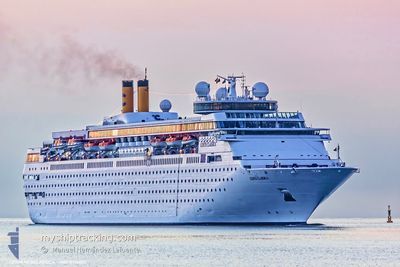
The vessel MARGARITAVILLE A.S.P (IMO: 8716502, MMSI: 311000969) is a Passengers Ship that was built in 1991 ( 35 лет ). It's sailing under the flag of [BS] Bahamas.
In this page you can find informations about the vessels current position, last detected port calls, and current voyage information. If the vessels is not in coverage by AIS you will find the latest position.
The current position of MARGARITAVILLE A.S.P is detected by our AIS receivers and we are not responsible for the reliability of the data. The last position was recorded while the vessel was in Coverage by the Ais receivers of our vessel tracking app.
The current draught of MARGARITAVILLE A.S.P as reported by AIS is 7.2 meters
Weather
| Temperature | 24.6°C / 76.28°F |
|---|---|
| Wind Speed | 8 knots |
| Direction | 126° SE |
| Pressure | 1019.2 hPa |
| Humidity | 60.5 % |
| Cloud Coverage | --- |
Featured Company
Last Port Calls
| Port | Arrival | Departure | Time In Port |
|---|---|---|---|
| 2026-01-05 07:34 | 2026-01-05 17:24 | 9 h | |
| 2026-01-04 05:22 | 2026-01-04 16:36 | 11 h | |
| 2026-01-02 06:59 | 2026-01-02 15:56 | 8 h | |
| 2026-01-01 06:42 | 2026-01-01 17:47 | 11 h | |
| 2025-12-31 06:58 | 2025-12-31 16:03 | 9 h | |
| 2025-12-30 05:51 | 2025-12-30 16:47 | 10 h | |
| 2025-12-29 07:00 | 2025-12-29 15:42 | 8 h | |
| 2025-12-27 22:40 | 2025-12-28 17:52 | 19 h | |
| 2025-12-26 06:45 | 2025-12-26 15:51 | 9 h | |
| 2025-12-25 07:12 | 2025-12-25 17:43 | 10 h |
Most Visited Ports (Last year)
| Port | Arrivals | |
|---|---|---|
| 134 | ||
| 89 | ||
| 62 | ||
| 11 |
Last Trips
| Origin | Departure | Destination | Arrival | Distance | |
|---|---|---|---|---|---|
| 2026-01-04 16:36 | 2026-01-05 07:34 | 205.49 морская миля | |||
| 2026-01-02 15:56 | 2026-01-04 05:22 | 239.90 морская миля | |||
| 2026-01-01 17:47 | 2026-01-02 06:59 | 90.83 морская миля | |||
| 2025-12-31 16:03 | 2026-01-01 06:42 | 85.94 морская миля | |||
| 2025-12-30 16:47 | 2025-12-31 06:58 | 190.74 морская миля | |||
| 2025-12-29 15:42 | 2025-12-30 05:51 | 190.93 морская миля | |||
| 2025-12-28 17:52 | 2025-12-29 07:00 | 94.18 морская миля | |||
| 2025-12-26 15:51 | 2025-12-27 22:40 | 157.27 морская миля | |||
| 2025-12-25 17:43 | 2025-12-26 06:45 | 86.78 морская миля | |||
| 2025-12-24 16:01 | 2025-12-25 07:12 | 84.23 морская миля |
Events
| Время | Событие | Детали | Позиция / Направление | Информация |
|---|---|---|---|---|
| 2026-01-05 22:34 | Статус изменился | Default Under way using engine |
26.50443 / -78.79112
BSFPO > USPAB
|
Скорость: 7 kn Курс: 215.5° |
| 2026-01-05 22:29 | Вне покрытия |
26.50851 / -78.78123
North Atlantic Ocean
BSFPO > USPAB
|
Скорость: 7 kn Курс: 215.5° |
|
| 2026-01-05 22:24 | ПОРТ ОТПРАВЛЕНИЯ |
|
26.51694 / -78.77725
BSFPO > USPAB
|
Скорость: 8.6 kn Курс: 202° |
| 2026-01-05 22:22 | Начало движения |
26.52206 / -78.77441
[BS] FREEPORT (BS)
|
Скорость: 4.5 kn Курс: 210° |
|
| 2026-01-05 22:07 | Статус изменился | Under way using engine Moored |
26.52062 / -78.76915
[BS] FREEPORT (BS)
|
Скорость: Курс: 126° |
| 2026-01-05 22:02 | ETA изменился | 2026/01/06 11:35 2026/01/06 11:45 |
26.52062 / -78.76917
[BS] FREEPORT (BS)
|
Скорость: Курс: 126° |
| 2026-01-05 19:52 | Статус изменился | Moored Default |
26.52063 / -78.76918
[BS] FREEPORT (BS)
|
Скорость: Курс: 126° |
| 2026-01-05 19:49 | Статус изменился | Default Moored |
26.52063 / -78.76917
[BS] FREEPORT (BS)
|
Скорость: Курс: 126° |
| 2026-01-05 19:19 | Статус изменился | Moored Default |
26.52063 / -78.76919
[BS] FREEPORT (BS)
|
Скорость: Курс: 125° |
| 2026-01-05 19:16 | Статус изменился | Default Moored |
26.52063 / -78.76919
[BS] FREEPORT (BS)
|
Скорость: Курс: 125° |