
MARGARITAVILLE A.S.P
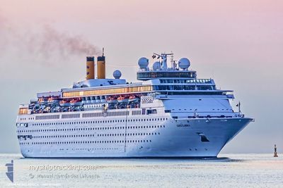
Passengers Ship
Current Trip
| Time Travelled | 8 h, 16 mins |
|---|---|
| Remaining Time | 4 h, 29 mins |
| Distance Travelled | 38.06 nm |
| Remaining Distance | --- |
| AVG Speed | 7.6 Knoten |
| MAX Speed | 9.4 Knoten |
| AVG Wind | 4.1 knots |
| MAX Wind | 5 knots |
| MIN Temp | 21.8°C / 71.24°F |
| MAX Temp | 22.3°C / 72.14°F |
| Tiefgang | 7.2 m |
| Position erhalten | 3 h, 59 m alt |
Current Position
| Länge | --- |
|---|---|
| Breite | --- |
| Zustand | Under way using engine |
| Geschwindigkeit | 8.6 Knoten |
| Kurs | 268.1° |
| Gebiet | North Atlantic Ocean |
| Station | T-AIS |
| Position erhalten | 3 h, 59 m alt |
Info
Information
Die aktuelle Position von MARGARITAVILLE A.S.P befindet sich in North Atlantic Ocean mit den Koordinaten 26.39771° / -78.97300°, wie von AIS am 2024-11-25 02:38 an unsere Schiffsverfolgungs-App. Die aktuelle Geschwindigkeit des Schiffes betragt 8.6 Knoten und fahrt in den Hafen von PALM BEACH. Die geschatzte Ankunftszeit, berechnet von der MyShipTracking-App zur Schiffsverfolgung, ist 2024-11-25 06:07 LT
Das Schiff MARGARITAVILLE A.S.P (IMO: 8716502, MMSI: 311000969) ist Passengers Ship das wurde im Jahr 1991 ( 33 Jahre alt ) gebaut. Es segelt unter der Flagge [BS] Bahamas.
Auf dieser Seite finden Sie Informationen zur aktuellen Position des Schiffes, zu den zuletzt erkannten Hafenanlaufen und zu aktuellen Reiseinformationen. Wenn die Schiffe nicht von AIS abgedeckt werden, finden Sie die neueste Position.
Die aktuelle Position von MARGARITAVILLE A.S.P wird von unseren AIS-Empfangern erkannt und wir sind nicht fur die Zuverlassigkeit der Daten verantwortlich. Die letzte Position wurde von den Ais-Empfangern unserer Schiffsverfolgungs-App aufgezeichnet, wahrend sich das Schiff in Deckung befand.
Der aktuelle Entwurf von MARGARITAVILLE A.S.P, wie von AIS gemeldet, betragt 7.2 meter
Weather
| Temperature | 22.2°C / 71.96°F |
|---|---|
| Wind Speed | 5 knots |
| Direction | 98° E |
| Pressure | 1021.7 hPa |
| Humidity | 56.2 % |
| Cloud Coverage | 32 % |
Featured Company
Last Port Calls
| Port | Arrival | Departure | Time In Port |
|---|---|---|---|
| 2024-11-23 17:34 | 2024-11-24 17:22 | 23 h | |
| 2024-11-22 07:02 | 2024-11-22 17:34 | 10 h | |
| 2024-11-21 07:38 | 2024-11-21 17:18 | 9 h | |
| 2024-11-20 07:03 | 2024-11-20 17:25 | 10 h | |
| 2024-11-19 07:22 | 2024-11-19 17:42 | 10 h | |
| 2024-11-18 07:02 | 2024-11-18 17:22 | 10 h | |
| 2024-11-16 17:26 | 2024-11-17 17:26 | 1 d | |
| 2024-11-15 07:01 | 2024-11-15 17:23 | 10 h | |
| 2024-11-14 07:26 | 2024-11-14 17:22 | 9 h | |
| 2024-11-13 12:16 | 2024-11-13 17:35 | 5 h |
Most Visited Ports (Last year)
| Port | Arrivals | |
|---|---|---|
| 170 | ||
| 170 | ||
| 3 |
Last Trips
| Origin | Departure | Destination | Arrival | Distance | |
|---|---|---|---|---|---|
| 2024-11-22 17:34 | 2024-11-23 17:34 | 125.68 nm | |||
| 2024-11-21 17:18 | 2024-11-22 07:02 | 88.93 nm | |||
| 2024-11-20 17:25 | 2024-11-21 07:38 | 78.00 nm | |||
| 2024-11-19 17:42 | 2024-11-20 07:03 | 89.32 nm | |||
| 2024-11-18 17:22 | 2024-11-19 07:22 | 83.22 nm | |||
| 2024-11-17 17:26 | 2024-11-18 07:02 | 100.99 nm | |||
| 2024-11-15 17:23 | 2024-11-16 17:26 | 141.11 nm | |||
| 2024-11-14 17:22 | 2024-11-15 07:01 | 85.43 nm | |||
| 2024-11-13 17:35 | 2024-11-14 07:26 | 88.15 nm | |||
| 2024-11-12 17:42 | 2024-11-13 12:16 | 89.25 nm |
Events
| Zeit | Ereignis | Details | Position / Ziel | Information |
|---|---|---|---|---|
| 2024-11-25 02:46 | geänderter Status | Default Under way using engine |
26.39728 / -78.99328
FREEPORT
|
Geschwindigkeit: 8.6 kn Kurs: 268.1° |
| 2024-11-25 02:38 | außerhalb Abdeckung |
26.39771 / -78.97300
North Atlantic Ocean
|
Geschwindigkeit: 8.6 kn Kurs: 268.1° |
|
| 2024-11-25 02:36 | geänderter Status | Under way using engine Default |
26.39787 / -78.96728
FREEPORT
|
Geschwindigkeit: 8.8 kn Kurs: 268° |
| 2024-11-25 02:26 | geänderter Status | Default Under way using engine |
26.39890 / -78.94025
FREEPORT
|
Geschwindigkeit: 8.4 kn Kurs: 267.7° |
| 2024-11-25 02:03 | START Bewegung | 9.45 nm, South West of FREEPORT (BS) |
26.40180 / -78.88668
FREEPORT
|
Geschwindigkeit: 3.5 kn Kurs: 270° |
| 2024-11-25 01:37 | geänderter Status | Under way using engine Default |
26.40420 / -78.88506
FREEPORT
|
Geschwindigkeit: 0.3 kn Kurs: 252° |
| 2024-11-25 01:34 | geänderter Status | Default Under way using engine |
26.40434 / -78.88512
FREEPORT
|
Geschwindigkeit: Kurs: 248° |
| 2024-11-25 01:11 | STOP Bewegung | 9.25 nm, South West of FREEPORT (BS) |
26.40584 / -78.88617
FREEPORT
|
Geschwindigkeit: 0.3 kn Kurs: 248° |
| 2024-11-24 23:13 | Ändere Seegebiet | Bahamas part of the North Atlantic Ocean United States part of the North Atlantic Ocean |
26.43295 / -78.86961
North Atlantic Ocean
|
Geschwindigkeit: 4.9 kn Kurs: 230.2° |
| 2024-11-24 23:13 | geänderter Status | Under way using engine Default |
26.43295 / -78.86961
FREEPORT
|
Geschwindigkeit: 5.5 kn Kurs: 227° |