
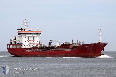
MAR VESTA
Oil/Chemical Tanker
Current Trip
UAIZM
| Time Travelled | 11 days |
|---|---|
| Remaining Time | --- |
| Distance Travelled | 829.95 морская миля |
| Remaining Distance | --- |
| AVG Speed | 8.3 Узлы |
| MAX Speed | 11.1 Узлы |
| AVG Wind | 15.5 knots |
| MAX Wind | 25.5 knots |
| MIN Temp | -4.5°C / 23.9°F |
| MAX Temp | 8.8°C / 47.84°F |
| Осадка | 6.9 м |
| Позиция Получена | 7 d тому назад |
Current Position
| Долгота | --- |
|---|---|
| Широта | --- |
| Статус | Under way using engine |
| Скорость | 8.6 Узлы |
| Курс | 13.3° |
| Район | Black Sea |
| Станция | T-AIS |
| Позиция Получена | 7 d тому назад |
Info
Information
The current position of MAR VESTA is in Black Sea with coordinates 41.49977° / 29.25859° as reported on 2025-02-22 21:26 by AIS to our vessel tracker app. The vessel's current speed is 8.6 Узлы
The vessel MAR VESTA (IMO: 9489560, MMSI: 229866000) is a Oil/Chemical Tanker that was built in 2008 ( 17 лет ). It's sailing under the flag of [MT] Malta.
In this page you can find informations about the vessels current position, last detected port calls, and current voyage information. If the vessels is not in coverage by AIS you will find the latest position.
The current position of MAR VESTA is detected by our AIS receivers and we are not responsible for the reliability of the data. The last position was recorded while the vessel was in Coverage by the Ais receivers of our vessel tracking app.
The current draught of MAR VESTA as reported by AIS is 6.9 meters
Weather
| Temperature | 5.6°C / 42.08°F |
|---|---|
| Wind Speed | 9 knots |
| Direction | 149° SSE |
| Pressure | 1027.2 hPa |
| Humidity | 78.4 % |
| Cloud Coverage | 100 % |
Featured Company
Last Trips
| Origin | Departure | Destination | Arrival | Distance | |
|---|---|---|---|---|---|
| 2025-02-10 06:20 | 2025-02-18 10:37 | 1493.07 морская миля | |||
| 2025-01-31 06:18 | 2025-02-08 23:08 | 669.90 морская миля | |||
| 2025-01-26 23:33 | 2025-01-29 11:30 | 598.93 морская миля | |||
| 2025-01-11 05:36 | 2025-01-25 07:45 | 1917.26 морская миля | |||
| 2024-12-23 00:08 | 2025-01-09 23:30 | 1130.08 морская миля |
Events
| Время | Событие | Детали | Позиция / Направление | Информация |
|---|---|---|---|---|
| 2025-02-28 07:21 | Начало движения | 9.31 nm, North of TULCEA |
45.33501 / 28.82158
UAIZM
|
Скорость: 4.1 kn Курс: 302° |
| 2025-02-25 10:29 | Окончание движения | 9.27 nm, North of TULCEA |
45.33410 / 28.82463
UAIZM
|
Скорость: 0.1 kn Курс: 309° |
| 2025-02-22 21:33 | Статус изменился | Default Under way using engine |
41.51555 / 29.26360
UAIZM
|
Скорость: 8.6 kn Курс: 13.3° |
| 2025-02-22 21:26 | Вне покрытия |
41.49977 / 29.25859
Black Sea
UAIZM
|
Скорость: 8.6 kn Курс: 13.3° |
|
| 2025-02-22 20:53 | Статус изменился | Under way using engine Default |
41.41608 / 29.24458
UAIZM
|
Скорость: 9 kn Курс: 7° |
| 2025-02-22 20:45 | Статус изменился | Default Under way using engine |
41.39811 / 29.24356
UAIZM
|
Скорость: 8.6 kn Курс: 4.3° |
| 2025-02-22 19:29 | Изменение морского района | Turkish part of the Black Sea Turkish part of the Sea of Marmara |
41.23183 / 29.14103
Black Sea
UAIZM
|
Скорость: 9.2 kn Курс: 33.4° |
| 2025-02-22 11:38 | Начало движения | 12.91 nm, South of AMBARLI |
40.75456 / 28.58841
UAIZM
|
Скорость: 3.5 kn Курс: 340° |
| 2025-02-22 09:17 | Окончание движения | 11.55 nm, South of AMBARLI |
40.78169 / 28.57740
UAIZM
|
Скорость: 0.3 kn Курс: 343° |
| 2025-02-22 07:58 | ETA изменился | 2025/02/23 20:00 2025/02/22 11:00 |
40.67249 / 28.55129
UAIZM
|
Скорость: 6.3 kn Курс: 339° |