
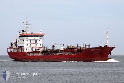
MAR VESTA
Oil/Chemical Tanker
Current Trip
ROMID
| Time Travelled | 1 day |
|---|---|
| Remaining Time | --- |
| Distance Travelled | 11.21 nm |
| Remaining Distance | --- |
| AVG Speed | 8.9 Knots |
| MAX Speed | 11.8 Knots |
| AVG Wind | 17.7 knots |
| MAX Wind | 21.8 knots |
| MIN Temp | 10.9°C / 51.62°F |
| MAX Temp | 12.9°C / 55.22°F |
| Draught | 5 m |
| Position Received | 5 d ago |
Current Position
| Longitude | --- |
|---|---|
| Latitude | --- |
| Status | Under way using engine |
| Speed | 11.6 Knots |
| Course | 324° |
| Area | Black Sea |
| Station | T-AIS |
| Position Received | 5 d ago |
Info
Information
The current position of MAR VESTA is in Black Sea with coordinates 41.68854° / 41.62298° as reported on 2025-11-30 15:51 by AIS to our vessel tracker app. The vessel's current speed is 11.6 Knots
The vessel MAR VESTA (IMO: 9489560, MMSI: 229866000) is a Oil/Chemical Tanker that was built in 2008 ( 17 years old ). It's sailing under the flag of [MT] Malta.
In this page you can find informations about the vessels current position, last detected port calls, and current voyage information. If the vessels is not in coverage by AIS you will find the latest position.
The current position of MAR VESTA is detected by our AIS receivers and we are not responsible for the reliability of the data. The last position was recorded while the vessel was in Coverage by the Ais receivers of our vessel tracking app.
The current draught of MAR VESTA as reported by AIS is 5 meters
Weather
| Temperature | 11.1°C / 51.98°F |
|---|---|
| Wind Speed | 22 knots |
| Direction | 58° ENE |
| Pressure | 1015 hPa |
| Humidity | 83.3 % |
| Cloud Coverage | 100 % |
Featured Company
Last Port Calls
| Port | Arrival | Departure | Time In Port |
|---|---|---|---|
| 2025-12-03 03:13 | 2025-12-04 16:57 | 1 d | |
| 2025-11-29 18:32 | 2025-11-30 19:41 | 1 d | |
| 2025-11-29 16:55 | 2025-11-29 18:20 | 1 h | |
| 2025-11-28 21:26 | 2025-11-29 16:52 | 19 h | |
| 2025-11-28 18:04 | 2025-11-28 20:04 | 2 h | |
| 2025-11-23 23:39 | 2025-11-26 03:25 | 2 d | |
| 2025-11-17 20:40 | 2025-11-19 17:07 | 1 d | |
| 2025-11-13 14:04 | 2025-11-15 10:40 | 1 d | |
| 2025-11-07 22:25 | 2025-11-09 17:20 | 1 d | |
| 2025-11-03 20:36 | 2025-11-05 04:04 | 1 d |
Last Trips
| Origin | Departure | Destination | Arrival | Distance | |
|---|---|---|---|---|---|
| 2025-11-30 19:41 | 2025-12-03 03:13 | 599.36 nm | |||
| 2025-11-29 18:20 | 2025-11-29 18:32 | 5.19 nm | |||
| 2025-11-29 16:52 | 2025-11-29 16:55 | 1.65 nm | |||
| 2025-11-28 20:04 | 2025-11-28 21:26 | 10.22 nm | |||
| 2025-11-26 03:25 | 2025-11-28 18:04 | 598.76 nm | |||
| 2025-11-19 17:07 | 2025-11-23 23:39 | 1224.50 nm | |||
| 2025-11-15 10:40 | 2025-11-17 20:40 | 598.80 nm | |||
| 2025-11-09 17:20 | 2025-11-13 14:04 | 602.35 nm | |||
| 2025-11-05 04:04 | 2025-11-07 22:25 | 598.15 nm | |||
| 2025-11-01 08:32 | 2025-11-03 20:36 | 600.03 nm |
Events
| Time | Event | Details | Position / Dest | Info |
|---|---|---|---|---|
| 2025-12-04 16:17 | STOP Moving | 6.57 nm, North East of CONSTANTA |
44.17072 / 28.80841
ROMID
|
Speed: 0.3 kn Course: 91° |
| 2025-12-04 14:57 | PORT DEPARTURE |
|
44.31914 / 28.69381
ROMID
|
Speed: 4.2 kn Course: 148° |
| 2025-12-04 14:44 | START Moving |
44.33118 / 28.67922
[RO] MIDIA
|
Speed: 3.9 kn Course: 112° |
|
| 2025-12-03 01:21 | STOP Moving |
44.33250 / 28.67265
[RO] MIDIA
|
Speed: 0.2 kn Course: 4° |
|
| 2025-12-03 01:13 | PORT ARRIVAL |
|
44.33196 / 28.67405
[RO] MIDIA
|
Speed: 1.2 kn Course: 311° |
| 2025-11-30 15:57 | Status Changed | Default Under way using engine |
41.70113 / 41.60780
ROMID
|
Speed: 11.6 kn Course: 324° |
| 2025-11-30 15:51 | OUT of Coverage |
41.68854 / 41.62298
Black Sea
|
Speed: 11.6 kn Course: 324° |
|
| 2025-11-30 15:41 | PORT DEPARTURE |
|
41.65993 / 41.64453
ROMID
|
Speed: 7.3 kn Course: 334° |
| 2025-11-30 15:30 | START Moving |
41.64834 / 41.65043
[GE] BATUMI
|
Speed: 3.1 kn Course: 272° |
|
| 2025-11-30 15:28 | Status Changed | Under way using engine Moored |
41.64862 / 41.65167
[GE] BATUMI
|
Speed: 2.7 kn Course: 260° |