
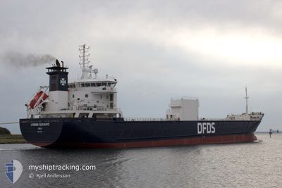
LYSBRIS SEAWAYS
Cargo/Container Ship
Current Trip
| Time Travelled | 2 days |
|---|---|
| Remaining Time | 22 h, 51 mins |
| Distance Travelled | 539.29 морская миля |
| Remaining Distance | 282.12 морская миля |
| AVG Speed | 11.9 Узлы |
| MAX Speed | 15.3 Узлы |
| AVG Wind | 19.8 knots |
| MAX Wind | 41.9 knots |
| MIN Temp | 5°C / 41°F |
| MAX Temp | 9.7°C / 49.46°F |
| Осадка | 5.8 м |
| Позиция Получена | 3 m тому назад |
Current Position
| Долгота | --- |
|---|---|
| Широта | --- |
| Статус | Under way using engine |
| Скорость | 12 Узлы |
| Курс | 2.2° |
| Район | Norwegian Sea |
| Станция | T-AIS |
| Позиция Получена | 3 m тому назад |
Info
Information
The current position of LYSBRIS SEAWAYS is in Norwegian Sea with coordinates 61.23051° / 4.19252° as reported on 2024-11-29 17:09 by AIS to our vessel tracker app. The vessel's current speed is 12 Узлы and is heading at the port of SKOGN. The estimated time of arrival as calculated by MyShipTracking vessel tracking app is 2024-11-30 17:03 LT
The vessel LYSBRIS SEAWAYS (IMO: 9144263, MMSI: 259538000) is a Cargo/Container Ship that was built in 1999 ( 25 лет ). It's sailing under the flag of [NO] Norway.
In this page you can find informations about the vessels current position, last detected port calls, and current voyage information. If the vessels is not in coverage by AIS you will find the latest position.
The current position of LYSBRIS SEAWAYS is detected by our AIS receivers and we are not responsible for the reliability of the data. The last position was recorded while the vessel was in Coverage by the Ais receivers of our vessel tracking app.
The current draught of LYSBRIS SEAWAYS as reported by AIS is 5.8 meters
Weather
| Temperature | 8.7°C / 47.66°F |
|---|---|
| Wind Speed | 28 knots |
| Direction | 164° SSE |
| Pressure | 1014.4 hPa |
| Humidity | 96.2 % |
| Cloud Coverage | 100 % |
Featured Company
Last Port Calls
| Port | Arrival | Departure | Time In Port |
|---|---|---|---|
| 2024-11-26 12:55 | 2024-11-27 16:52 | 1 d | |
| 2024-11-24 03:51 | 2024-11-24 10:21 | 6 h | |
| 2024-11-21 21:38 | 2024-11-22 19:16 | 21 h | |
| 2024-11-18 07:47 | 2024-11-18 17:02 | 9 h | |
| 2024-11-17 06:54 | 2024-11-17 20:33 | 13 h | |
| 2024-11-12 14:25 | 2024-11-13 19:35 | 1 d | |
| 2024-11-08 04:06 | 2024-11-09 12:00 | 1 d | |
| 2024-11-03 21:23 | 2024-11-04 20:54 | 23 h | |
| 2024-10-30 08:45 | 2024-10-31 16:54 | 1 d | |
| 2024-10-24 18:50 | 2024-10-26 17:39 | 1 d |
Last Trips
| Origin | Departure | Destination | Arrival | Distance | |
|---|---|---|---|---|---|
| 2024-11-24 10:21 | 2024-11-26 12:55 | 498.27 морская миля | |||
| 2024-11-22 19:16 | 2024-11-24 03:51 | 336.29 морская миля | |||
| 2024-11-18 17:02 | 2024-11-21 21:38 | 891.91 морская миля | |||
| 2024-11-17 20:33 | 2024-11-18 07:47 | 92.99 морская миля | |||
| 2024-11-13 19:35 | 2024-11-17 06:54 | 876.02 морская миля | |||
| 2024-11-09 12:00 | 2024-11-12 14:25 | 822.47 морская миля | |||
| 2024-11-04 20:54 | 2024-11-08 04:06 | 832.51 морская миля | |||
| 2024-10-31 16:54 | 2024-11-03 21:23 | 824.01 морская миля | |||
| 2024-10-26 17:39 | 2024-10-30 08:45 | 836.37 морская миля | |||
| 2024-10-21 10:52 | 2024-10-24 18:50 | 913.94 морская миля |
Events
| Время | Событие | Детали | Позиция / Направление | Информация |
|---|---|---|---|---|
| 2024-11-29 16:04 | Изменение морского района | Norwegian part of the Norwegian Sea Norwegian part of the North Sea |
61.00688 / 4.19174
Norwegian Sea
NO SKX
|
Скорость: 12.1 kn Курс: 355.9° |
| 2024-11-28 21:17 | Статус изменился | Under way using engine Default |
57.40645 / 5.26307
NO SKX
|
Скорость: 11.9 kn Курс: 341° |
| 2024-11-28 21:08 | Статус изменился | Default Under way using engine |
57.37714 / 5.28283
NO SKX
|
Скорость: 11.9 kn Курс: 341.1° |
| 2024-11-28 20:31 | ETA изменился | 2024/11/30 22:00 2024/12/01 06:00 |
57.26122 / 5.35695
NO SKX
|
Скорость: 11.8 kn Курс: 340.7° |
| 2024-11-28 19:55 | Статус изменился | Under way using engine Default |
57.14981 / 5.42605
NO SKX
|
Скорость: 11.7 kn Курс: 339° |
| 2024-11-28 19:22 | Статус изменился | Default Under way using engine |
57.04812 / 5.49327
NO SKX
|
Скорость: 11.7 kn Курс: 338.8° |
| 2024-11-28 18:26 | Обнаружено в море | Norwegian part of the North Sea |
56.87358 / 5.61519
North Sea
NO SKX
|
Скорость: 11.9 kn Курс: 342° |
| 2024-11-28 18:26 | Статус изменился | Under way using engine Default |
56.87358 / 5.61519
NO SKX
|
Скорость: 11.7 kn Курс: 341° |
| 2024-11-28 18:26 | В покрытии |
56.87358 / 5.61519
North Sea
NO SKX
|
Скорость: 11.9 kn Курс: 342° |
|
| 2024-11-27 23:08 | Вне покрытия |
54.10301 / 7.84060
North Sea
NO SKX
|
Скорость: 10.9 kn Курс: 299.5° |