

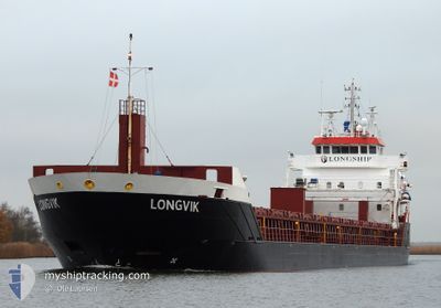
LONGVIK
General Cargo

Current Trip
| Time Travelled | 23 h, 36 mins |
|---|---|
| Remaining Time | 19 h, 17 mins |
| Distance Travelled | 254.46 морская миля |
| Remaining Distance | 215.26 морская миля |
| AVG Speed | 10.5 Узлы |
| MAX Speed | 12.1 Узлы |
| AVG Wind | 8.4 knots |
| MAX Wind | 12.8 knots |
| MIN Temp | 3°C / 37.4°F |
| MAX Temp | 4.4°C / 39.92°F |
| Осадка | 4.1 м |
| Позиция Получена | 7 h, 44 m тому назад |
Current Position
| Долгота | --- |
|---|---|
| Широта | --- |
| Статус | Under way using engine |
| Скорость | 11.8 Узлы |
| Курс | 57° |
| Район | Baltic Sea |
| Станция | T-AIS |
| Позиция Получена | 7 h, 44 m тому назад |
Information
The current position of LONGVIK is in Baltic Sea with coordinates 55.98792° / 16.58632° as reported on 2025-02-28 11:29 by AIS to our vessel tracker app. The vessel's current speed is 11.8 Узлы and is heading at the port of RIGA. The estimated time of arrival as calculated by MyShipTracking vessel tracking app is 2025-03-01 14:31 LT
The vessel LONGVIK (IMO: 9548299, MMSI: 246669000) is a General Cargo that was built in 2011 ( 14 лет ). It's sailing under the flag of [NL] Netherlands.
In this page you can find informations about the vessels current position, last detected port calls, and current voyage information. If the vessels is not in coverage by AIS you will find the latest position.
The current position of LONGVIK is detected by our AIS receivers and we are not responsible for the reliability of the data. The last position was recorded while the vessel was in Coverage by the Ais receivers of our vessel tracking app.
The current draught of LONGVIK as reported by AIS is 4.1 meters
Weather
| Temperature | 3.2°C / 37.76°F |
|---|---|
| Wind Speed | 10 knots |
| Direction | 34° NE |
| Pressure | 1023.6 hPa |
| Humidity | 83.3 % |
| Cloud Coverage | 14 % |


Featured Company
Last Port Calls
| Port | Arrival | Departure | Time In Port |
|---|---|---|---|
| 2025-02-26 09:44 | 2025-02-27 19:38 | 1 d | |
| 2025-02-21 21:46 | 2025-02-23 05:14 | 1 d | |
| 2025-02-17 22:27 | 2025-02-19 15:24 | 1 d | |
| 2025-02-14 18:07 | 2025-02-16 16:06 | 1 d | |
| 2025-02-12 10:12 | 2025-02-13 10:22 | 1 d | |
| 2025-02-09 05:17 | 2025-02-09 19:49 | 14 h | |
| 2025-02-06 05:49 | 2025-02-06 19:29 | 13 h | |
| 2025-02-03 05:17 | 2025-02-03 21:37 | 16 h | |
| 2025-01-30 17:11 | 2025-01-31 15:07 | 21 h | |
| 2025-01-26 21:22 | 2025-01-27 20:53 | 23 h |
Last Trips
| Origin | Departure | Destination | Arrival | Distance | |
|---|---|---|---|---|---|
| 2025-02-23 07:14 | 2025-02-26 10:44 | 438.56 морская миля | |||
| 2025-02-19 16:24 | 2025-02-21 23:46 | 565.43 морская миля | |||
| 2025-02-16 17:06 | 2025-02-17 23:27 | 286.00 морская миля | |||
| 2025-02-13 11:22 | 2025-02-14 19:07 | 292.87 морская миля | |||
| 2025-02-09 21:49 | 2025-02-12 11:12 | 609.22 морская миля | |||
| 2025-02-06 20:29 | 2025-02-09 07:17 | 577.40 морская миля | |||
| 2025-02-03 23:37 | 2025-02-06 06:49 | 577.37 морская миля | |||
| 2025-01-31 16:07 | 2025-02-03 07:17 | 601.92 морская миля | |||
| 2025-01-27 22:53 | 2025-01-30 18:11 | 573.58 морская миля | |||
| 2025-01-24 15:40 | 2025-01-26 23:22 | 568.10 морская миля |
Events
| Время | Событие | Детали | Позиция / Направление | Информация |
|---|---|---|---|---|
| 2025-02-28 11:37 | Статус изменился | Default Under way using engine |
56.00187 / 16.62532
LV RIX
|
Скорость: 11.8 kn Курс: 57° |
| 2025-02-28 11:29 | Вне покрытия |
55.98792 / 16.58632
Baltic Sea
LV RIX
|
Скорость: 11.8 kn Курс: 57° |
|
| 2025-02-28 07:05 | Изменение морского района | Swedish part of the Baltic Sea Danish part of the Kattegat |
55.61938 / 15.36565
Baltic Sea
LV RIX
|
Скорость: 10.4 kn Курс: 62° |
| 2025-02-28 02:50 | Изменение морского района | Danish part of the Kattegat Swedish part of the Baltic Sea |
55.18932 / 14.29802
Kattegat
LV RIX
|
Скорость: 11.3 kn Курс: 78° |
| 2025-02-27 21:32 | Изменение морского района | Swedish part of the Baltic Sea Danish part of the Baltic Sea |
55.30230 / 12.64742
Baltic Sea
LV RIX
|
Скорость: 10.5 kn Курс: 121° |
| 2025-02-27 21:23 | Изменение морского района | Danish part of the Baltic Sea Danish part of the Kattegat |
55.32467 / 12.62763
Baltic Sea
LV RIX
|
Скорость: 10.3 kn Курс: 166° |
| 2025-02-27 21:05 | Изменение морского района | Danish part of the Kattegat Swedish part of the Kattegat |
55.37792 / 12.62828
Kattegat
LV RIX
|
Скорость: 11.1 kn Курс: 188° |
| 2025-02-27 20:47 | Изменение морского района | Swedish part of the Kattegat Danish part of the Kattegat |
55.43277 / 12.63613
Kattegat
LV RIX
|
Скорость: 10.9 kn Курс: 155° |
| 2025-02-27 19:38 | ПОРТ ОТПРАВЛЕНИЯ |
|
55.59620 / 12.48577
LV RIX
|
Скорость: 4.8 kn Курс: 175° |
| 2025-02-27 19:36 | Начало движения |
55.59870 / 12.48530
[DK] AVEDORE
|
Скорость: 3.7 kn Курс: 169° |