

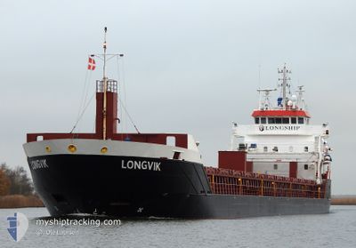
LONGVIK
General Cargo

Current Trip
| Time Travelled | 16 h, 29 mins |
|---|---|
| Remaining Time | 1 day |
| Distance Travelled | 164.92 nm |
| Remaining Distance | 307.90 nm |
| AVG Speed | 9.9 Knopen |
| MAX Speed | 10.6 Knopen |
| AVG Wind | 7.9 knots |
| MAX Wind | 16.2 knots |
| MIN Temp | 4.2°C / 39.56°F |
| MAX Temp | 5.6°C / 42.08°F |
| Diepgang | 4.2 M |
| Positie ontvangen | Nu |
Current Position
| Lengtegraad | --- |
|---|---|
| Breedtegraat | --- |
| Status | Under way using engine |
| Snelheid | 10.4 Knopen |
| Koers | 61° |
| Gebied | Baltic Sea |
| Station | T-AIS |
| Positie ontvangen | Nu |
Information
The current position of LONGVIK is in Baltic Sea with coordinates 55.97747° / 16.57843° as reported on 2025-03-27 12:41 by AIS to our vessel tracker app. The vessel's current speed is 10.4 Knopen and is heading at the port of PARNU. The estimated time of arrival as calculated by MyShipTracking vessel tracking app is 2025-03-28 19:59 LT
The vessel LONGVIK (IMO: 9548299, MMSI: 246669000) is a General Cargo that was built in 2011 ( 14 Jaar oud ). It's sailing under the flag of [NL] Netherlands.
In this page you can find informations about the vessels current position, last detected port calls, and current voyage information. If the vessels is not in coverage by AIS you will find the latest position.
The current position of LONGVIK is detected by our AIS receivers and we are not responsible for the reliability of the data. The last position was recorded while the vessel was in Coverage by the Ais receivers of our vessel tracking app.
The current draught of LONGVIK as reported by AIS is 4.2 meters
Weather
| Temperature | 4.3°C / 39.74°F |
|---|---|
| Wind Speed | 16 knots |
| Direction | 223° SW |
| Pressure | 1016.5 hPa |
| Humidity | 91.2 % |
| Cloud Coverage | 41 % |


Featured Company
Last Port Calls
| Port | Arrival | Departure | Time In Port |
|---|---|---|---|
| 2025-03-26 01:17 | 2025-03-26 21:13 | 19 h | |
| 2025-03-23 13:26 | 2025-03-24 19:14 | 1 d | |
| 2025-03-19 22:44 | 2025-03-21 15:48 | 1 d | |
| 2025-03-16 20:24 | 2025-03-18 21:33 | 2 d | |
| 2025-03-13 07:27 | 2025-03-15 15:15 | 2 d | |
| 2025-03-07 22:14 | 2025-03-11 16:27 | 3 d | |
| 2025-03-06 08:32 | 2025-03-07 12:48 | 1 d | |
| 2025-02-26 10:44 | 2025-02-27 20:38 | 1 d | |
| 2025-02-21 23:46 | 2025-02-23 07:14 | 1 d | |
| 2025-02-17 23:27 | 2025-02-19 16:24 | 1 d |
Most Visited Ports (Last year)
| Port | Arrivals | |
|---|---|---|
| 20 | ||
| 10 | ||
| 6 | ||
| 4 | ||
| 4 | ||
| 4 |
Last Trips
| Origin | Departure | Destination | Arrival | Distance | |
|---|---|---|---|---|---|
| 2025-03-24 19:14 | 2025-03-26 01:17 | 315.62 nm | |||
| 2025-03-21 15:48 | 2025-03-23 13:26 | 433.14 nm | |||
| 2025-03-18 21:33 | 2025-03-19 22:44 | 256.84 nm | |||
| 2025-03-15 15:15 | 2025-03-16 20:24 | 285.30 nm | |||
| 2025-03-11 16:27 | 2025-03-13 07:27 | 98.31 nm | |||
| 2025-03-07 12:48 | 2025-03-07 22:14 | 98.06 nm | |||
| 2025-02-27 20:38 | 2025-03-06 08:32 | 937.09 nm | |||
| 2025-02-23 07:14 | 2025-02-26 10:44 | 438.56 nm | |||
| 2025-02-19 16:24 | 2025-02-21 23:46 | 565.43 nm | |||
| 2025-02-16 17:06 | 2025-02-17 23:27 | 286.00 nm |
Events
| Tijd | Evenement | Details | Positie / Bestemming | Info |
|---|---|---|---|---|
| 2025-03-27 12:40 | Status Changed | Under way using engine Default |
55.97522 / 16.57085
EE PAR
|
Snelheid: 10.3 kn Koers: 61° |
| 2025-03-27 12:38 | Status Changed | Default Under way using engine |
55.97275 / 16.56255
EE PAR
|
Snelheid: 10.3 kn Koers: 61° |
| 2025-03-27 10:15 | Status Changed | Under way using engine Default |
55.77950 / 15.91115
EE PAR
|
Snelheid: 10.3 kn Koers: 62° |
| 2025-03-27 10:06 | Status Changed | Default Under way using engine |
55.76750 / 15.87120
EE PAR
|
Snelheid: 10.4 kn Koers: 59° |
| 2025-03-27 08:14 | Wijzig zee gebeid | Swedish part of the Baltic Sea Danish part of the Kattegat |
55.61987 / 15.37298
Baltic Sea
EE PAR
|
Snelheid: 10.2 kn Koers: 60° |
| 2025-03-27 03:50 | Gevonden in zee | Danish part of the Kattegat |
55.19122 / 14.30930
Kattegat
EE PAR
|
Snelheid: 10.1 kn Koers: 79° |
| 2025-03-26 22:08 | Wijzig zee gebeid | Swedish part of the Baltic Sea Danish part of the Baltic Sea |
55.29948 / 12.65040
Baltic Sea
EE PAR
|
Snelheid: 10.2 kn Koers: 113° |
| 2025-03-26 21:58 | Wijzig zee gebeid | Danish part of the Baltic Sea Danish part of the Kattegat |
55.31940 / 12.62090
Baltic Sea
EE PAR
|
Snelheid: 10.1 kn Koers: 162° |
| 2025-03-26 20:13 | Vertrekhaven |
|
55.59623 / 12.48578
EE PAR
|
Snelheid: 6.6 kn Koers: 174° |
| 2025-03-26 20:11 | Start beweging |
55.59875 / 12.48528
[DK] AVEDORE
|
Snelheid: 4 kn Koers: 172° |