
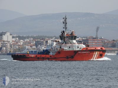
KURTARMA 10
Tug
Current Trip
TRCKS
| Time Travelled | 1 day |
|---|---|
| Remaining Time | --- |
| Distance Travelled | 134.41 морская миля |
| Remaining Distance | --- |
| AVG Speed | 11.2 Узлы |
| MAX Speed | 13.6 Узлы |
| AVG Wind | 11.9 knots |
| MAX Wind | 26 knots |
| MIN Temp | -0.5°C / 31.1°F |
| MAX Temp | 14.1°C / 57.38°F |
| Осадка | 6.5 м |
| Позиция Получена | 6 m тому назад |
Current Position
| Долгота | --- |
|---|---|
| Широта | --- |
| Статус | Moored |
| Скорость | |
| Курс | 175° |
| Район | Sea of Marmara |
| Станция | T-AIS |
| Позиция Получена | 6 m тому назад |
Info
Information
The current position of KURTARMA 10 is in Sea of Marmara with coordinates 40.22767° / 26.42674° as reported on 2026-01-10 19:38 by AIS to our vessel tracker app. The vessel's current speed is 0 Узлы
The vessel KURTARMA 10 (IMO: 9598593, MMSI: 271042963) is a Tug that was built in 2011 ( 15 лет ). It's sailing under the flag of [TR] Turkey.
In this page you can find informations about the vessels current position, last detected port calls, and current voyage information. If the vessels is not in coverage by AIS you will find the latest position.
The current position of KURTARMA 10 is detected by our AIS receivers and we are not responsible for the reliability of the data. The last position was recorded while the vessel was in Coverage by the Ais receivers of our vessel tracking app.
The current draught of KURTARMA 10 as reported by AIS is 6.5 meters
Weather
| Temperature | 12.2°C / 53.96°F |
|---|---|
| Wind Speed | 21 knots |
| Direction | 238° WSW |
| Pressure | 998 hPa |
| Humidity | 73.1 % |
| Cloud Coverage | 100 % |
Featured Company
Last Port Calls
| Port | Arrival | Departure | Time In Port |
|---|---|---|---|
| 2026-01-08 15:08 | 2026-01-09 05:41 | 14 h | |
| 2026-01-07 00:31 | 2026-01-07 19:06 | 18 h | |
| 2026-01-06 15:43 | 2026-01-06 19:04 | 3 h | |
| 2026-01-02 08:05 | 2026-01-02 09:35 | 1 h | |
| 2025-12-31 18:52 | 2026-01-01 04:37 | 9 h | |
| 2025-12-30 20:02 | 2025-12-31 07:06 | 11 h | |
| 2025-12-30 10:48 | 2025-12-30 15:46 | 4 h | |
| 2025-12-29 10:45 | 2025-12-30 06:28 | 19 h | |
| 2025-12-28 11:55 | 2025-12-28 16:18 | 4 h | |
| 2025-12-27 12:56 | 2025-12-28 07:56 | 18 h |
Most Visited Ports (Last year)
| Port | Arrivals | |
|---|---|---|
| 201 | ||
| 164 | ||
| 19 | ||
| 17 | ||
| 11 |
Last Trips
| Origin | Departure | Destination | Arrival | Distance | |
|---|---|---|---|---|---|
| 2026-01-07 22:06 | 2026-01-08 18:08 | 45.10 морская миля | |||
| 2026-01-06 22:04 | 2026-01-07 03:31 | 53.15 морская миля | |||
| 2026-01-02 12:35 | 2026-01-06 18:43 | 275.00 морская миля | |||
| 2026-01-01 07:37 | 2026-01-02 11:05 | 69.50 морская миля | |||
| 2025-12-31 10:06 | 2025-12-31 21:52 | 86.54 морская миля | |||
| 2025-12-30 18:46 | 2025-12-30 23:02 | 38.50 морская миля | |||
| 2025-12-30 09:28 | 2025-12-30 13:48 | 38.49 морская миля | |||
| 2025-12-28 19:18 | 2025-12-29 13:45 | 42.50 морская миля | |||
| 2025-12-28 10:56 | 2025-12-28 14:55 | 38.52 морская миля | |||
| 2025-12-27 10:52 | 2025-12-27 15:56 | 51.25 морская миля |
Events
| Время | Событие | Детали | Позиция / Направление | Информация |
|---|---|---|---|---|
| 2026-01-10 15:29 | Статус изменился | Moored Under way using engine |
40.22767 / 26.42693
TRCKS
|
Скорость: Курс: 172° |
| 2026-01-10 15:16 | Статус изменился | Under way using engine Moored |
40.22767 / 26.42678
TRCKS
|
Скорость: Курс: 174° |
| 2026-01-10 08:06 | Статус изменился | Moored Under way using engine |
40.22762 / 26.42675
TRCKS
|
Скорость: Курс: 175° |
| 2026-01-10 08:01 | Окончание движения | 4.51 nm, North of CANAKKALE |
40.22763 / 26.42675
TRCKS
|
Скорость: 0.2 kn Курс: 175° |
| 2026-01-10 07:31 | Статус изменился | Under way using engine Default |
40.27248 / 26.51788
TRCKS
|
Скорость: 10.6 kn Курс: 227° |
| 2026-01-10 07:31 | В покрытии |
40.27159 / 26.51609
Sea of Marmara
TRCKS
|
Скорость: 10.3 kn Курс: 233.2° |
|
| 2026-01-10 06:44 | Начало движения | 1.61 nm, West of LAPSEKI |
40.35401 / 26.64976
TRCKS
|
Скорость: 9.8 kn Курс: 224° |
| 2026-01-10 06:37 | Окончание движения | 1.3 nm, North West of LAPSEKI |
40.36504 / 26.66148
TRCKS
|
Скорость: 0.3 kn Курс: 26° |
| 2026-01-10 05:50 | Статус изменился | Default Under way using engine |
40.30362 / 26.59860
TRCKS
|
Скорость: 11.7 kn Курс: 46.7° |
| 2026-01-10 05:48 | Вне покрытия |
40.29915 / 26.59187
Sea of Marmara
TRCKS
|
Скорость: 11.7 kn Курс: 46.7° |