

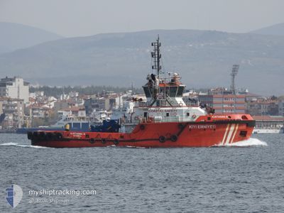
KURTARMA 10
Tug

Current Trip
TRCKZ
| Time Travelled | 1 day |
|---|---|
| Remaining Time | --- |
| Distance Travelled | 13.56 nm |
| Remaining Distance | --- |
| AVG Speed | 8.9 Knop |
| MAX Speed | 10.1 Knop |
| AVG Wind | 3 knots |
| MAX Wind | 3 knots |
| MIN Temp | 10.6°C / 51.08°F |
| MAX Temp | 11°C / 51.8°F |
| Djupgående | 6.5 m |
| Position mottagen | 1 d sen |
Current Position
| Longitud | --- |
|---|---|
| Latitude | --- |
| Status | Under way using engine |
| Fart | 9.6 Knop |
| Kurs | 54.4° |
| Område | Sea of Marmara |
| Station | T-AIS |
| Position mottagen | 1 d sen |
Information
The current position of KURTARMA 10 is in Sea of Marmara with coordinates 40.27836° / 26.52614° as reported on 2025-03-28 19:18 by AIS to our vessel tracker app. The vessel's current speed is 9.6 Knop
The vessel KURTARMA 10 (IMO: 9598593, MMSI: 271042963) is a Tug that was built in 2011 ( 14 År gammal ). It's sailing under the flag of [TR] Turkey.
In this page you can find informations about the vessels current position, last detected port calls, and current voyage information. If the vessels is not in coverage by AIS you will find the latest position.
The current position of KURTARMA 10 is detected by our AIS receivers and we are not responsible for the reliability of the data. The last position was recorded while the vessel was in Coverage by the Ais receivers of our vessel tracking app.
The current draught of KURTARMA 10 as reported by AIS is 6.5 meters
Weather
| Temperature | 12.8°C / 55.04°F |
|---|---|
| Wind Speed | 11 knots |
| Direction | 176° S |
| Pressure | 1005.3 hPa |
| Humidity | 77.2 % |
| Cloud Coverage | 36 % |


Featured Company
Last Port Calls
| Port | Arrival | Departure | Time In Port |
|---|---|---|---|
| 2025-03-28 21:09 | 2025-03-28 21:13 | 3 m | |
| 2025-03-27 11:28 | 2025-03-28 16:48 | 1 d | |
| 2025-03-26 16:09 | 2025-03-27 07:59 | 15 h | |
| 2025-03-26 14:18 | 2025-03-26 14:21 | 2 m | |
| 2025-03-26 06:21 | 2025-03-26 08:54 | 2 h | |
| 2025-03-24 15:11 | 2025-03-25 19:06 | 1 d | |
| 2025-03-23 14:30 | 2025-03-24 11:07 | 20 h | |
| 2025-03-22 16:52 | 2025-03-23 10:39 | 17 h | |
| 2025-03-20 20:27 | 2025-03-22 10:45 | 1 d | |
| 2025-03-19 12:09 | 2025-03-20 16:21 | 1 d |
Most Visited Ports (Last year)
| Port | Arrivals | |
|---|---|---|
| 359 | ||
| 355 | ||
| 38 | ||
| 21 |
Last Trips
| Origin | Departure | Destination | Arrival | Distance | |
|---|---|---|---|---|---|
| 2025-03-28 16:48 | 2025-03-28 21:09 | 37.10 nm | |||
| 2025-03-27 07:59 | 2025-03-27 11:28 | 34.19 nm | |||
| 2025-03-26 14:21 | 2025-03-26 16:09 | 18.33 nm | |||
| 2025-03-26 08:54 | 2025-03-26 14:18 | 35.15 nm | |||
| 2025-03-25 19:06 | 2025-03-26 06:21 | 65.45 nm | |||
| 2025-03-24 11:07 | 2025-03-24 15:11 | 36.37 nm | |||
| 2025-03-23 10:39 | 2025-03-23 14:30 | 34.91 nm | |||
| 2025-03-22 10:45 | 2025-03-22 16:52 | 52.36 nm | |||
| 2025-03-20 16:21 | 2025-03-20 20:27 | 37.59 nm | |||
| 2025-03-18 15:33 | 2025-03-19 12:09 | 72.52 nm |
Events
| Tid | Event | Detaljer | Position / Dest | Information |
|---|---|---|---|---|
| 2025-03-28 20:31 | STOPPAR förflyttning | 4.72 nm, South West of LAPSEKI |
40.32019 / 26.59121
TRCKZ
|
Fart: 0.1 kn Kurs: 144° |
| 2025-03-28 19:27 | Status ändrad | Default Under way using engine |
40.29167 / 26.54801
TRCKZ
|
Fart: 9.6 kn Kurs: 54.4° |
| 2025-03-28 19:18 | UTANFÖR täckningsområde |
40.27836 / 26.52614
Sea of Marmara
|
Fart: 9.6 kn Kurs: 54.4° |
|
| 2025-03-28 18:13 | AVGÅTT HAMN |
|
40.15816 / 26.39704
TRCKZ
|
Fart: 9.6 kn Kurs: 329° |
| 2025-03-28 18:11 | STARTAR förflyttning |
40.15324 / 26.40004
[TR] CANAKKALE
|
Fart: 9.5 kn Kurs: 338° |
|
| 2025-03-28 18:10 | STOPPAR förflyttning |
40.15146 / 26.40062
[TR] CANAKKALE
|
Fart: 0.2 kn Kurs: 40° |
|
| 2025-03-28 18:09 | ANLÄNDER HAMN |
|
40.15146 / 26.40062
[TR] CANAKKALE
|
Fart: 0.7 kn Kurs: 46° |
| 2025-03-28 17:17 | STARTAR förflyttning | 7.86 nm, South West of CANAKKALE |
40.04601 / 26.30733
TRCKZ
|
Fart: 4.7 kn Kurs: 39° |
| 2025-03-28 17:03 | STOPPAR förflyttning | 8.02 nm, South West of CANAKKALE |
40.04430 / 26.30442
TRCKZ
|
Fart: 0.2 kn Kurs: 199° |
| 2025-03-28 15:23 | Status ändrad | Under way using engine Default |
40.24733 / 26.47614
TRCKZ
|
Fart: 10.6 kn Kurs: 225° |