
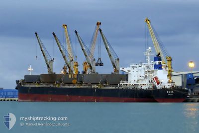
ILIA
Bulk Carrier
Current Trip
| Time Travelled | 18 days |
|---|---|
| Remaining Time | 19 days |
| Distance Travelled | 4501.13 морская миля |
| Remaining Distance | 4548.88 морская миля |
| AVG Speed | 10 Узлы |
| MAX Speed | 13 Узлы |
| AVG Wind | 19 knots |
| MAX Wind | 38 knots |
| MIN Temp | 11.5°C / 52.7°F |
| MAX Temp | 26.4°C / 79.52°F |
| Осадка | 12.2 м |
| Позиция Получена | 3 d тому назад |
Current Position
| Долгота | --- |
|---|---|
| Широта | --- |
| Статус | Under way using engine |
| Скорость | 10.9 Узлы |
| Курс | 82° |
| Район | Indian Ocean |
| Станция | T-AIS |
| Позиция Получена | 3 d тому назад |
Info
Information
The current position of ILIA is in Indian Ocean with coordinates -34.37137° / 23.54352° as reported on 2024-09-29 22:52 by AIS to our vessel tracker app. The vessel's current speed is 10.9 Узлы and is heading at the port of SINGAPORE. The estimated time of arrival as calculated by MyShipTracking vessel tracking app is 2024-10-22 20:24 LT
The vessel ILIA (IMO: 9490650, MMSI: 636014299) is a Bulk Carrier that was built in 2009 ( 15 лет ). It's sailing under the flag of [LR] Liberia.
In this page you can find informations about the vessels current position, last detected port calls, and current voyage information. If the vessels is not in coverage by AIS you will find the latest position.
The current position of ILIA is detected by our AIS receivers and we are not responsible for the reliability of the data. The last position was recorded while the vessel was in Coverage by the Ais receivers of our vessel tracking app.
The current draught of ILIA as reported by AIS is 12.2 meters
Weather
| Temperature | --- |
|---|---|
| Wind Speed | --- |
| Direction | --- |
| Pressure | --- |
| Humidity | --- |
| Cloud Coverage | --- |
Featured Company
Events
| Время | Событие | Детали | Позиция / Направление | Информация |
|---|---|---|---|---|
| 2024-09-29 22:56 | Статус изменился | Default Under way using engine |
-34.36946 / 23.55805
SINGAPORE
|
Скорость: 10.9 kn Курс: 82° |
| 2024-09-29 22:52 | Статус изменился | Under way using engine Default |
-34.37137 / 23.54352
SINGAPORE
|
Скорость: 10.7 kn Курс: 80° |
| 2024-09-29 22:52 | Вне покрытия |
-34.37137 / 23.54352
Indian Ocean
SINGAPORE
|
Скорость: 10.9 kn Курс: 82° |
|
| 2024-09-29 22:35 | Статус изменился | Default Under way using engine |
-34.37948 / 23.47973
SINGAPORE
|
Скорость: 11 kn Курс: 83° |
| 2024-09-29 22:28 | Статус изменился | Under way using engine Default |
-34.38276 / 23.45689
SINGAPORE
|
Скорость: 11 kn Курс: 80° |
| 2024-09-29 22:23 | Статус изменился | Default Under way using engine |
-34.38498 / 23.43840
SINGAPORE
|
Скорость: 10.8 kn Курс: 80° |
| 2024-09-29 22:13 | Статус изменился | Under way using engine Default |
-34.38912 / 23.40200
SINGAPORE
|
Скорость: 10.7 kn Курс: 82° |
| 2024-09-29 22:10 | Статус изменился | Default Under way using engine |
-34.39035 / 23.38848
SINGAPORE
|
Скорость: 10.8 kn Курс: 87° |
| 2024-09-29 22:05 | Статус изменился | Under way using engine Default |
-34.39141 / 23.37125
SINGAPORE
|
Скорость: 10.5 kn Курс: 89° |
| 2024-09-29 21:59 | Статус изменился | Default Under way using engine |
-34.39190 / 23.35207
SINGAPORE
|
Скорость: 10.5 kn Курс: 87° |