

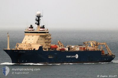
ILE DE BATZ
Cable Layer

Current Trip
| Time Travelled | 30 days |
|---|---|
| Remaining Time | 4 h, 2 mins |
| Distance Travelled | 497.27 морская миля |
| Remaining Distance | 22.30 морская миля |
| AVG Speed | 8.2 Узлы |
| MAX Speed | 13.1 Узлы |
| AVG Wind | 8.9 knots |
| MAX Wind | 25.5 knots |
| MIN Temp | 10.6°C / 51.08°F |
| MAX Temp | 27.4°C / 81.32°F |
| Осадка | 8 м |
| Позиция Получена | 1 m тому назад |
Current Position
| Долгота | --- |
|---|---|
| Широта | --- |
| Статус | Restricted manoeuverability |
| Скорость | |
| Курс | 323° |
| Район | Persian Gulf |
| Станция | T-AIS |
| Позиция Получена | 1 m тому назад |
Information
The current position of ILE DE BATZ is in Persian Gulf with coordinates 29.21517° / 48.17692° as reported on 2025-03-28 00:31 by AIS to our vessel tracker app. The vessel's current speed is 0 Узлы and is heading at the port of KUWAIT. The estimated time of arrival as calculated by MyShipTracking vessel tracking app is 2025-03-28 07:34 LT
The vessel ILE DE BATZ (IMO: 9247041, MMSI: 226332000) is a Cable Layer that was built in 2001 ( 24 лет ). It's sailing under the flag of [FR] France.
In this page you can find informations about the vessels current position, last detected port calls, and current voyage information. If the vessels is not in coverage by AIS you will find the latest position.
The current position of ILE DE BATZ is detected by our AIS receivers and we are not responsible for the reliability of the data. The last position was recorded while the vessel was in Coverage by the Ais receivers of our vessel tracking app.
The current draught of ILE DE BATZ as reported by AIS is 8 meters
Weather
| Temperature | 20.4°C / 68.72°F |
|---|---|
| Wind Speed | 5 knots |
| Direction | 219° SW |
| Pressure | 1013.9 hPa |
| Humidity | 45.6 % |
| Cloud Coverage | --- |


Featured Company
Events
| Время | Событие | Детали | Позиция / Направление | Информация |
|---|---|---|---|---|
| 2025-03-27 18:12 | Статус изменился | Restricted manoeuverability Under way using engine |
29.21661 / 48.18882
KW KWI
|
Скорость: 0.3 kn Курс: 169° |
| 2025-03-27 18:10 | Окончание движения | 4.16 nm, North East of FINTAS |
29.21675 / 48.18893
KW KWI
|
Скорость: 0.3 kn Курс: 173° |
| 2025-03-27 17:14 | Статус изменился | Under way using engine Restricted manoeuverability |
29.27454 / 48.15386
KW KWI
|
Скорость: 4.9 kn Курс: 347° |
| 2025-03-27 16:46 | Начало движения | 4.09 nm, North of FINTAS |
29.23754 / 48.14572
KW KWI
|
Скорость: 3.1 kn Курс: 323° |
| 2025-03-27 11:28 | Статус изменился | Restricted manoeuverability Under way using engine |
29.23221 / 48.15460
KW KWI
|
Скорость: Курс: 346° |
| 2025-03-27 11:12 | Окончание движения | 3.89 nm, North of FINTAS |
29.23172 / 48.15499
KW KWI
|
Скорость: 0.3 kn Курс: 256° |
| 2025-03-27 09:25 | ETA изменился | 2025/03/28 16:00 2025/03/26 05:00 |
29.40930 / 48.03770
KW KWI
|
Скорость: 11.6 kn Курс: 105° |
| 2025-03-27 09:08 | Статус изменился | Under way using engine Moored |
29.41938 / 47.98959
KW KWI
|
Скорость: 9.2 kn Курс: 58° |
| 2025-03-27 09:04 | В покрытии |
29.41200 / 47.98009
Persian Gulf
|
Скорость: 10 kn Курс: 45° |
|
| 2025-03-26 07:19 | Вне покрытия |
29.43249 / 48.00627
Persian Gulf
KW KWI
|
Скорость: Курс: 346° |