
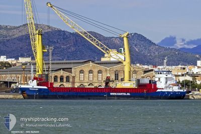
HOOGVLIET
General Cargo
Current Trip
| Time Travelled | 15 h, 23 mins |
|---|---|
| Remaining Time | 1 day |
| Distance Travelled | 151.96 морская миля |
| Remaining Distance | 446.41 морская миля |
| AVG Speed | 9.8 Узлы |
| MAX Speed | 11 Узлы |
| AVG Wind | 6.8 knots |
| MAX Wind | 11.9 knots |
| MIN Temp | 8°C / 46.4°F |
| MAX Temp | 14.3°C / 57.74°F |
| Осадка | 4.9 м |
| Позиция Получена | 1 m тому назад |
Current Position
| Долгота | 14.42646° |
|---|---|
| Широта | 55.23982° |
| Статус | Under way using engine |
| Скорость | 10.1 Узлы |
| Курс | 44.4° |
| Район | Kattegat |
| Станция | T-AIS |
| Позиция Получена | 1 m тому назад |
Info
Information
The current position of HOOGVLIET is in Kattegat with coordinates 55.23982° / 14.42646° as reported on 2024-04-30 03:16 by AIS to our vessel tracker app. The vessel's current speed is 10.1 Узлы and is heading at the port of MUUGA. The estimated time of arrival as calculated by MyShipTracking vessel tracking app is 2024-05-01 23:54 LT
The vessel HOOGVLIET (IMO: 9625231, MMSI: 246458000) is a General Cargo that was built in 2013 ( 11 лет ). It's sailing under the flag of [NL] Netherlands.
In this page you can find informations about the vessels current position, last detected port calls, and current voyage information. If the vessels is not in coverage by AIS you will find the latest position.
The current position of HOOGVLIET is detected by our AIS receivers and we are not responsible for the reliability of the data. The last position was recorded while the vessel was in Coverage by the Ais receivers of our vessel tracking app.
The current draught of HOOGVLIET as reported by AIS is 4.9 meters
Weather
| Temperature | 8°C / 46.4°F |
|---|---|
| Wind Speed | 12 knots |
| Direction | 83° E |
| Pressure | 1025.2 hPa |
| Humidity | 80.6 % |
| Cloud Coverage | 63 % |
Featured Company
Last Port Calls
| Port | Arrival | Departure | Time In Port |
|---|---|---|---|
| 2024-04-28 00:22 | 2024-04-29 11:54 | 1 d | |
| 2024-04-22 22:01 | 2024-04-25 03:04 | 2 d | |
| 2024-04-19 02:52 | 2024-04-20 05:25 | 1 d | |
| 2024-04-15 07:44 | 2024-04-16 04:16 | 20 h | |
| 2024-04-11 13:52 | 2024-04-15 06:44 | 3 d | |
| 2024-04-08 00:07 | 2024-04-09 19:57 | 1 d | |
| 2024-04-01 08:41 | 2024-04-04 12:02 | 3 d | |
| 2024-03-08 08:50 | 2024-03-16 17:35 | 8 d | |
| 2024-03-08 06:43 | |||
| 2024-03-03 10:10 | 2024-03-04 10:08 | 23 h |
Last Trips
| Origin | Departure | Destination | Arrival | Distance | |
|---|---|---|---|---|---|
| 2024-04-25 05:04 | 2024-04-28 02:22 | 652.07 морская миля | |||
| 2024-04-20 06:25 | 2024-04-23 00:01 | 511.39 морская миля | |||
| 2024-04-16 06:16 | 2024-04-19 03:52 | 608.12 морская миля | |||
| 2024-04-15 08:44 | 2024-04-15 09:44 | 9.41 морская миля | |||
| 2024-04-09 21:57 | 2024-04-11 15:52 | 297.44 морская миля | |||
| 2024-04-04 13:02 | 2024-04-08 02:07 | 854.52 морская миля | |||
| 2024-03-16 20:35 | 2024-04-01 09:41 | 3221.61 морская миля | |||
| 2024-03-08 09:43 | 2024-03-08 11:50 | 6.34 морская миля | |||
| 2024-02-29 17:33 | 2024-03-03 13:10 | 593.11 морская миля | |||
| 2024-02-26 20:35 | 2024-02-28 13:17 | 308.27 морская миля |
Events
| Время | Событие | Детали | Позиция / Направление | Информация |
|---|---|---|---|---|
| 2024-04-30 02:44 | Обнаружено в море | Danish part of the Kattegat |
55.19333 / 14.30152
Kattegat
EEMUG
|
Скорость: 9.9 kn Курс: 78.4° |
| 2024-04-29 21:05 | Изменение морского района | Swedish part of the Baltic Sea Danish part of the Baltic Sea |
55.30026 / 12.65096
Baltic Sea
EEMUG
|
Скорость: 10 kn Курс: 119.2° |
| 2024-04-29 20:56 | Изменение морского района | Danish part of the Baltic Sea Danish part of the Kattegat |
55.32056 / 12.63185
Baltic Sea
EEMUG
|
Скорость: 10 kn Курс: 182° |
| 2024-04-29 20:50 | Обнаружено в море | Danish part of the Kattegat |
55.33706 / 12.63672
Kattegat
EEMUG
|
Скорость: 10 kn Курс: 191.9° |
| 2024-04-29 20:02 | Изменение морского района | Swedish part of the Kattegat Danish part of the Kattegat |
55.46758 / 12.68353
Kattegat
EEMUG
|
Скорость: 9.9 kn Курс: 189.8° |
| 2024-04-29 17:53 | Изменение морского района | Danish part of the Kattegat Swedish part of the Kattegat |
55.80853 / 12.71939
Kattegat
EEMUG
|
Скорость: 9.7 kn Курс: 197.4° |
| 2024-04-29 16:32 | Изменение морского района | Swedish part of the Kattegat Danish part of the Kattegat |
56.02545 / 12.65698
Kattegat
EEMUG
|
Скорость: 9.6 kn Курс: 162.7° |
| 2024-04-29 15:08 | Изменение морского района | Danish part of the Kattegat Swedish part of the Kattegat |
56.18821 / 12.40629
Kattegat
EEMUG
|
Скорость: 10 kn Курс: 170.6° |
| 2024-04-29 11:54 | ПОРТ ОТПРАВЛЕНИЯ |
|
56.64922 / 12.83471
EEMUG
|
Скорость: 6.9 kn Курс: 218° |
| 2024-04-29 11:45 | Начало движения |
56.65693 / 12.85075
[SE] HALMSTAD
|
Скорость: 3.2 kn Курс: 203° |