

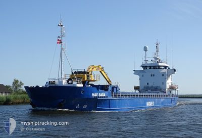
HAV SAGA
General Cargo

Current Trip
| Time Travelled | 2 days |
|---|---|
| Remaining Time | --- |
| Distance Travelled | 505.55 морская миля |
| Remaining Distance | --- |
| AVG Speed | 9.1 Узлы |
| MAX Speed | 10.8 Узлы |
| AVG Wind | 20.2 knots |
| MAX Wind | 33 knots |
| MIN Temp | 2.8°C / 37.04°F |
| MAX Temp | 6.1°C / 42.98°F |
| Осадка | 6 м |
| Позиция Получена | 8 d тому назад |
Current Position
| Долгота | --- |
|---|---|
| Широта | --- |
| Статус | Under way using engine |
| Скорость | 5.3 Узлы |
| Курс | 268.1° |
| Район | Norwegian Sea |
| Станция | T-AIS |
| Позиция Получена | 8 d тому назад |
Information
The current position of HAV SAGA is in Norwegian Sea with coordinates 62.38437° / 2.60150° as reported on 2025-03-04 21:52 by AIS to our vessel tracker app. The vessel's current speed is 5.3 Узлы and is heading at the port of SUND. The estimated time of arrival as calculated by MyShipTracking vessel tracking app is 2025-03-06 07:00 LT
The vessel HAV SAGA (IMO: 8719073, MMSI: 231108000) is a General Cargo that was built in 1990 ( 35 лет ). It's sailing under the flag of [FO] Faroe Is.
In this page you can find informations about the vessels current position, last detected port calls, and current voyage information. If the vessels is not in coverage by AIS you will find the latest position.
The current position of HAV SAGA is detected by our AIS receivers and we are not responsible for the reliability of the data. The last position was recorded while the vessel was in Coverage by the Ais receivers of our vessel tracking app.
The current draught of HAV SAGA as reported by AIS is 6 meters
Weather
| Temperature | 5.8°C / 42.44°F |
|---|---|
| Wind Speed | 16 knots |
| Direction | 9° N |
| Pressure | 1010.8 hPa |
| Humidity | 66.8 % |
| Cloud Coverage | 99 % |


Featured Company
Last Port Calls
| Port | Arrival | Departure | Time In Port |
|---|---|---|---|
| 2025-03-08 22:07 | 2025-03-10 18:14 | 1 d | |
| 2025-03-06 20:07 | 2025-03-07 20:20 | 1 d | |
| 2025-02-28 02:46 | 2025-03-01 00:05 | 21 h | |
| 2025-02-17 07:51 | 2025-02-18 00:43 | 16 h | |
| 2025-02-12 01:58 | 2025-02-12 16:49 | 14 h | |
| 2025-02-06 10:25 | 2025-02-07 01:25 | 14 h | |
| 2025-02-02 06:44 | 2025-02-03 01:03 | 18 h | |
| 2025-01-29 07:07 | 2025-01-30 23:02 | 1 d | |
| 2025-01-23 20:34 | 2025-01-25 19:48 | 1 d | |
| 2025-01-23 00:38 | 2025-01-23 01:15 | 37 m |
Last Trips
| Origin | Departure | Destination | Arrival | Distance | |
|---|---|---|---|---|---|
| 2025-03-07 20:20 | 2025-03-08 22:07 | 259.21 морская миля | |||
| 2025-03-01 00:05 | 2025-03-06 20:07 | 977.03 морская миля | |||
| 2025-02-18 00:43 | 2025-02-28 02:46 | 1481.94 морская миля | |||
| 2025-02-12 16:49 | 2025-02-17 07:51 | 1025.96 морская миля | |||
| 2025-02-07 01:25 | 2025-02-12 01:58 | 980.64 морская миля | |||
| 2025-02-03 01:03 | 2025-02-06 10:25 | 376.34 морская миля | |||
| 2025-01-30 23:02 | 2025-02-02 06:44 | 491.81 морская миля | |||
| 2025-01-25 19:48 | 2025-01-29 07:07 | 736.58 морская миля | |||
| 2025-01-23 01:15 | 2025-01-23 20:34 | 153.72 морская миля | |||
| 2025-01-22 14:30 | 2025-01-23 00:38 | 84.42 морская миля |
Events
| Время | Событие | Детали | Позиция / Направление | Информация |
|---|---|---|---|---|
| 2025-03-10 18:14 | ПОРТ ОТПРАВЛЕНИЯ |
|
65.15535 / -13.60940
SUND FO
|
Скорость: 9.1 kn Курс: 74° |
| 2025-03-10 18:01 | Начало движения |
65.13912 / -13.68578
[IS] NESKAUPSTADUR
|
Скорость: 9.1 kn Курс: 74° |
|
| 2025-03-08 22:07 | Порт |
|
65.13930 / -13.73780
[IS] NESKAUPSTADUR
|
Скорость: 10.2 kn Курс: 318° |
| 2025-03-07 20:26 | Начало движения | 1.15 nm, East of FUGLAFJORDUR |
62.23455 / -6.77241
SUND FO
|
Скорость: 7.4 kn Курс: 60° |
| 2025-03-07 20:20 | ПОРТ ОТПРАВЛЕНИЯ |
|
62.23455 / -6.77241
SUND FO
|
Скорость: Курс: 145° |
| 2025-03-06 20:23 | Окончание движения |
62.23490 / -6.79859
[FO] FUGLAFJORDUR
|
Скорость: Курс: 148° |
|
| 2025-03-06 20:07 | Порт |
|
62.23247 / -6.80112
[FO] FUGLAFJORDUR
|
Скорость: 7.5 kn Курс: 272° |
| 2025-03-04 21:52 | Вне покрытия |
62.38437 / 2.60150
Norwegian Sea
SUND FO
|
Скорость: 5.3 kn Курс: 268.1° |
|
| 2025-03-04 21:36 | Статус изменился | Under way using engine Default |
62.38669 / 2.65232
SUND FO
|
Скорость: 5.4 kn Курс: 256° |
| 2025-03-04 21:27 | Статус изменился | Default Under way using engine |
62.38863 / 2.68144
SUND FO
|
Скорость: 4.8 kn Курс: 254° |