

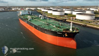
HABRUT
Crude Oil Tanker

Current Trip
ZA CPT>BR ADR
| Time Travelled | 9 days |
|---|---|
| Remaining Time | --- |
| Distance Travelled | 2825.06 морская миля |
| Remaining Distance | --- |
| AVG Speed | 12.1 Узлы |
| MAX Speed | 13.4 Узлы |
| AVG Wind | 14.3 knots |
| MAX Wind | 29.8 knots |
| MIN Temp | 14.6°C / 58.28°F |
| MAX Temp | 26.3°C / 79.34°F |
| Осадка | 11 м |
| Позиция Получена | 9 d тому назад |
Current Position
| Долгота | --- |
|---|---|
| Широта | --- |
| Статус | Under way using engine |
| Скорость | 12.2 Узлы |
| Курс | 112.4° |
| Район | South Atlantic Ocean |
| Станция | T-AIS |
| Позиция Получена | 9 d тому назад |
Information
The current position of HABRUT is in South Atlantic Ocean with coordinates -23.55873° / -44.05344° as reported on 2025-03-20 19:38 by AIS to our vessel tracker app. The vessel's current speed is 12.2 Узлы
The vessel HABRUT (IMO: 9500730, MMSI: 538004577) is a Crude Oil Tanker that was built in 2012 ( 13 лет ). It's sailing under the flag of [MH] Marshall Is.
In this page you can find informations about the vessels current position, last detected port calls, and current voyage information. If the vessels is not in coverage by AIS you will find the latest position.
The current position of HABRUT is detected by our AIS receivers and we are not responsible for the reliability of the data. The last position was recorded while the vessel was in Coverage by the Ais receivers of our vessel tracking app.
The current draught of HABRUT as reported by AIS is 11 meters
Weather
| Temperature | 15°C / 59°F |
|---|---|
| Wind Speed | 11 knots |
| Direction | 177° S |
| Pressure | 1025 hPa |
| Humidity | 59.5 % |
| Cloud Coverage | 58 % |


Featured Company
Most Visited Ports (Last year)
| Port | Arrivals | |
|---|---|---|
| 1 | ||
| 1 | ||
| 1 | ||
| 1 | ||
| 1 |
Last Trips
| Origin | Departure | Destination | Arrival | Distance |
|---|
Events
| Время | Событие | Детали | Позиция / Направление | Информация |
|---|---|---|---|---|
| 2025-03-20 19:42 | Статус изменился | Default Under way using engine |
-23.56465 / -44.03733
ZA CPT>BR ADR
|
Скорость: 12.2 kn Курс: 112.4° |
| 2025-03-20 19:38 | Вне покрытия |
-23.55873 / -44.05344
South Atlantic Ocean
|
Скорость: 12.2 kn Курс: 112.4° |
|
| 2025-03-20 15:20 | Начало движения | 0.43 nm, South East of TEBIG |
-23.06535 / -44.22553
ZA CPT>BR ADR
|
Скорость: 3.4 kn Курс: 250° |
| 2025-03-20 15:02 | Статус изменился | Under way using engine Default |
-23.06174 / -44.22149
ZA CPT>BR ADR
|
Скорость: 1.5 kn Курс: 296° |
| 2025-03-20 14:59 | В покрытии |
-23.06156 / -44.22098
South Atlantic Ocean
|
Скорость: 0.4 kn Курс: 52.4° |
|
| 2025-03-20 14:58 | ПОРТ ОТПРАВЛЕНИЯ |
|
-23.06132 / -44.22285
ZA CPT>BR ADR
|
Скорость: Курс: 279° |