
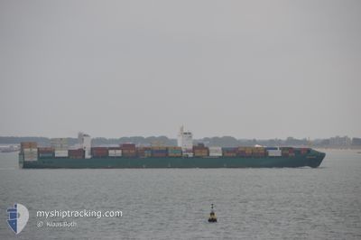
GSL TINOS
Container Ship
Current Trip
PANAMA CANAL
| Time Travelled | 31 days |
|---|---|
| Remaining Time | --- |
| Distance Travelled | 10710.21 морская миля |
| Remaining Distance | --- |
| AVG Speed | 14.7 Узлы |
| MAX Speed | 22.1 Узлы |
| AVG Wind | 11.7 knots |
| MAX Wind | 30.8 knots |
| MIN Temp | 12.4°C / 54.32°F |
| MAX Temp | 33°C / 91.4°F |
| Осадка | 9.4 м |
| Позиция Получена | 1 d тому назад |
Current Position
| Долгота | 120.96674° |
|---|---|
| Широта | 35.85391° |
| Статус | At anchor |
| Скорость | |
| Курс | 95° |
| Район | Yellow Sea |
| Станция | T-AIS |
| Позиция Получена | 1 d тому назад |
Info
Information
The current position of GSL TINOS is in Yellow Sea with coordinates 35.85391° / 120.96674° as reported on 2024-04-28 09:04 by AIS to our vessel tracker app. The vessel's current speed is 0 Узлы
The vessel GSL TINOS (IMO: 9437050, MMSI: 636020984) is a Container Ship that was built in 2010 ( 14 лет ). It's sailing under the flag of [LR] Liberia.
In this page you can find informations about the vessels current position, last detected port calls, and current voyage information. If the vessels is not in coverage by AIS you will find the latest position.
The current position of GSL TINOS is detected by our AIS receivers and we are not responsible for the reliability of the data. The last position was recorded while the vessel was in Coverage by the Ais receivers of our vessel tracking app.
The current draught of GSL TINOS as reported by AIS is 9.4 meters
Weather
| Temperature | 13.1°C / 55.58°F |
|---|---|
| Wind Speed | 17 knots |
| Direction | 10° N |
| Pressure | 1012.9 hPa |
| Humidity | 68.4 % |
| Cloud Coverage | 100 % |
Featured Company
Last Port Calls
| Port | Arrival | Departure | Time In Port |
|---|---|---|---|
| 2024-03-28 16:44 | 2024-03-29 12:44 | 19 h | |
| 2024-03-19 06:10 | 2024-03-21 04:06 | 1 d | |
| 2024-03-16 08:24 | 2024-03-17 16:45 | 1 d | |
| 2024-03-11 14:11 | 2024-03-12 08:47 | 18 h | |
| 2024-02-12 16:02 | 2024-02-13 10:42 | 18 h | |
| 2024-02-09 23:49 | 2024-02-10 12:14 | 12 h |
Last Trips
| Origin | Departure | Destination | Arrival | Distance | |
|---|---|---|---|---|---|
| 2024-03-21 00:06 | 2024-03-28 11:44 | 1895.25 морская миля | |||
| 2024-03-17 12:45 | 2024-03-19 02:10 | 444.10 морская миля | |||
| 2024-03-12 04:47 | 2024-03-16 04:24 | 809.07 морская миля | |||
| 2024-02-13 19:42 | 2024-03-11 10:11 | 10435.45 морская миля | |||
| 2024-02-10 20:14 | 2024-02-13 01:02 | 484.63 морская миля | |||
| 2024-01-31 16:42 | 2024-02-10 07:49 | 1192.96 морская миля |
Events
| Время | Событие | Детали | Позиция / Направление | Информация |
|---|---|---|---|---|
| 2024-04-29 12:48 | Начало движения |
35.85792 / 120.98053
PANAMA CANAL
|
Скорость: 4.5 kn Курс: 6° |
|
| 2024-04-29 00:34 | Окончание движения |
35.85676 / 120.97652
PANAMA CANAL
|
Скорость: 0.2 kn Курс: 94° |
|
| 2024-04-28 22:56 | Начало движения |
35.85575 / 120.96658
PANAMA CANAL
|
Скорость: 5.5 kn Курс: 321° |
|
| 2024-04-28 09:09 | Статус изменился | Default At anchor |
35.85402 / 120.96674
PANAMA CANAL
|
Скорость: Курс: 95° |
| 2024-04-28 09:04 | Вне покрытия |
35.85391 / 120.96674
Yellow Sea
|
Скорость: Курс: 95° |
|
| 2024-04-28 08:39 | Статус изменился | At anchor Default |
35.85357 / 120.96693
PANAMA CANAL
|
Скорость: Курс: 89° |
| 2024-04-28 08:36 | Статус изменился | Default At anchor |
35.85355 / 120.96693
PANAMA CANAL
|
Скорость: Курс: 93° |
| 2024-04-28 08:29 | Статус изменился | At anchor Default |
35.85362 / 120.96690
PANAMA CANAL
|
Скорость: Курс: 95° |
| 2024-04-28 08:12 | Статус изменился | Default At anchor |
35.85367 / 120.96685
PANAMA CANAL
|
Скорость: 0.1 kn Курс: 82° |
| 2024-04-28 08:06 | Статус изменился | At anchor Default |
35.85365 / 120.96675
PANAMA CANAL
|
Скорость: Курс: 77° |