

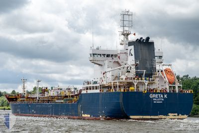
GRETA K
Tanker

Current Trip
| Time Travelled | 30 days |
|---|---|
| Remaining Time | --- |
| Distance Travelled | 2278.27 морская миля |
| Remaining Distance | --- |
| AVG Speed | 6.5 Узлы |
| MAX Speed | 15.2 Узлы |
| AVG Wind | 8.3 knots |
| MAX Wind | 29 knots |
| MIN Temp | 3.1°C / 37.58°F |
| MAX Temp | 21.8°C / 71.24°F |
| Осадка | 6.6 м |
| Позиция Получена | 1 d тому назад |
Current Position
| Долгота | --- |
|---|---|
| Широта | --- |
| Статус | Under way using engine |
| Скорость | 9 Узлы |
| Курс | 139.2° |
| Район | Mediterranean Sea - Eastern Basin |
| Станция | T-AIS |
| Позиция Получена | 1 d тому назад |
Information
The current position of GRETA K is in Mediterranean Sea - Eastern Basin with coordinates 34.53420° / 33.41187° as reported on 2025-03-21 11:46 by AIS to our vessel tracker app. The vessel's current speed is 9 Узлы and is heading at the port of TERNEUZEN. The estimated time of arrival as calculated by MyShipTracking vessel tracking app is 2025-03-20 06:00 LT
The vessel GRETA K (IMO: 9800374, MMSI: 249711000) is a Tanker It's sailing under the flag of [MT] Malta.
In this page you can find informations about the vessels current position, last detected port calls, and current voyage information. If the vessels is not in coverage by AIS you will find the latest position.
The current position of GRETA K is detected by our AIS receivers and we are not responsible for the reliability of the data. The last position was recorded while the vessel was in Coverage by the Ais receivers of our vessel tracking app.
The current draught of GRETA K as reported by AIS is 6.6 meters
Weather
| Temperature | 14.2°C / 57.56°F |
|---|---|
| Wind Speed | 4 knots |
| Direction | 276° W |
| Pressure | 1022.1 hPa |
| Humidity | 49.8 % |
| Cloud Coverage | --- |


Featured Company
Events
| Время | Событие | Детали | Позиция / Направление | Информация |
|---|---|---|---|---|
| 2025-03-22 10:54 | Окончание движения |
34.17395 / 33.80264
FOR ORDERS
|
Скорость: 0.3 kn Курс: 358° |
|
| 2025-03-22 08:38 | Начало движения |
34.19410 / 33.74851
FOR ORDERS
|
Скорость: 3.9 kn Курс: 118° |
|
| 2025-03-21 14:14 | Окончание движения |
34.26184 / 33.61946
FOR ORDERS
|
Скорость: 0.1 kn Курс: 137° |
|
| 2025-03-21 11:54 | Статус изменился | Default Under way using engine |
34.51738 / 33.42475
FOR ORDERS
|
Скорость: 9 kn Курс: 139.2° |
| 2025-03-21 11:46 | Вне покрытия |
34.53420 / 33.41187
Mediterranean Sea - Eastern Basin
|
Скорость: 9 kn Курс: 139.2° |
|
| 2025-03-21 10:43 | Пункт назначения изменился | FOR ORDERS CYLMS |
34.59895 / 33.22468
FOR ORDERS
|
Скорость: 11.4 kn Курс: 108.4° |
| 2025-03-21 09:47 | Начало движения | 2.28 nm, East of LIMASSOL |
34.66568 / 33.07280
CYLMS
|
Скорость: 4.3 kn Курс: 120° |
| 2025-03-21 09:28 | Статус изменился | Under way using engine At anchor |
34.66729 / 33.06951
CYLMS
|
Скорость: 0.5 kn Курс: 147° |
| 2025-03-20 17:18 | Статус изменился | At anchor Default |
34.66422 / 33.07233
CYLMS
|
Скорость: 0.2 kn Курс: 320° |
| 2025-03-20 17:15 | Статус изменился | Default At anchor |
34.66421 / 33.07220
CYLMS
|
Скорость: 0.2 kn Курс: 317° |