

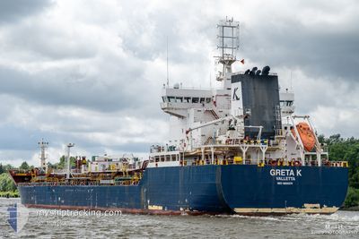
GRETA K
Tanker

Current Trip
| Time Travelled | 35 days |
|---|---|
| Remaining Time | --- |
| Distance Travelled | 2412.71 nm |
| Remaining Distance | --- |
| AVG Speed | 6.4 Noeuds |
| MAX Speed | 15.2 Noeuds |
| AVG Wind | 7.9 knots |
| MAX Wind | 29 knots |
| MIN Temp | 3.1°C / 37.58°F |
| MAX Temp | 21.8°C / 71.24°F |
| Tirant d eau | 7.7 m |
| Position reçue | 1 m depuis |
Current Position
| Longitude | --- |
|---|---|
| Latitude | --- |
| Etat | Not under command |
| Vitesse | 0.2 Noeuds |
| Parcours | 162° |
| Zone | Mediterranean Sea - Eastern Basin |
| Station | T-AIS |
| Position reçue | 1 m depuis |
Information
The current position of GRETA K is in Mediterranean Sea - Eastern Basin with coordinates 34.16614° / 33.65490° as reported on 2025-03-26 22:38 by AIS to our vessel tracker app. The vessel's current speed is 0.2 Noeuds and is heading at the port of TERNEUZEN. The estimated time of arrival as calculated by MyShipTracking vessel tracking app is 2025-03-20 06:00 LT
The vessel GRETA K (IMO: 9800374, MMSI: 249711000) is a Tanker It's sailing under the flag of [MT] Malta.
In this page you can find informations about the vessels current position, last detected port calls, and current voyage information. If the vessels is not in coverage by AIS you will find the latest position.
The current position of GRETA K is detected by our AIS receivers and we are not responsible for the reliability of the data. The last position was recorded while the vessel was in Coverage by the Ais receivers of our vessel tracking app.
The current draught of GRETA K as reported by AIS is 7.7 meters
Weather
| Temperature | 18.9°C / 66.02°F |
|---|---|
| Wind Speed | 8 knots |
| Direction | 60° ENE |
| Pressure | 1013.7 hPa |
| Humidity | 63.4 % |
| Cloud Coverage | 100 % |


Featured Company
Events
| Heure | Evenement | Détails | Position/ Destination | Info |
|---|---|---|---|---|
| 2025-03-26 22:03 | Etat Changé | Not under command Default |
34.16486 / 33.65650
FOR ORDERS
|
Vitesse: 0.2 kn Parcours: 175° |
| 2025-03-26 21:54 | Etat Changé | Default Not under command |
34.16430 / 33.65670
FOR ORDERS
|
Vitesse: 0.4 kn Parcours: 177° |
| 2025-03-26 21:08 | Etat Changé | Not under command Default |
34.16190 / 33.65684
FOR ORDERS
|
Vitesse: 0.2 kn Parcours: 157° |
| 2025-03-26 21:06 | Etat Changé | Default Not under command |
34.16184 / 33.65681
FOR ORDERS
|
Vitesse: 0.2 kn Parcours: 145° |
| 2025-03-26 20:45 | Etat Changé | Not under command Default |
34.16098 / 33.65631
FOR ORDERS
|
Vitesse: 0.2 kn Parcours: 151° |
| 2025-03-26 20:42 | Etat Changé | Default Not under command |
34.16083 / 33.65620
FOR ORDERS
|
Vitesse: 0.2 kn Parcours: 157° |
| 2025-03-26 18:06 | Tirant d'eau modifié | 7.7 7.4 |
34.15746 / 33.64287
FOR ORDERS
|
Vitesse: 0.4 kn Parcours: 125° |
| 2025-03-26 13:29 | Etat Changé | Not under command Default |
34.13490 / 33.62014
FOR ORDERS
|
Vitesse: 0.4 kn Parcours: 184° |
| 2025-03-26 13:18 | Etat Changé | Default Not under command |
34.13360 / 33.61997
FOR ORDERS
|
Vitesse: 0.2 kn Parcours: 180° |
| 2025-03-26 12:22 | Etat Changé | Not under command Default |
34.12894 / 33.62044
FOR ORDERS
|
Vitesse: 0.2 kn Parcours: 150° |