
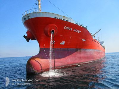
GINGA SAKER
Oil/Chemical Tanker
Current Trip
| Time Travelled | 8 days |
|---|---|
| Remaining Time | 4 days |
| Distance Travelled | 2538.42 морская миля |
| Remaining Distance | 1302.04 морская миля |
| AVG Speed | 11.5 Узлы |
| MAX Speed | 14.6 Узлы |
| AVG Wind | 12.8 knots |
| MAX Wind | 26 knots |
| MIN Temp | 15.5°C / 59.9°F |
| MAX Temp | 28.4°C / 83.12°F |
| Осадка | 7.8 м |
| Позиция Получена | 1 d тому назад |
Current Position
| Долгота | --- |
|---|---|
| Широта | --- |
| Статус | Under way using engine |
| Скорость | 13.6 Узлы |
| Курс | 118° |
| Район | Laccadive Sea |
| Станция | T-AIS |
| Позиция Получена | 1 d тому назад |
Info
Information
The current position of GINGA SAKER is in Laccadive Sea with coordinates 6.14335° / 79.17045° as reported on 2025-02-16 00:30 by AIS to our vessel tracker app. The vessel's current speed is 13.6 Узлы and is heading at the port of SINGAPORE. The estimated time of arrival as calculated by MyShipTracking vessel tracking app is 2025-02-21 11:38 LT
The vessel GINGA SAKER (IMO: 9258155, MMSI: 352530000) is a Oil/Chemical Tanker that was built in 2003 ( 22 лет ). It's sailing under the flag of [PA] Panama.
In this page you can find informations about the vessels current position, last detected port calls, and current voyage information. If the vessels is not in coverage by AIS you will find the latest position.
The current position of GINGA SAKER is detected by our AIS receivers and we are not responsible for the reliability of the data. The last position was recorded while the vessel was in Coverage by the Ais receivers of our vessel tracking app.
The current draught of GINGA SAKER as reported by AIS is 7.8 meters
Weather
| Temperature | 28°C / 82.4°F |
|---|---|
| Wind Speed | 13 knots |
| Direction | 51° NE |
| Pressure | 1012.8 hPa |
| Humidity | 75 % |
| Cloud Coverage | 100 % |
Featured Company
Most Visited Ports (Last year)
| Port | Arrivals | |
|---|---|---|
| 5 | ||
| 5 | ||
| 3 | ||
| 3 | ||
| 3 | ||
| 1 |
Last Trips
| Origin | Departure | Destination | Arrival | Distance | |
|---|---|---|---|---|---|
| 2024-12-30 04:30 | 2025-02-03 08:11 | 3352.20 морская миля | |||
| 2024-12-18 18:29 | 2024-12-27 12:53 | 1063.55 морская миля | |||
| 2024-12-09 15:25 | 2024-12-13 09:07 | 1040.81 морская миля | |||
| 2024-11-23 08:44 | 2024-12-07 19:56 | 1545.84 морская миля |
Events
| Время | Событие | Детали | Позиция / Направление | Информация |
|---|---|---|---|---|
| 2025-02-16 00:35 | Статус изменился | Default Under way using engine |
6.13418 / 79.18853
SG SIN
|
Скорость: 13.6 kn Курс: 118° |
| 2025-02-16 00:30 | Вне покрытия |
6.14335 / 79.17045
Laccadive Sea
SG SIN
|
Скорость: 13.6 kn Курс: 118° |
|
| 2025-02-16 00:24 | Статус изменился | Under way using engine Default |
6.15513 / 79.14897
SG SIN
|
Скорость: 13.5 kn Курс: 118° |
| 2025-02-15 23:59 | Статус изменился | Default Under way using engine |
6.19875 / 79.07008
SG SIN
|
Скорость: 13.5 kn Курс: 118° |
| 2025-02-15 23:46 | Изменение морского района | Sri Lankan part of the Laccadive Sea Indian part of the Laccadive Sea |
6.22410 / 79.02483
Laccadive Sea
SG SIN
|
Скорость: 13.4 kn Курс: 119° |
| 2025-02-15 23:46 | Статус изменился | Under way using engine Default |
6.22410 / 79.02483
SG SIN
|
Скорость: 13.4 kn Курс: 111° |
| 2025-02-15 23:46 | В покрытии |
6.22410 / 79.02483
Laccadive Sea
SG SIN
|
Скорость: 13.4 kn Курс: 119° |
|
| 2025-02-15 11:25 | Статус изменился | Default Under way using engine |
7.62960 / 76.82982
SG SIN
|
Скорость: 11.9 kn Курс: 136° |
| 2025-02-15 11:21 | Вне покрытия |
7.64005 / 76.81982
Laccadive Sea
SG SIN
|
Скорость: 11.9 kn Курс: 136° |
|
| 2025-02-15 11:16 | Статус изменился | Under way using engine Default |
7.65120 / 76.80920
SG SIN
|
Скорость: 12 kn Курс: 140° |