
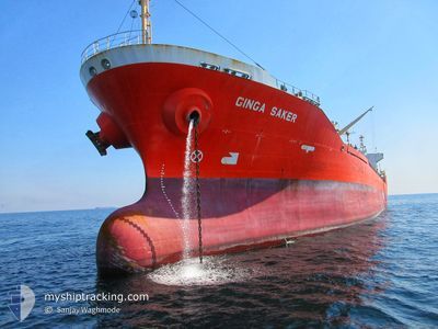
GINGA SAKER
Oil/Chemical Tanker
Current Trip
| Time Travelled | 1 day |
|---|---|
| Remaining Time | --- |
| Distance Travelled | 375.73 nm |
| Remaining Distance | --- |
| AVG Speed | 12.9 Knots |
| MAX Speed | 14.8 Knots |
| AVG Wind | 26.6 knots |
| MAX Wind | 37.7 knots |
| MIN Temp | 8.4°C / 47.12°F |
| MAX Temp | 12.4°C / 54.32°F |
| Draught | 7.5 m |
| Position Received | 13 d ago |
Current Position
| Longitude | --- |
|---|---|
| Latitude | --- |
| Status | Under way using engine |
| Speed | 12.6 Knots |
| Course | 172° |
| Area | South China Sea |
| Station | T-AIS |
| Position Received | 13 d ago |
Info
Information
The current position of GINGA SAKER is in South China Sea with coordinates 22.28272° / 113.80567° as reported on 2025-03-02 04:46 by AIS to our vessel tracker app. The vessel's current speed is 12.6 Knots and is heading at the port of YEOSU. The estimated time of arrival as calculated by MyShipTracking vessel tracking app is 2025-03-06 11:00 LT
The vessel GINGA SAKER (IMO: 9258155, MMSI: 352530000) is a Oil/Chemical Tanker that was built in 2003 ( 22 years old ). It's sailing under the flag of [PA] Panama.
In this page you can find informations about the vessels current position, last detected port calls, and current voyage information. If the vessels is not in coverage by AIS you will find the latest position.
The current position of GINGA SAKER is detected by our AIS receivers and we are not responsible for the reliability of the data. The last position was recorded while the vessel was in Coverage by the Ais receivers of our vessel tracking app.
The current draught of GINGA SAKER as reported by AIS is 7.5 meters
Weather
| Temperature | 7.1°C / 44.78°F |
|---|---|
| Wind Speed | 24 knots |
| Direction | 345° NNW |
| Pressure | 1018.3 hPa |
| Humidity | 69.3 % |
| Cloud Coverage | 100 % |
Featured Company
Last Trips
| Origin | Departure | Destination | Arrival | Distance | |
|---|---|---|---|---|---|
| 2025-03-11 16:02 | 2025-03-12 16:50 | 60.92 nm | |||
| 2025-03-09 21:47 | 2025-03-10 12:27 | 134.17 nm | |||
| 2025-02-22 22:32 | 2025-03-09 06:06 | 2789.53 nm | |||
| 2025-02-08 09:58 | 2025-02-22 08:14 | 3864.73 nm | |||
| 2024-12-30 04:30 | 2025-02-03 08:11 | 3352.20 nm |
Events
| Time | Event | Details | Position / Dest | Info |
|---|---|---|---|---|
| 2025-03-14 06:51 | PORT DEPARTURE |
|
35.40772 / 129.37697
KRYOS
|
Speed: 6.9 kn Course: 176° |
| 2025-03-14 06:38 | START Moving |
35.43288 / 129.37404
[KR] ONSAN
|
Speed: 5.7 kn Course: 167° |
|
| 2025-03-12 07:50 | STOP Moving |
35.43996 / 129.36818
[KR] ONSAN
|
Speed: Course: 24° |
|
| 2025-03-12 07:50 | PORT ARRIVAL |
|
35.43996 / 129.36818
[KR] ONSAN
|
Speed: 4.4 kn Course: 330° |
| 2025-03-12 06:44 | START Moving | 3.95 nm, East of ONSAN |
35.41200 / 129.45175
KRYOS
|
Speed: 10.2 kn Course: 208° |
| 2025-03-11 20:17 | STOP Moving | 4.39 nm, East of ONSAN |
35.42992 / 129.46622
KRYOS
|
Speed: 0.1 kn Course: 222° |
| 2025-03-11 18:17 | START Moving | 17.24 nm, North East of ULSAN |
35.59595 / 129.71654
KRYOS
|
Speed: 3.4 kn Course: 40° |
| 2025-03-11 09:58 | STOP Moving | 14.89 nm, East of ULSAN |
35.39302 / 129.67920
KRYOS
|
Speed: 0.3 kn Course: 158° |
| 2025-03-11 07:02 | PORT DEPARTURE |
|
35.44460 / 129.39504
KRYOS
|
Speed: 10.1 kn Course: 105° |
| 2025-03-11 06:45 | START Moving |
35.46022 / 129.35074
[KR] ONSAN
|
Speed: 3.7 kn Course: 150° |