
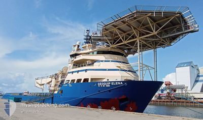
GEOQUIP ELENA
Offshore Supply Ship
Current Trip
KEEP 0,5NM DISTANC
| Time Travelled | 9 days |
|---|---|
| Remaining Time | --- |
| Distance Travelled | 120.79 морская миля |
| Remaining Distance | --- |
| AVG Speed | 8.8 Узлы |
| MAX Speed | 12 Узлы |
| AVG Wind | 10.2 knots |
| MAX Wind | 18.4 knots |
| MIN Temp | 4.5°C / 40.1°F |
| MAX Temp | 10.4°C / 50.72°F |
| Осадка | 5.2 м |
| Позиция Получена | 9 h, 16 m тому назад |
Current Position
| Долгота | 17.49855° |
|---|---|
| Широта | 55.59060° |
| Статус | Restricted manoeuverability |
| Скорость | 4.5 Узлы |
| Курс | 17° |
| Район | Baltic Sea |
| Станция | T-AIS |
| Позиция Получена | 9 h, 16 m тому назад |
Info
Information
The current position of GEOQUIP ELENA is in Baltic Sea with coordinates 55.59060° / 17.49855° as reported on 2024-05-04 18:19 by AIS to our vessel tracker app. The vessel's current speed is 4.5 Узлы
The vessel GEOQUIP ELENA (IMO: 9249439, MMSI: 576431000) is a Offshore Supply Ship that was built in 2002 ( 22 лет ). It's sailing under the flag of [VU] Vanuatu.
In this page you can find informations about the vessels current position, last detected port calls, and current voyage information. If the vessels is not in coverage by AIS you will find the latest position.
The current position of GEOQUIP ELENA is detected by our AIS receivers and we are not responsible for the reliability of the data. The last position was recorded while the vessel was in Coverage by the Ais receivers of our vessel tracking app.
The current draught of GEOQUIP ELENA as reported by AIS is 5.2 meters
Weather
| Temperature | 10.4°C / 50.72°F |
|---|---|
| Wind Speed | 2 knots |
| Direction | 109° ESE |
| Pressure | 1014.2 hPa |
| Humidity | 86 % |
| Cloud Coverage | 100 % |
Featured Company
Last Port Calls
| Port | Arrival | Departure | Time In Port |
|---|---|---|---|
| 2024-04-23 08:39 | 2024-04-26 02:18 | 2 d | |
| 2024-04-12 17:28 | 2024-04-20 05:00 | 7 d | |
| 2024-04-01 09:47 | 2024-04-12 05:49 | 10 d | |
| 2024-03-31 07:34 | 2024-03-31 08:19 | 44 m | |
| 2024-03-27 19:01 | 2024-03-31 07:13 | 3 d | |
| 2024-03-22 18:34 | 2024-03-27 17:53 | 4 d | |
| 2024-03-22 17:37 |
Last Trips
| Origin | Departure | Destination | Arrival | Distance | |
|---|---|---|---|---|---|
| 2024-04-20 07:00 | 2024-04-23 10:39 | 648.71 морская миля | |||
| 2024-04-12 07:49 | 2024-04-12 19:28 | 30.44 морская миля | |||
| 2024-03-31 10:19 | 2024-04-01 11:47 | 70.62 морская миля | |||
| 2024-03-31 09:13 | 2024-03-31 09:34 | 1.33 морская миля | |||
| 2024-03-27 18:53 | 2024-03-27 20:01 | 8.16 морская миля | |||
| 2024-03-22 18:37 | 2024-03-22 19:34 | 8.28 морская миля |
Events
| Время | Событие | Детали | Позиция / Направление | Информация |
|---|---|---|---|---|
| 2024-05-04 18:19 | Вне покрытия |
55.59060 / 17.49855
Baltic Sea
|
Скорость: 4.5 kn Курс: 16.8° |
|
| 2024-05-04 18:11 | Начало движения |
55.58123 / 17.49349
KEEP 0,5NM DISTANC
|
Скорость: 4.5 kn Курс: 17° |
|
| 2024-05-04 17:34 | В покрытии |
55.52822 / 17.46702
Baltic Sea
|
Скорость: 1 kn Курс: 39.8° |
|
| 2024-05-04 14:02 | Вне покрытия |
55.52797 / 17.46722
Baltic Sea
|
Скорость: 0.1 kn Курс: 287.2° |
|
| 2024-05-04 14:02 | В покрытии |
55.52797 / 17.46722
Baltic Sea
|
Скорость: 0.1 kn Курс: 287.2° |
|
| 2024-05-04 11:08 | Вне покрытия |
55.52785 / 17.46730
Baltic Sea
|
Скорость: Курс: 332.1° |
|
| 2024-05-04 06:20 | В покрытии |
55.52787 / 17.46707
Baltic Sea
|
Скорость: Курс: 235.2° |
|
| 2024-05-04 04:17 | Вне покрытия |
55.52794 / 17.46715
Baltic Sea
|
Скорость: Курс: 0° |
|
| 2024-05-03 23:05 | В покрытии |
55.52791 / 17.46705
Baltic Sea
|
Скорость: Курс: 254.5° |
|
| 2024-05-03 21:37 | Вне покрытия |
55.52805 / 17.46708
Baltic Sea
|
Скорость: 0.1 kn Курс: 210° |