
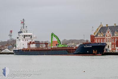
FRI KARMSUND
General Cargo
Current Trip
| Time Travelled | 6 days |
|---|---|
| Remaining Time | --- |
| Distance Travelled | 1006.15 морская миля |
| Remaining Distance | --- |
| AVG Speed | 8.2 Узлы |
| MAX Speed | 12 Узлы |
| AVG Wind | 14.2 knots |
| MAX Wind | 20.8 knots |
| MIN Temp | 7.7°C / 45.86°F |
| MAX Temp | 15.3°C / 59.54°F |
| Осадка | 5.6 м |
| Позиция Получена | 8 h, 31 m тому назад |
Current Position
| Долгота | --- |
|---|---|
| Широта | --- |
| Статус | At anchor |
| Скорость | 0.1 Узлы |
| Курс | 262° |
| Район | Irish Sea and St. George's Channel |
| Станция | T-AIS |
| Позиция Получена | 8 h, 31 m тому назад |
Info
Information
The current position of FRI KARMSUND is in Irish Sea and St. George's Channel with coordinates 53.36935° / -4.19333° as reported on 2024-12-26 06:41 by AIS to our vessel tracker app. The vessel's current speed is 0.1 Узлы
The vessel FRI KARMSUND (IMO: 9211066, MMSI: 210852000) is a General Cargo that was built in 1999 ( 25 лет ). It's sailing under the flag of [CY] Cyprus.
In this page you can find informations about the vessels current position, last detected port calls, and current voyage information. If the vessels is not in coverage by AIS you will find the latest position.
The current position of FRI KARMSUND is detected by our AIS receivers and we are not responsible for the reliability of the data. The last position was recorded while the vessel was in Coverage by the Ais receivers of our vessel tracking app.
The current draught of FRI KARMSUND as reported by AIS is 5.6 meters
Weather
| Temperature | 10°C / 50°F |
|---|---|
| Wind Speed | 5 knots |
| Direction | 180° S |
| Pressure | 1033 hPa |
| Humidity | 89 % |
| Cloud Coverage | 87 % |
Featured Company
Last Port Calls
| Port | Arrival | Departure | Time In Port |
|---|---|---|---|
| 2024-12-17 21:44 | 2024-12-20 01:12 | 2 d | |
| 2024-12-16 13:08 | 2024-12-17 02:22 | 13 h | |
| 2024-12-11 01:07 | 2024-12-12 16:31 | 1 d | |
| 2024-12-03 11:11 | 2024-12-04 18:17 | 1 d | |
| 2024-12-02 06:19 | 2024-12-03 06:54 | 1 d | |
| 2024-11-18 23:38 | 2024-11-22 01:55 | 3 d | |
| 2024-11-08 09:43 | 2024-11-09 10:52 | 1 d | |
| 2024-10-26 12:06 | 2024-10-28 21:55 | 2 d | |
| 2024-10-23 23:30 | 2024-10-24 12:55 | 13 h | |
| 2024-10-22 18:46 | 2024-10-23 11:24 | 16 h |
Last Trips
| Origin | Departure | Destination | Arrival | Distance | |
|---|---|---|---|---|---|
| 2024-12-17 02:22 | 2024-12-17 21:44 | 207.51 морская миля | |||
| 2024-12-12 16:31 | 2024-12-16 13:08 | 947.77 морская миля | |||
| 2024-12-04 18:17 | 2024-12-11 01:07 | 1209.90 морская миля | |||
| 2024-12-03 06:54 | 2024-12-03 11:11 | 41.56 морская миля | |||
| 2024-11-22 02:55 | 2024-12-02 06:19 | 1201.53 морская миля | |||
| 2024-11-09 10:52 | 2024-11-19 00:38 | 1651.29 морская миля | |||
| 2024-10-28 22:55 | 2024-11-08 09:43 | 2064.52 морская миля | |||
| 2024-10-24 14:55 | 2024-10-26 14:06 | 165.34 морская миля | |||
| 2024-10-23 13:24 | 2024-10-24 01:30 | 113.48 морская миля | |||
| 2024-10-21 21:30 | 2024-10-22 20:46 | 236.95 морская миля |
Events
| Время | Событие | Детали | Позиция / Направление | Информация |
|---|---|---|---|---|
| 2024-12-26 06:44 | Статус изменился | Default At anchor |
53.36941 / -4.19335
BROMBOROUGH
|
Скорость: 0.1 kn Курс: 262° |
| 2024-12-26 06:41 | Статус изменился | At anchor Default |
53.36935 / -4.19333
BROMBOROUGH
|
Скорость: 0.1 kn Курс: 264° |
| 2024-12-26 06:41 | Вне покрытия |
53.36935 / -4.19333
Irish Sea and St. George's Channel
|
Скорость: 0.1 kn Курс: 312.9° |
|
| 2024-12-26 06:26 | В покрытии |
53.36935 / -4.19333
Irish Sea and St. George's Channel
|
Скорость: 0.1 kn Курс: 312.9° |
|
| 2024-12-25 10:17 | Окончание движения | 13.71 nm, West of CONWY |
53.37093 / -4.19554
BROMBOROUGH
|
Скорость: 0.1 kn Курс: 155° |
| 2024-12-25 08:19 | Статус изменился | Default Under way using engine |
53.49129 / -4.49987
BROMBOROUGH
|
Скорость: 9.6 kn Курс: 85.1° |
| 2024-12-25 08:12 | Вне покрытия |
53.49003 / -4.53295
Irish Sea and St. George's Channel
BROMBOROUGH
|
Скорость: 9.6 kn Курс: 85.1° |
|
| 2024-12-25 08:08 | Статус изменился | Under way using engine Default |
53.48931 / -4.55070
BROMBOROUGH
|
Скорость: 9.6 kn Курс: 86° |
| 2024-12-25 08:07 | В покрытии |
53.48933 / -4.55025
Irish Sea and St. George's Channel
BROMBOROUGH
|
Скорость: 9.6 kn Курс: 86.9° |
|
| 2024-12-25 06:33 | Вне покрытия |
53.31765 / -4.84963
Irish Sea and St. George's Channel
BROMBOROUGH
|
Скорость: 10.7 kn Курс: 31.4° |