
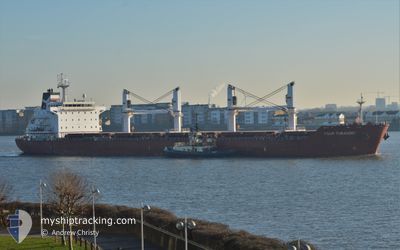
FOUR TURANDOT
Bulk Carrier
Current Trip
| Trip Time | 2 days |
|---|---|
| Trip Distance | 568.67 морская миля |
| AVG Speed | 9.2 Узлы |
| MAX Speed | 12.5 Узлы |
| Осадка | 6 м |
| AVG Wind | 11 knots |
| MAX Wind | 23 knots |
| MIN Temp | 22.7°C / 72.86°F |
| MAX Temp | 30.2°C / 86.36°F |
| Позиция Получена | 2 d тому назад |
Current Position
| Долгота | -90.23840° |
|---|---|
| Широта | 29.96584° |
| Статус | At anchor |
| Скорость | 7.7 Узлы |
| Курс | 290° |
| Район | Gulf of Mexico |
| Станция | T-AIS |
| Позиция Получена | 2 d тому назад |
Info
Information
The current position of FOUR TURANDOT is in Gulf of Mexico with coordinates 29.96584° / -90.23840° as reported on 2024-05-01 20:29 by AIS to our vessel tracker app. The vessel's current speed is 7.7 Узлы and is currently inside the port of NEW ORLEANS.
The vessel FOUR TURANDOT (IMO: 9480710, MMSI: 248506000) is a Bulk Carrier that was built in 2012 ( 12 лет ). It's sailing under the flag of [MT] Malta.
In this page you can find informations about the vessels current position, last detected port calls, and current voyage information. If the vessels is not in coverage by AIS you will find the latest position.
The current position of FOUR TURANDOT is detected by our AIS receivers and we are not responsible for the reliability of the data. The last position was recorded while the vessel was in Coverage by the Ais receivers of our vessel tracking app.
The current draught of FOUR TURANDOT as reported by AIS is 6 meters
Weather
| Temperature | 21.5°C / 70.7°F |
|---|---|
| Wind Speed | 6 knots |
| Direction | 131° SE |
| Pressure | 1013.4 hPa |
| Humidity | 77.9 % |
| Cloud Coverage | 50 % |
Featured Company
Last Port Calls
| Port | Arrival | Departure | Time In Port |
|---|---|---|---|
| 2024-05-01 03:06 | |||
| 2024-04-24 14:10 | 2024-04-28 14:59 | 4 d | |
| 2024-03-24 14:05 | 2024-03-26 19:33 | 2 d | |
| 2024-03-04 18:17 | 2024-03-16 03:11 | 11 d |
Most Visited Ports (Last year)
| Port | Arrivals | |
|---|---|---|
| 2 | ||
| 2 | ||
| 1 | ||
| 1 | ||
| 1 | ||
| 1 |
Last Trips
| Origin | Departure | Destination | Arrival | Distance | |
|---|---|---|---|---|---|
| 2024-04-28 09:59 | 2024-04-30 22:06 | 568.67 морская миля | |||
| 2024-03-26 20:33 | 2024-04-24 09:10 | 4877.00 морская миля | |||
| 2024-03-16 03:11 | 2024-03-24 15:05 | 877.89 морская миля | |||
| 2024-02-27 23:48 | 2024-03-04 19:17 | 1048.73 морская миля |
Events
| Время | Событие | Детали | Позиция / Направление | Информация |
|---|---|---|---|---|
| 2024-05-03 18:15 | Окончание движения |
29.93930 / -90.35651
[US] NEW ORLEANS
|
Скорость: Курс: 289° |
|
| 2024-05-03 17:23 | Начало движения |
29.96521 / -90.28185
[US] NEW ORLEANS
|
Скорость: 5.4 kn Курс: 245° |
|
| 2024-05-01 21:03 | Окончание движения |
29.96599 / -90.27641
[US] NEW ORLEANS
|
Скорость: 0.2 kn Курс: 233° |
|
| 2024-05-01 20:32 | Статус изменился | Default At anchor |
29.96719 / -90.24273
[US] NEW ORLEANS
|
Скорость: 7.7 kn Курс: 290° |
| 2024-05-01 20:29 | Вне покрытия |
29.96584 / -90.23840
Gulf of Mexico
[US] NEW ORLEANS
|
Скорость: 7.7 kn Курс: 289.5° |
|
| 2024-05-01 19:53 | Статус изменился | At anchor Default |
29.93440 / -90.17892
[US] NEW ORLEANS
|
Скорость: 8 kn Курс: 227° |
| 2024-05-01 19:38 | Статус изменился | Default At anchor |
29.95653 / -90.15043
[US] NEW ORLEANS
|
Скорость: 8.4 kn Курс: 314° |
| 2024-05-01 19:28 | Статус изменился | At anchor Default |
29.94079 / -90.13893
[US] NEW ORLEANS
|
Скорость: 8.8 kn Курс: 5° |
| 2024-05-01 19:18 | Статус изменился | Default At anchor |
29.91735 / -90.13738
[US] NEW ORLEANS
|
Скорость: 8.5 kn Курс: 264° |
| 2024-05-01 19:07 | Статус изменился | At anchor Default |
29.90799 / -90.11029
[US] NEW ORLEANS
|
Скорость: 8.4 kn Курс: 263° |