

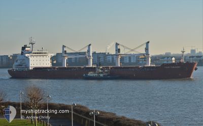
FOUR TURANDOT
Bulk Carrier

Current Trip
AGADIR
| Time Travelled | 8 h, 34 mins |
|---|---|
| Remaining Time | --- |
| Distance Travelled | --- |
| Remaining Distance | --- |
| AVG Speed | --- |
| MAX Speed | --- |
| AVG Wind | --- |
| MAX Wind | --- |
| MIN Temp | --- |
| MAX Temp | --- |
| Djupgående | 9.7 m |
| Position mottagen | 15 d sen |
Current Position
| Longitud | --- |
|---|---|
| Latitude | --- |
| Status | At anchor |
| Fart | 0.7 Knop |
| Kurs | 32° |
| Område | North Atlantic Ocean |
| Station | T-AIS |
| Position mottagen | 15 d sen |
Information
The current position of FOUR TURANDOT is in North Atlantic Ocean with coordinates 33.18633° / -8.70002° as reported on 2025-02-14 22:47 by AIS to our vessel tracker app. The vessel's current speed is 0.7 Knop
The vessel FOUR TURANDOT (IMO: 9480710, MMSI: 248506000) is a Bulk Carrier that was built in 2012 ( 13 År gammal ). It's sailing under the flag of [MT] Malta.
In this page you can find informations about the vessels current position, last detected port calls, and current voyage information. If the vessels is not in coverage by AIS you will find the latest position.
The current position of FOUR TURANDOT is detected by our AIS receivers and we are not responsible for the reliability of the data. The last position was recorded while the vessel was in Coverage by the Ais receivers of our vessel tracking app.
The current draught of FOUR TURANDOT as reported by AIS is 9.7 meters
Weather
| Temperature | 15.9°C / 60.62°F |
|---|---|
| Wind Speed | 4 knots |
| Direction | 233° SW |
| Pressure | 1011.1 hPa |
| Humidity | 70.8 % |
| Cloud Coverage | 96 % |


Featured Company
Last Port Calls
| Port | Arrival | Departure | Time In Port |
|---|---|---|---|
| 2025-02-26 21:04 | 2025-03-02 07:25 | 3 d | |
| 2025-02-01 20:34 | 2025-02-10 18:21 | 8 d | |
| 2025-01-15 08:25 | 2025-01-19 14:24 | 4 d | |
| 2025-01-03 13:41 |
Most Visited Ports (Last year)
| Port | Arrivals | |
|---|---|---|
| 5 | ||
| 2 | ||
| 2 | ||
| 2 | ||
| 1 | ||
| 1 |
Last Trips
| Origin | Departure | Destination | Arrival | Distance | |
|---|---|---|---|---|---|
| 2025-02-10 19:21 | 2025-02-26 21:04 | 324.78 nm | |||
| 2025-01-19 16:24 | 2025-02-01 21:34 | 2466.02 nm | |||
| 2025-01-03 16:41 | 2025-01-15 10:25 | 1174.49 nm |
Events
| Tid | Event | Detaljer | Position / Dest | Information |
|---|---|---|---|---|
| 2025-03-02 07:25 | AVGÅTT HAMN |
|
33.11902 / -8.64692
AGADIR
|
Fart: 3.8 kn Kurs: 213° |
| 2025-03-02 07:19 | STARTAR förflyttning |
33.12370 / -8.64077
[MA] JORF LASFAR
|
Fart: 3.8 kn Kurs: 213° |
|
| 2025-02-26 21:19 | STOPPAR förflyttning |
33.12547 / -8.63554
[MA] JORF LASFAR
|
Fart: 0.1 kn Kurs: 121° |
|
| 2025-02-26 21:04 | ANLÄNDER HAMN |
|
33.12301 / -8.64120
[MA] JORF LASFAR
|
Fart: 6.6 kn Kurs: 92° |
| 2025-02-26 19:28 | STARTAR förflyttning | 5.57 nm, North West of JORF LASFAR |
33.19939 / -8.70482
AGADIR
|
Fart: 4.4 kn Kurs: 228° |
| 2025-02-23 06:37 | STOPPAR förflyttning | 5.33 nm, North West of JORF LASFAR |
33.19787 / -8.69947
AGADIR
|
Fart: 0.3 kn Kurs: 8° |