
ETE N
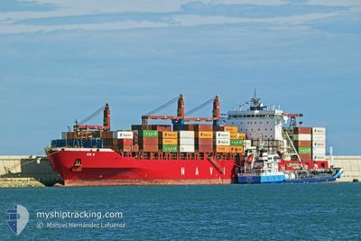
Container Ship
Current Trip
| Time Travelled | 4 h, 52 mins |
|---|---|
| Remaining Time | --- |
| Distance Travelled | 44.96 морская миля |
| Remaining Distance | --- |
| AVG Speed | 9.8 Узлы |
| MAX Speed | 14.8 Узлы |
| AVG Wind | 6.8 knots |
| MAX Wind | 12 knots |
| MIN Temp | 14.1°C / 57.38°F |
| MAX Temp | 16.9°C / 62.42°F |
| Осадка | 10.4 м |
| Позиция Получена | Сейчас |
Current Position
| Долгота | --- |
|---|---|
| Широта | --- |
| Статус | Under way using engine |
| Скорость | 5.1 Узлы |
| Курс | 118.9° |
| Район | Strait of Gibraltar |
| Станция | T-AIS |
| Позиция Получена | Сейчас |
Info
Information
The current position of ETE N is in Strait of Gibraltar with coordinates 35.90617° / -5.54532° as reported on 2025-02-18 19:59 by AIS to our vessel tracker app. The vessel's current speed is 5.1 Узлы
The vessel ETE N (IMO: 9509126, MMSI: 636019197) is a Container Ship that was built in 2012 ( 13 лет ). It's sailing under the flag of [LR] Liberia.
In this page you can find informations about the vessels current position, last detected port calls, and current voyage information. If the vessels is not in coverage by AIS you will find the latest position.
The current position of ETE N is detected by our AIS receivers and we are not responsible for the reliability of the data. The last position was recorded while the vessel was in Coverage by the Ais receivers of our vessel tracking app.
The current draught of ETE N as reported by AIS is 10.4 meters
Weather
| Temperature | 14.5°C / 58.1°F |
|---|---|
| Wind Speed | 9 knots |
| Direction | 224° SW |
| Pressure | 1013.1 hPa |
| Humidity | 82.1 % |
| Cloud Coverage | 100 % |
Featured Company
Last Port Calls
| Port | Arrival | Departure | Time In Port |
|---|---|---|---|
| 2025-02-18 02:08 | 2025-02-18 15:08 | 13 h | |
| 2025-02-16 08:39 | 2025-02-16 22:13 | 13 h | |
| 2025-02-12 15:47 | 2025-02-13 14:44 | 22 h | |
| 2025-02-09 19:04 | 2025-02-10 10:50 | 15 h | |
| 2025-02-07 09:24 | 2025-02-08 09:56 | 1 d | |
| 2025-02-04 21:26 | 2025-02-04 22:43 | 1 h | |
| 2025-02-04 10:25 | 2025-02-04 19:39 | 9 h | |
| 2025-02-03 11:59 | 2025-02-03 23:58 | 11 h | |
| 2025-01-30 11:38 | 2025-01-31 15:08 | 1 d | |
| 2025-01-27 10:50 | 2025-01-28 02:12 | 15 h |
Most Visited Ports (Last year)
| Port | Arrivals | |
|---|---|---|
| 17 | ||
| 17 | ||
| 14 | ||
| 10 | ||
| 10 | ||
| 4 |
Last Trips
| Origin | Departure | Destination | Arrival | Distance | |
|---|---|---|---|---|---|
| 2025-02-16 23:13 | 2025-02-18 03:08 | 92.37 морская миля | |||
| 2025-02-13 15:44 | 2025-02-16 09:39 | 874.20 морская миля | |||
| 2025-02-10 11:50 | 2025-02-12 16:47 | 294.41 морская миля | |||
| 2025-02-08 10:56 | 2025-02-09 20:04 | 357.16 морская миля | |||
| 2025-02-04 23:43 | 2025-02-07 10:24 | 525.42 морская миля | |||
| 2025-02-04 20:39 | 2025-02-04 22:26 | 9.10 морская миля | |||
| 2025-02-04 00:58 | 2025-02-04 11:25 | 79.52 морская миля | |||
| 2025-01-31 16:08 | 2025-02-03 12:59 | 867.75 морская миля | |||
| 2025-01-28 03:12 | 2025-01-30 12:38 | 273.35 морская миля | |||
| 2025-01-26 08:29 | 2025-01-27 11:50 | 355.85 морская миля |
Events
| Время | Событие | Детали | Позиция / Направление | Информация |
|---|---|---|---|---|
| 2025-02-18 19:37 | Изменение морского района | Moroccan part of the Strait of Gibraltar Spanish part of the Strait of Gibraltar |
35.93876 / -5.55536
Strait of Gibraltar
TANGER MED 2
|
Скорость: 11.6 kn Курс: 174.8° |
| 2025-02-18 18:08 | Изменение морского района | Spanish part of the Strait of Gibraltar Gibraltarian part of the Strait of Gibraltar |
36.02368 / -5.34424
Strait of Gibraltar
TANGER MED 2
|
Скорость: 7.4 kn Курс: 245.5° |
| 2025-02-18 18:04 | Изменение морского района | Gibraltarian part of the Strait of Gibraltar Gibraltarian part of the Alboran Sea |
36.02705 / -5.33455
Strait of Gibraltar
TANGER MED 2
|
Скорость: 7.4 kn Курс: 252.2° |
| 2025-02-18 16:10 | Изменение морского района | Gibraltarian part of the Alboran Sea Spanish part of the Alboran Sea |
36.01661 / -5.27296
Alboran Sea
TANGER MED 2
|
Скорость: 12.9 kn Курс: 69.2° |
| 2025-02-18 16:02 | Изменение морского района | Spanish part of the Alboran Sea Spanish part of the Strait of Gibraltar |
36.00405 / -5.30577
Alboran Sea
TANGER MED 2
|
Скорость: 14.7 kn Курс: 64° |
| 2025-02-18 15:46 | Изменение морского района | Spanish part of the Strait of Gibraltar Moroccan part of the Strait of Gibraltar |
35.97709 / -5.37860
Strait of Gibraltar
TANGER MED 2
|
Скорость: 14.3 kn Курс: 65.1° |
| 2025-02-18 15:08 | ПОРТ ОТПРАВЛЕНИЯ |
|
35.90321 / -5.49203
TANGER MED 2
|
Скорость: 5.4 kn Курс: 345° |
| 2025-02-18 15:02 | Начало движения |
35.89309 / -5.49594
[MA] TANGER MED
|
Скорость: 4.1 kn Курс: 25° |
|
| 2025-02-18 14:43 | Статус изменился | Under way using engine Moored |
35.89113 / -5.49618
[MA] TANGER MED
|
Скорость: Курс: 44° |
| 2025-02-18 14:32 | Статус изменился | Moored Default |
35.89114 / -5.49616
[MA] TANGER MED
|
Скорость: Курс: 43° |